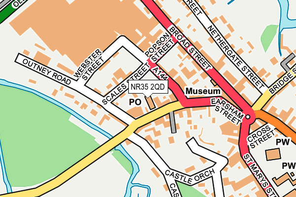
NR35 2QD is located in the Ditchingham & Earsham electoral ward, within the local authority district of South Norfolk and the English Parliamentary constituency of South Norfolk. The Sub Integrated Care Board (ICB) Location is NHS Norfolk and Waveney ICB - 26A and the police force is Norfolk. This postcode has been in use since February 2023.


GetTheData
Source: OS OpenMap – Local (Ordnance Survey)
Source: OS VectorMap District (Ordnance Survey)
Licence: Open Government Licence (requires attribution)
| Easting | 629225 |
| Northing | 294219 |
| Latitude | 52.497692 |
| Longitude | 1.375586 |
GetTheData
Source: Open Postcode Geo
Licence: Open Government Licence
| Country | England |
| Postcode District | NR35 |
➜ See where NR35 is on a map ➜ Where is Woodton? | |
GetTheData
Source: Land Registry Price Paid Data
Licence: Open Government Licence
Elevation or altitude of NR35 2QD as distance above sea level:
| Metres | Feet | |
|---|---|---|
| Elevation | 10m | 33ft |
Elevation is measured from the approximate centre of the postcode, to the nearest point on an OS contour line from OS Terrain 50, which has contour spacing of ten vertical metres.
➜ How high above sea level am I? Find the elevation of your current position using your device's GPS.
GetTheData
Source: Open Postcode Elevation
Licence: Open Government Licence
| Ward | Ditchingham & Earsham |
| Constituency | South Norfolk |
GetTheData
Source: ONS Postcode Database
Licence: Open Government Licence
16, NURSERY PLACE, WOODTON, BUNGAY, NR35 2QD 2023 18 DEC £255,000 |
18, NURSERY PLACE, WOODTON, BUNGAY, NR35 2QD 2023 9 OCT £515,000 |
11, NURSERY PLACE, WOODTON, BUNGAY, NR35 2QD 2023 11 SEP £310,000 |
1, NURSERY PLACE, WOODTON, BUNGAY, NR35 2QD 2023 7 JUL £325,000 |
21, NURSERY PLACE, WOODTON, BUNGAY, NR35 2QD 2023 11 APR £580,000 |
13, NURSERY PLACE, WOODTON, BUNGAY, NR35 2QD 2023 16 MAR £490,000 |
9, NURSERY PLACE, WOODTON, BUNGAY, NR35 2QD 2023 16 FEB £450,000 |
3, NURSERY PLACE, WOODTON, BUNGAY, NR35 2QD 2023 15 FEB £330,000 |
GetTheData
Source: HM Land Registry Price Paid Data
Licence: Contains HM Land Registry data © Crown copyright and database right 2025. This data is licensed under the Open Government Licence v3.0.
| Hempnall Road | Woodton | 252m |
| Hempnall Road | Woodton | 267m |
| Mill Gardens (Hempnall Road) | Woodton | 338m |
| Norwich Road | Woodton | 416m |
| Norwich Road | Woodton | 423m |
GetTheData
Source: NaPTAN
Licence: Open Government Licence
GetTheData
Source: ONS Postcode Database
Licence: Open Government Licence


➜ Get more ratings from the Food Standards Agency
GetTheData
Source: Food Standards Agency
Licence: FSA terms & conditions
| Last Collection | |||
|---|---|---|---|
| Location | Mon-Fri | Sat | Distance |
| Hempnall Road Post Office | 16:15 | 09:45 | 231m |
| Kirstead Green | 14:30 | 07:30 | 249m |
| The Green | 16:00 | 09:30 | 1,571m |
GetTheData
Source: Dracos
Licence: Creative Commons Attribution-ShareAlike
The below table lists the International Territorial Level (ITL) codes (formerly Nomenclature of Territorial Units for Statistics (NUTS) codes) and Local Administrative Units (LAU) codes for NR35 2QD:
| ITL 1 Code | Name |
|---|---|
| TLH | East |
| ITL 2 Code | Name |
| TLH1 | East Anglia |
| ITL 3 Code | Name |
| TLH17 | Breckland and South Norfolk |
| LAU 1 Code | Name |
| E07000149 | South Norfolk |
GetTheData
Source: ONS Postcode Directory
Licence: Open Government Licence
The below table lists the Census Output Area (OA), Lower Layer Super Output Area (LSOA), and Middle Layer Super Output Area (MSOA) for NR35 2QD:
| Code | Name | |
|---|---|---|
| OA | E00136849 | |
| LSOA | E01026904 | South Norfolk 012E |
| MSOA | E02005608 | South Norfolk 012 |
GetTheData
Source: ONS Postcode Directory
Licence: Open Government Licence
| NR35 2LT | The Woodyard Square | 65m |
| NR35 2LZ | The Street | 103m |
| NR35 2NP | Suckling Place | 190m |
| NR35 2LS | Hempnall Road | 222m |
| NR35 2NN | Hilary Terrace | 236m |
| NR35 2LJ | Old Forge Close | 301m |
| NR35 2NH | Highfields | 314m |
| NR35 2NQ | Hempnall Road | 345m |
| NR35 2NX | Chapel Hill | 356m |
| NR35 2NR | Mill Gardens | 370m |
GetTheData
Source: Open Postcode Geo; Land Registry Price Paid Data
Licence: Open Government Licence