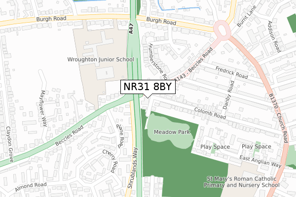
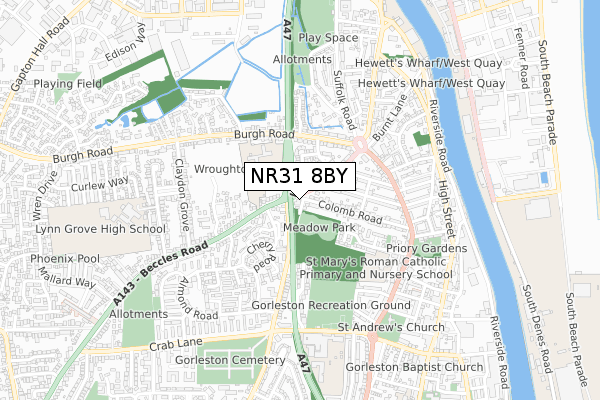
NR31 8BY is located in the Claydon electoral ward, within the local authority district of Great Yarmouth and the English Parliamentary constituency of Great Yarmouth. The Sub Integrated Care Board (ICB) Location is NHS Norfolk and Waveney ICB - 26A and the police force is Norfolk. This postcode has been in use since November 2019.


GetTheData
Source: OS Open Zoomstack (Ordnance Survey)
Licence: Open Government Licence (requires attribution)
Attribution: Contains OS data © Crown copyright and database right 2024
Source: Open Postcode Geo
Licence: Open Government Licence (requires attribution)
Attribution: Contains OS data © Crown copyright and database right 2024; Contains Royal Mail data © Royal Mail copyright and database right 2024; Source: Office for National Statistics licensed under the Open Government Licence v.3.0
| Easting | 651780 |
| Northing | 304919 |
| Latitude | 52.583749 |
| Longitude | 1.715249 |
GetTheData
Source: Open Postcode Geo
Licence: Open Government Licence
| Country | England |
| Postcode District | NR31 |
➜ See where NR31 is on a map ➜ Where is Gorleston-on-Sea? | |
GetTheData
Source: Land Registry Price Paid Data
Licence: Open Government Licence
| Ward | Claydon |
| Constituency | Great Yarmouth |
GetTheData
Source: ONS Postcode Database
Licence: Open Government Licence
| Westbrook Avenue (Beccles Road) | Gorleston | 95m |
| Westbrook Avenue (Beccles Road) | Gorleston | 101m |
| Westbrooke Avenue (Almond Road) | Gorleston | 259m |
| Lynn Grove (Beccles Road) | Gorleston | 272m |
| Sycamore Green (Almond Road) | Gorleston | 275m |
| Great Yarmouth Station | 3.2km |
GetTheData
Source: NaPTAN
Licence: Open Government Licence
GetTheData
Source: ONS Postcode Database
Licence: Open Government Licence


➜ Get more ratings from the Food Standards Agency
GetTheData
Source: Food Standards Agency
Licence: FSA terms & conditions
| Last Collection | |||
|---|---|---|---|
| Location | Mon-Fri | Sat | Distance |
| Claydon Grove | 17:30 | 12:00 | 209m |
| Shrublands Post Office | 17:30 | 12:15 | 408m |
| Almond Road | 17:30 | 12:00 | 474m |
GetTheData
Source: Dracos
Licence: Creative Commons Attribution-ShareAlike
The below table lists the International Territorial Level (ITL) codes (formerly Nomenclature of Territorial Units for Statistics (NUTS) codes) and Local Administrative Units (LAU) codes for NR31 8BY:
| ITL 1 Code | Name |
|---|---|
| TLH | East |
| ITL 2 Code | Name |
| TLH1 | East Anglia |
| ITL 3 Code | Name |
| TLH15 | Norwich and East Norfolk |
| LAU 1 Code | Name |
| E07000145 | Great Yarmouth |
GetTheData
Source: ONS Postcode Directory
Licence: Open Government Licence
The below table lists the Census Output Area (OA), Lower Layer Super Output Area (LSOA), and Middle Layer Super Output Area (MSOA) for NR31 8BY:
| Code | Name | |
|---|---|---|
| OA | E00135174 | |
| LSOA | E01026602 | Great Yarmouth 009B |
| MSOA | E02005546 | Great Yarmouth 009 |
GetTheData
Source: ONS Postcode Directory
Licence: Open Government Licence
| NR31 8AH | Beccles Road | 102m |
| NR31 8DA | Beccles Road | 127m |
| NR31 8AT | Claydon Grove | 161m |
| NR31 8EH | Cotoneaster Court | 173m |
| NR31 8AL | Beccles Road | 184m |
| NR31 8DD | Beccles Road | 193m |
| NR31 8EG | Plane Road | 202m |
| NR31 8DB | Westbrook Avenue | 207m |
| NR31 8BZ | Beccles Road | 214m |
| NR31 8AU | Claydon Grove | 227m |
GetTheData
Source: Open Postcode Geo; Land Registry Price Paid Data
Licence: Open Government Licence