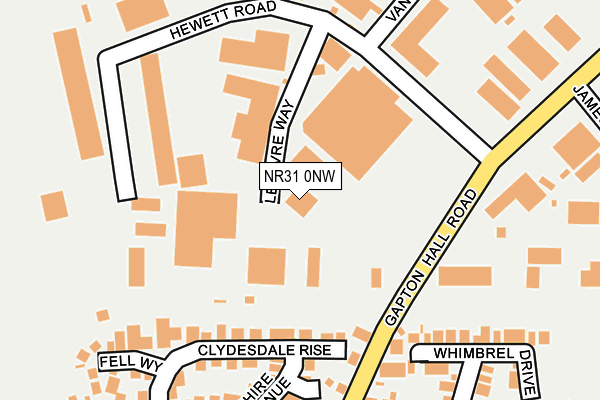
NR31 0NW is located in the Bradwell North electoral ward, within the local authority district of Great Yarmouth and the English Parliamentary constituency of Great Yarmouth. The Sub Integrated Care Board (ICB) Location is NHS Norfolk and Waveney ICB - 26A and the police force is Norfolk. This postcode has been in use since August 1993.


GetTheData
Source: OS OpenMap – Local (Ordnance Survey)
Source: OS VectorMap District (Ordnance Survey)
Licence: Open Government Licence (requires attribution)
| Easting | 650727 |
| Northing | 305528 |
| Latitude | 52.589698 |
| Longitude | 1.700202 |
GetTheData
Source: Open Postcode Geo
Licence: Open Government Licence
| Country | England |
| Postcode District | NR31 |
➜ See where NR31 is on a map ➜ Where is Bradwell? | |
GetTheData
Source: Land Registry Price Paid Data
Licence: Open Government Licence
Elevation or altitude of NR31 0NW as distance above sea level:
| Metres | Feet | |
|---|---|---|
| Elevation | 10m | 33ft |
Elevation is measured from the approximate centre of the postcode, to the nearest point on an OS contour line from OS Terrain 50, which has contour spacing of ten vertical metres.
➜ How high above sea level am I? Find the elevation of your current position using your device's GPS.
GetTheData
Source: Open Postcode Elevation
Licence: Open Government Licence
| Ward | Bradwell North |
| Constituency | Great Yarmouth |
GetTheData
Source: ONS Postcode Database
Licence: Open Government Licence
| Lefevre Way (Hewett Road) | Bradwell | 253m |
| Burgh Road | Bradwell | 292m |
| Hill House (Bure Road) | Bradwell | 422m |
| Hill House (Bure Road) | Bradwell | 429m |
| Millwood Surgery (Blackbird Close) | Bradwell | 478m |
| Great Yarmouth Station | 2.9km |
| Berney Arms Station | 4.7km |
GetTheData
Source: NaPTAN
Licence: Open Government Licence
GetTheData
Source: ONS Postcode Database
Licence: Open Government Licence


➜ Get more ratings from the Food Standards Agency
GetTheData
Source: Food Standards Agency
Licence: FSA terms & conditions
| Last Collection | |||
|---|---|---|---|
| Location | Mon-Fri | Sat | Distance |
| Morton Peto Road | 17:30 | 676m | |
| Morton Peto Road | 17:30 | 12:30 | 678m |
| Mill Lane | 17:30 | 12:00 | 685m |
GetTheData
Source: Dracos
Licence: Creative Commons Attribution-ShareAlike
The below table lists the International Territorial Level (ITL) codes (formerly Nomenclature of Territorial Units for Statistics (NUTS) codes) and Local Administrative Units (LAU) codes for NR31 0NW:
| ITL 1 Code | Name |
|---|---|
| TLH | East |
| ITL 2 Code | Name |
| TLH1 | East Anglia |
| ITL 3 Code | Name |
| TLH15 | Norwich and East Norfolk |
| LAU 1 Code | Name |
| E07000145 | Great Yarmouth |
GetTheData
Source: ONS Postcode Directory
Licence: Open Government Licence
The below table lists the Census Output Area (OA), Lower Layer Super Output Area (LSOA), and Middle Layer Super Output Area (MSOA) for NR31 0NW:
| Code | Name | |
|---|---|---|
| OA | E00135084 | |
| LSOA | E01026582 | Great Yarmouth 008B |
| MSOA | E02005545 | Great Yarmouth 008 |
GetTheData
Source: ONS Postcode Directory
Licence: Open Government Licence
| NR31 9UG | Clydesdale Rise | 127m |
| NR31 9UF | Fell Way | 163m |
| NR31 9UB | Shire Avenue | 175m |
| NR31 9UA | Hunter Drive | 203m |
| NR31 0NN | Hewett Road | 224m |
| NR31 9UQ | Cob Close | 231m |
| NR31 8UQ | Cob Close | 243m |
| NR31 9EG | Burgh Road | 245m |
| NR31 9UE | Dales Court | 290m |
| NR31 9UN | Whimbrel Drive | 315m |
GetTheData
Source: Open Postcode Geo; Land Registry Price Paid Data
Licence: Open Government Licence