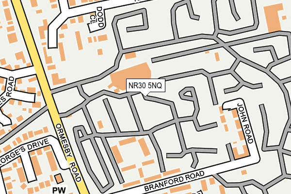
NR30 5NQ is located in the Caister North electoral ward, within the local authority district of Great Yarmouth and the English Parliamentary constituency of Great Yarmouth. The Sub Integrated Care Board (ICB) Location is NHS Norfolk and Waveney ICB - 26A and the police force is Norfolk. This postcode has been in use since July 2017.


GetTheData
Source: OS OpenMap – Local (Ordnance Survey)
Source: OS VectorMap District (Ordnance Survey)
Licence: Open Government Licence (requires attribution)
| Easting | 651909 |
| Northing | 313285 |
| Latitude | 52.658741 |
| Longitude | 1.723521 |
GetTheData
Source: Open Postcode Geo
Licence: Open Government Licence
| Country | England |
| Postcode District | NR30 |
➜ See where NR30 is on a map ➜ Where is Caister-on-Sea? | |
GetTheData
Source: Land Registry Price Paid Data
Licence: Open Government Licence
| Ward | Caister North |
| Constituency | Great Yarmouth |
GetTheData
Source: ONS Postcode Database
Licence: Open Government Licence
| Holiday Camp (Ormesby Road) | Caister-on-sea | 176m |
| Covent Garden Road (Ormesby Road) | Caister-on-sea | 216m |
| St Christopher Close (St. Georges Drive) | Caister-on-sea | 219m |
| Holiday Camp (Ormesby Road) | Caister-on-sea | 271m |
| Ridgeway (Second Avenue) | Caister-on-sea | 322m |
GetTheData
Source: NaPTAN
Licence: Open Government Licence
GetTheData
Source: ONS Postcode Database
Licence: Open Government Licence


➜ Get more ratings from the Food Standards Agency
GetTheData
Source: Food Standards Agency
Licence: FSA terms & conditions
| Last Collection | |||
|---|---|---|---|
| Location | Mon-Fri | Sat | Distance |
| Queens Road | 17:45 | 12:15 | 2,270m |
| Seashore Camp | 17:30 | 11:30 | 3,025m |
| Caystreward | 17:30 | 11:30 | 3,293m |
GetTheData
Source: Dracos
Licence: Creative Commons Attribution-ShareAlike
The below table lists the International Territorial Level (ITL) codes (formerly Nomenclature of Territorial Units for Statistics (NUTS) codes) and Local Administrative Units (LAU) codes for NR30 5NQ:
| ITL 1 Code | Name |
|---|---|
| TLH | East |
| ITL 2 Code | Name |
| TLH1 | East Anglia |
| ITL 3 Code | Name |
| TLH15 | Norwich and East Norfolk |
| LAU 1 Code | Name |
| E07000145 | Great Yarmouth |
GetTheData
Source: ONS Postcode Directory
Licence: Open Government Licence
The below table lists the Census Output Area (OA), Lower Layer Super Output Area (LSOA), and Middle Layer Super Output Area (MSOA) for NR30 5NQ:
| Code | Name | |
|---|---|---|
| OA | E00135112 | |
| LSOA | E01026589 | Great Yarmouth 003A |
| MSOA | E02005540 | Great Yarmouth 003 |
GetTheData
Source: ONS Postcode Directory
Licence: Open Government Licence
| NR30 5PA | Dodd Close | 122m |
| NR30 5NH | Ormesby Road | 161m |
| NR30 5NZ | Halt Road | 170m |
| NR30 5NU | Halt Road | 205m |
| NR30 5SA | Charles Burton Close | 220m |
| NR30 5NG | John Road | 242m |
| NR30 5NE | Branford Road | 243m |
| NR30 5QN | St Georges Drive | 245m |
| NR30 5NY | Greenhill Avenue | 254m |
| NR30 5NT | Carter Close | 256m |
GetTheData
Source: Open Postcode Geo; Land Registry Price Paid Data
Licence: Open Government Licence