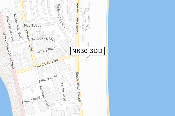
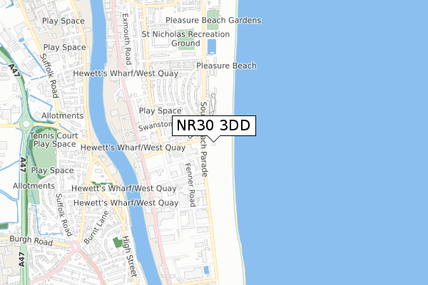
NR30 3DD is located in the Nelson electoral ward, within the local authority district of Great Yarmouth and the English Parliamentary constituency of Great Yarmouth. The Sub Integrated Care Board (ICB) Location is NHS Norfolk and Waveney ICB - 26A and the police force is Norfolk. This postcode has been in use since October 2018.


GetTheData
Source: OS Open Zoomstack (Ordnance Survey)
Licence: Open Government Licence (requires attribution)
Attribution: Contains OS data © Crown copyright and database right 2024
Source: Open Postcode Geo
Licence: Open Government Licence (requires attribution)
Attribution: Contains OS data © Crown copyright and database right 2024; Contains Royal Mail data © Royal Mail copyright and database right 2024; Source: Office for National Statistics licensed under the Open Government Licence v.3.0
| Easting | 653147 |
| Northing | 305779 |
| Latitude | 52.590830 |
| Longitude | 1.736039 |
GetTheData
Source: Open Postcode Geo
Licence: Open Government Licence
| Country | England |
| Postcode District | NR30 |
➜ See where NR30 is on a map | |
GetTheData
Source: Land Registry Price Paid Data
Licence: Open Government Licence
| Ward | Nelson |
| Constituency | Great Yarmouth |
GetTheData
Source: ONS Postcode Database
Licence: Open Government Licence
| Main Cross Road (South Beach Parade) | Great Yarmouth | 105m |
| Battery Road (Admiralty Road) | Great Yarmouth | 297m |
| Micawber Avenue (Peggotty Road) | Barrack Estate | 304m |
| Monument Road (Fenner Road) | Great Yarmouth | 347m |
| Peggotty Road (Admiralty Road) | Barrack Estate | 416m |
| Great Yarmouth Station | 2.6km |
GetTheData
Source: NaPTAN
Licence: Open Government Licence
GetTheData
Source: ONS Postcode Database
Licence: Open Government Licence


➜ Get more ratings from the Food Standards Agency
GetTheData
Source: Food Standards Agency
Licence: FSA terms & conditions
| Last Collection | |||
|---|---|---|---|
| Location | Mon-Fri | Sat | Distance |
| Beevor Road | 18:30 | 12:00 | 429m |
| Southtown Road | 17:00 | 12:00 | 888m |
| Addison Road | 15:00 | 12:00 | 900m |
GetTheData
Source: Dracos
Licence: Creative Commons Attribution-ShareAlike
The below table lists the International Territorial Level (ITL) codes (formerly Nomenclature of Territorial Units for Statistics (NUTS) codes) and Local Administrative Units (LAU) codes for NR30 3DD:
| ITL 1 Code | Name |
|---|---|
| TLH | East |
| ITL 2 Code | Name |
| TLH1 | East Anglia |
| ITL 3 Code | Name |
| TLH15 | Norwich and East Norfolk |
| LAU 1 Code | Name |
| E07000145 | Great Yarmouth |
GetTheData
Source: ONS Postcode Directory
Licence: Open Government Licence
The below table lists the Census Output Area (OA), Lower Layer Super Output Area (LSOA), and Middle Layer Super Output Area (MSOA) for NR30 3DD:
| Code | Name | |
|---|---|---|
| OA | E00135304 | |
| LSOA | E01026622 | Great Yarmouth 006A |
| MSOA | E02005543 | Great Yarmouth 006 |
GetTheData
Source: ONS Postcode Directory
Licence: Open Government Licence
| NR30 3PA | Main Cross Road | 102m |
| NR30 3EJ | South Beach Parade | 111m |
| NR30 3NZ | Main Cross Road | 183m |
| NR30 3EL | Harbord Crescent | 215m |
| NR30 3NQ | Swanstons Road | 279m |
| NR30 3EF | Peggotty Road | 300m |
| NR30 3EQ | South Beach Parade | 309m |
| NR30 3PU | Admiralty Road | 330m |
| NR30 3EG | Harbord Crescent | 356m |
| NR30 3EE | Micawber Avenue | 384m |
GetTheData
Source: Open Postcode Geo; Land Registry Price Paid Data
Licence: Open Government Licence