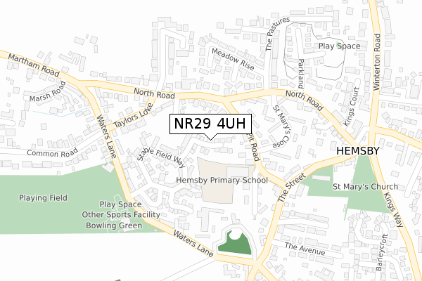
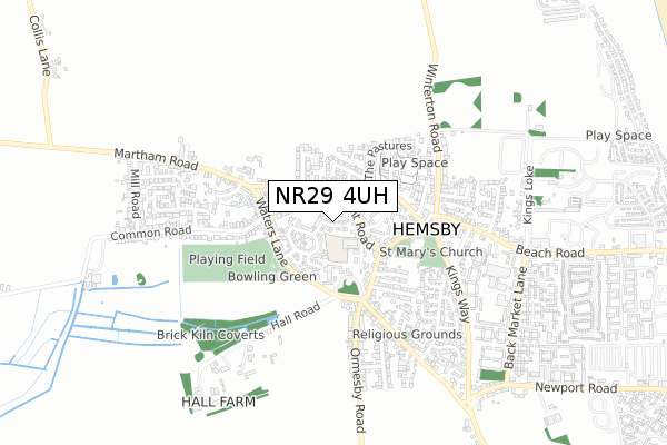
NR29 4UH is located in the East Flegg electoral ward, within the local authority district of Great Yarmouth and the English Parliamentary constituency of Great Yarmouth. The Sub Integrated Care Board (ICB) Location is NHS Norfolk and Waveney ICB - 26A and the police force is Norfolk. This postcode has been in use since September 2019.


GetTheData
Source: OS Open Zoomstack (Ordnance Survey)
Licence: Open Government Licence (requires attribution)
Attribution: Contains OS data © Crown copyright and database right 2025
Source: Open Postcode Geo
Licence: Open Government Licence (requires attribution)
Attribution: Contains OS data © Crown copyright and database right 2025; Contains Royal Mail data © Royal Mail copyright and database right 2025; Source: Office for National Statistics licensed under the Open Government Licence v.3.0
| Easting | 649190 |
| Northing | 317449 |
| Latitude | 52.697351 |
| Longitude | 1.686554 |
GetTheData
Source: Open Postcode Geo
Licence: Open Government Licence
| Country | England |
| Postcode District | NR29 |
➜ See where NR29 is on a map ➜ Where is Hemsby? | |
GetTheData
Source: Land Registry Price Paid Data
Licence: Open Government Licence
| Ward | East Flegg |
| Constituency | Great Yarmouth |
GetTheData
Source: ONS Postcode Database
Licence: Open Government Licence
4, BRIDLE CLOSE, HEMSBY, GREAT YARMOUTH, NR29 4UH 2020 5 JUN £318,200 |
3, BRIDLE CLOSE, HEMSBY, GREAT YARMOUTH, NR29 4UH 2020 5 FEB £249,950 |
10, BRIDLE CLOSE, HEMSBY, GREAT YARMOUTH, NR29 4UH 2019 3 DEC £225,950 |
1, BRIDLE CLOSE, HEMSBY, GREAT YARMOUTH, NR29 4UH 2019 20 NOV £247,950 |
5, BRIDLE CLOSE, HEMSBY, GREAT YARMOUTH, NR29 4UH 2019 14 NOV £235,950 |
9, BRIDLE CLOSE, HEMSBY, GREAT YARMOUTH, NR29 4UH 2019 26 SEP £255,950 |
2, BRIDLE CLOSE, HEMSBY, GREAT YARMOUTH, NR29 4UH 2019 9 AUG £259,950 |
GetTheData
Source: HM Land Registry Price Paid Data
Licence: Contains HM Land Registry data © Crown copyright and database right 2025. This data is licensed under the Open Government Licence v3.0.
| The Pastures (North Road) | Hemsby | 126m |
| The Pastures (North Road) | Hemsby | 164m |
| Kings Head (North Road) | Hemsby | 273m |
| Kings Head (North Road) | Hemsby | 287m |
| Post Office (Ormesby Road) | Hemsby | 295m |
GetTheData
Source: NaPTAN
Licence: Open Government Licence
| Percentage of properties with Next Generation Access | 0.0% |
| Percentage of properties with Superfast Broadband | 0.0% |
| Percentage of properties with Ultrafast Broadband | 0.0% |
| Percentage of properties with Full Fibre Broadband | 0.0% |
Superfast Broadband is between 30Mbps and 300Mbps
Ultrafast Broadband is > 300Mbps
| Percentage of properties unable to receive 2Mbps | 0.0% |
| Percentage of properties unable to receive 5Mbps | 0.0% |
| Percentage of properties unable to receive 10Mbps | 0.0% |
| Percentage of properties unable to receive 30Mbps | 0.0% |
GetTheData
Source: Ofcom
Licence: Ofcom Terms of Use (requires attribution)
GetTheData
Source: ONS Postcode Database
Licence: Open Government Licence


➜ Get more ratings from the Food Standards Agency
GetTheData
Source: Food Standards Agency
Licence: FSA terms & conditions
| Last Collection | |||
|---|---|---|---|
| Location | Mon-Fri | Sat | Distance |
| Winterton Post Office | 17:00 | 12:00 | 2,086m |
| Main Road | 16:00 | 09:00 | 2,807m |
| The Staithe | 16:00 | 09:00 | 3,477m |
GetTheData
Source: Dracos
Licence: Creative Commons Attribution-ShareAlike
The below table lists the International Territorial Level (ITL) codes (formerly Nomenclature of Territorial Units for Statistics (NUTS) codes) and Local Administrative Units (LAU) codes for NR29 4UH:
| ITL 1 Code | Name |
|---|---|
| TLH | East |
| ITL 2 Code | Name |
| TLH1 | East Anglia |
| ITL 3 Code | Name |
| TLH15 | Norwich and East Norfolk |
| LAU 1 Code | Name |
| E07000145 | Great Yarmouth |
GetTheData
Source: ONS Postcode Directory
Licence: Open Government Licence
The below table lists the Census Output Area (OA), Lower Layer Super Output Area (LSOA), and Middle Layer Super Output Area (MSOA) for NR29 4UH:
| Code | Name | |
|---|---|---|
| OA | E00135199 | |
| LSOA | E01026607 | Great Yarmouth 001C |
| MSOA | E02005538 | Great Yarmouth 001 |
GetTheData
Source: ONS Postcode Directory
Licence: Open Government Licence
| NR29 4LD | Copeman Close | 53m |
| NR29 4TT | Clydesdale Drive | 56m |
| NR29 4LG | Pit Road | 76m |
| NR29 4LQ | Pit Road | 110m |
| NR29 4JX | Pedlars Croft | 115m |
| NR29 4LH | School Loke | 116m |
| NR29 4LN | North Road | 131m |
| NR29 4TE | Stable Field Way | 147m |
| NR29 4LJ | North Road | 162m |
| NR29 4TR | Shire Close | 164m |
GetTheData
Source: Open Postcode Geo; Land Registry Price Paid Data
Licence: Open Government Licence