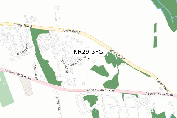
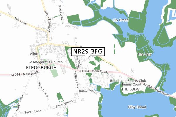
NR29 3FG is located in the Fleggburgh electoral ward, within the local authority district of Great Yarmouth and the English Parliamentary constituency of Great Yarmouth. The Sub Integrated Care Board (ICB) Location is NHS Norfolk and Waveney ICB - 26A and the police force is Norfolk. This postcode has been in use since April 2019.


GetTheData
Source: OS Open Zoomstack (Ordnance Survey)
Licence: Open Government Licence (requires attribution)
Attribution: Contains OS data © Crown copyright and database right 2025
Source: Open Postcode Geo
Licence: Open Government Licence (requires attribution)
Attribution: Contains OS data © Crown copyright and database right 2025; Contains Royal Mail data © Royal Mail copyright and database right 2025; Source: Office for National Statistics licensed under the Open Government Licence v.3.0
| Easting | 647176 |
| Northing | 314331 |
| Latitude | 52.670301 |
| Longitude | 1.654475 |
GetTheData
Source: Open Postcode Geo
Licence: Open Government Licence
| Country | England |
| Postcode District | NR29 |
➜ See where NR29 is on a map | |
GetTheData
Source: Land Registry Price Paid Data
Licence: Open Government Licence
| Ward | Fleggburgh |
| Constituency | Great Yarmouth |
GetTheData
Source: ONS Postcode Database
Licence: Open Government Licence
| Eels Foot Road (Main Road) | Ormesby St Michael | 707m |
| Pound Lane (Filby Main Road) | Filby | 825m |
| Pound Lane (Filby Main Road) | Filby | 835m |
| Burch Wood Road (Main Road) | Ormesby St Michael | 982m |
| Burch Wood Road (Main Road) | Ormesby St Michael | 991m |
GetTheData
Source: NaPTAN
Licence: Open Government Licence
| Percentage of properties with Next Generation Access | 50.0% |
| Percentage of properties with Superfast Broadband | 0.0% |
| Percentage of properties with Ultrafast Broadband | 0.0% |
| Percentage of properties with Full Fibre Broadband | 0.0% |
Superfast Broadband is between 30Mbps and 300Mbps
Ultrafast Broadband is > 300Mbps
| Percentage of properties unable to receive 2Mbps | 0.0% |
| Percentage of properties unable to receive 5Mbps | 0.0% |
| Percentage of properties unable to receive 10Mbps | 0.0% |
| Percentage of properties unable to receive 30Mbps | 50.0% |
GetTheData
Source: Ofcom
Licence: Ofcom Terms of Use (requires attribution)
GetTheData
Source: ONS Postcode Database
Licence: Open Government Licence


➜ Get more ratings from the Food Standards Agency
GetTheData
Source: Food Standards Agency
Licence: FSA terms & conditions
| Last Collection | |||
|---|---|---|---|
| Location | Mon-Fri | Sat | Distance |
| The Green Post Office | 16:45 | 12:00 | 3,941m |
| Hall Road | 16:00 | 10:00 | 4,608m |
| Queens Road | 17:45 | 12:15 | 5,106m |
GetTheData
Source: Dracos
Licence: Creative Commons Attribution-ShareAlike
The below table lists the International Territorial Level (ITL) codes (formerly Nomenclature of Territorial Units for Statistics (NUTS) codes) and Local Administrative Units (LAU) codes for NR29 3FG:
| ITL 1 Code | Name |
|---|---|
| TLH | East |
| ITL 2 Code | Name |
| TLH1 | East Anglia |
| ITL 3 Code | Name |
| TLH15 | Norwich and East Norfolk |
| LAU 1 Code | Name |
| E07000145 | Great Yarmouth |
GetTheData
Source: ONS Postcode Directory
Licence: Open Government Licence
The below table lists the Census Output Area (OA), Lower Layer Super Output Area (LSOA), and Middle Layer Super Output Area (MSOA) for NR29 3FG:
| Code | Name | |
|---|---|---|
| OA | E00135211 | |
| LSOA | E01026608 | Great Yarmouth 002A |
| MSOA | E02005539 | Great Yarmouth 002 |
GetTheData
Source: ONS Postcode Directory
Licence: Open Government Licence
| NR29 3LP | Eels Foot Road | 656m |
| NR29 3LW | Main Road | 705m |
| NR29 3HP | Pound Lane | 709m |
| NR29 3NA | 748m | |
| NR29 3HN | Main Road | 839m |
| NR29 3LR | Waterworks Road | 903m |
| NR29 3LS | Main Road | 954m |
| NR29 3LT | Burghwood Road | 981m |
| NR29 3HW | Church Lane | 981m |
| NR29 3HD | Mulberry Tree Close | 1006m |
GetTheData
Source: Open Postcode Geo; Land Registry Price Paid Data
Licence: Open Government Licence