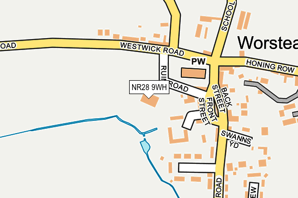
NR28 9WH is located in the Worstead electoral ward, within the local authority district of North Norfolk and the English Parliamentary constituency of North Norfolk. The Sub Integrated Care Board (ICB) Location is NHS Norfolk and Waveney ICB - 26A and the police force is Norfolk. This postcode has been in use since December 2000.


GetTheData
Source: OS OpenMap – Local (Ordnance Survey)
Source: OS VectorMap District (Ordnance Survey)
Licence: Open Government Licence (requires attribution)
| Easting | 630114 |
| Northing | 326006 |
| Latitude | 52.782548 |
| Longitude | 1.410771 |
GetTheData
Source: Open Postcode Geo
Licence: Open Government Licence
| Country | England |
| Postcode District | NR28 |
➜ See where NR28 is on a map ➜ Where is Worstead? | |
GetTheData
Source: Land Registry Price Paid Data
Licence: Open Government Licence
Elevation or altitude of NR28 9WH as distance above sea level:
| Metres | Feet | |
|---|---|---|
| Elevation | 20m | 66ft |
Elevation is measured from the approximate centre of the postcode, to the nearest point on an OS contour line from OS Terrain 50, which has contour spacing of ten vertical metres.
➜ How high above sea level am I? Find the elevation of your current position using your device's GPS.
GetTheData
Source: Open Postcode Elevation
Licence: Open Government Licence
| Ward | Worstead |
| Constituency | North Norfolk |
GetTheData
Source: ONS Postcode Database
Licence: Open Government Licence
| Bankside Turn (Yarmouth Road) | Bengate | 1,539m |
| Bankside Turn (Yarmouth Road) | Bengate | 1,564m |
| Worstead Station | 0.7km |
| North Walsham Station | 4.2km |
GetTheData
Source: NaPTAN
Licence: Open Government Licence
GetTheData
Source: ONS Postcode Database
Licence: Open Government Licence


➜ Get more ratings from the Food Standards Agency
GetTheData
Source: Food Standards Agency
Licence: FSA terms & conditions
| Last Collection | |||
|---|---|---|---|
| Location | Mon-Fri | Sat | Distance |
| Lyngate | 13:00 | 09:00 | 830m |
| Briggate | 16:30 | 08:45 | 1,858m |
| Westwick Arch | 15:15 | 07:15 | 2,051m |
GetTheData
Source: Dracos
Licence: Creative Commons Attribution-ShareAlike
The below table lists the International Territorial Level (ITL) codes (formerly Nomenclature of Territorial Units for Statistics (NUTS) codes) and Local Administrative Units (LAU) codes for NR28 9WH:
| ITL 1 Code | Name |
|---|---|
| TLH | East |
| ITL 2 Code | Name |
| TLH1 | East Anglia |
| ITL 3 Code | Name |
| TLH16 | North and West Norfolk |
| LAU 1 Code | Name |
| E07000147 | North Norfolk |
GetTheData
Source: ONS Postcode Directory
Licence: Open Government Licence
The below table lists the Census Output Area (OA), Lower Layer Super Output Area (LSOA), and Middle Layer Super Output Area (MSOA) for NR28 9WH:
| Code | Name | |
|---|---|---|
| OA | E00136230 | |
| LSOA | E01026790 | North Norfolk 012E |
| MSOA | E02005581 | North Norfolk 012 |
GetTheData
Source: ONS Postcode Directory
Licence: Open Government Licence
| NR28 9RW | Front Street | 108m |
| NR28 9SD | 123m | |
| NR28 9RN | Back Street | 149m |
| NR28 9AL | Church Plain | 152m |
| NR28 9RP | Swanns Yard | 193m |
| NR28 9FG | School Road | 216m |
| NR28 9RJ | Dilham Road | 225m |
| NR28 9SB | Cubitts Yard | 226m |
| NR28 9RR | Woodview | 235m |
| NR28 9RH | Honing Row | 253m |
GetTheData
Source: Open Postcode Geo; Land Registry Price Paid Data
Licence: Open Government Licence