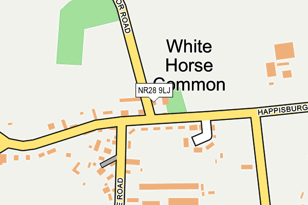
NR28 9LJ lies on Manor Road in North Walsham. NR28 9LJ is located in the North Walsham East electoral ward, within the local authority district of North Norfolk and the English Parliamentary constituency of North Norfolk. The Sub Integrated Care Board (ICB) Location is NHS Norfolk and Waveney ICB - 26A and the police force is Norfolk. This postcode has been in use since January 1980.


GetTheData
Source: OS OpenMap – Local (Ordnance Survey)
Source: OS VectorMap District (Ordnance Survey)
Licence: Open Government Licence (requires attribution)
| Easting | 630145 |
| Northing | 329479 |
| Latitude | 52.813727 |
| Longitude | 1.413693 |
GetTheData
Source: Open Postcode Geo
Licence: Open Government Licence
| Street | Manor Road |
| Town/City | North Walsham |
| Country | England |
| Postcode District | NR28 |
➜ See where NR28 is on a map ➜ Where is White Horse Common? | |
GetTheData
Source: Land Registry Price Paid Data
Licence: Open Government Licence
Elevation or altitude of NR28 9LJ as distance above sea level:
| Metres | Feet | |
|---|---|---|
| Elevation | 20m | 66ft |
Elevation is measured from the approximate centre of the postcode, to the nearest point on an OS contour line from OS Terrain 50, which has contour spacing of ten vertical metres.
➜ How high above sea level am I? Find the elevation of your current position using your device's GPS.
GetTheData
Source: Open Postcode Elevation
Licence: Open Government Licence
| Ward | North Walsham East |
| Constituency | North Norfolk |
GetTheData
Source: ONS Postcode Database
Licence: Open Government Licence
| Council Houses (Happisburgh Road) | White Horse Common | 45m |
| Council Houses (Happisburgh Road) | White Horse Common | 59m |
| Chestnut Avenue (Plantation Road) | North Walsham | 992m |
| Harmer Close (Brick Kiln Road) | North Walsham | 1,259m |
| Litester Close (Spenser Avenue) | North Walsham | 1,281m |
| North Walsham Station | 2km |
| Worstead Station | 4.1km |
GetTheData
Source: NaPTAN
Licence: Open Government Licence
| Percentage of properties with Next Generation Access | 100.0% |
| Percentage of properties with Superfast Broadband | 100.0% |
| Percentage of properties with Ultrafast Broadband | 0.0% |
| Percentage of properties with Full Fibre Broadband | 0.0% |
Superfast Broadband is between 30Mbps and 300Mbps
Ultrafast Broadband is > 300Mbps
| Percentage of properties unable to receive 2Mbps | 0.0% |
| Percentage of properties unable to receive 5Mbps | 0.0% |
| Percentage of properties unable to receive 10Mbps | 0.0% |
| Percentage of properties unable to receive 30Mbps | 0.0% |
GetTheData
Source: Ofcom
Licence: Ofcom Terms of Use (requires attribution)
GetTheData
Source: ONS Postcode Database
Licence: Open Government Licence


➜ Get more ratings from the Food Standards Agency
GetTheData
Source: Food Standards Agency
Licence: FSA terms & conditions
| Last Collection | |||
|---|---|---|---|
| Location | Mon-Fri | Sat | Distance |
| Brick Kiln Road | 16:00 | 10:00 | 1,109m |
| Spenser Ave | 16:00 | 11:00 | 1,300m |
| Royal Mail New Road | 19:00 | 12:00 | 1,867m |
GetTheData
Source: Dracos
Licence: Creative Commons Attribution-ShareAlike
The below table lists the International Territorial Level (ITL) codes (formerly Nomenclature of Territorial Units for Statistics (NUTS) codes) and Local Administrative Units (LAU) codes for NR28 9LJ:
| ITL 1 Code | Name |
|---|---|
| TLH | East |
| ITL 2 Code | Name |
| TLH1 | East Anglia |
| ITL 3 Code | Name |
| TLH16 | North and West Norfolk |
| LAU 1 Code | Name |
| E07000147 | North Norfolk |
GetTheData
Source: ONS Postcode Directory
Licence: Open Government Licence
The below table lists the Census Output Area (OA), Lower Layer Super Output Area (LSOA), and Middle Layer Super Output Area (MSOA) for NR28 9LJ:
| Code | Name | |
|---|---|---|
| OA | E00136021 | |
| LSOA | E01026755 | North Norfolk 010C |
| MSOA | E02005579 | North Norfolk 010 |
GetTheData
Source: ONS Postcode Directory
Licence: Open Government Licence
| NR28 9LL | White Horse Common | 53m |
| NR28 9FL | Holgate Road | 93m |
| NR28 9NE | White Horse Gardens | 104m |
| NR28 9LN | White Horse Common | 194m |
| NR28 9LP | Holgate Road | 293m |
| NR28 9NG | White Horse Common | 538m |
| NR28 9NB | Meeting Hill Road | 598m |
| NR28 9XT | Hollybush Road | 721m |
| NR28 9XU | Poppy Close | 744m |
| NR28 9XR | Brick Kiln Road | 827m |
GetTheData
Source: Open Postcode Geo; Land Registry Price Paid Data
Licence: Open Government Licence