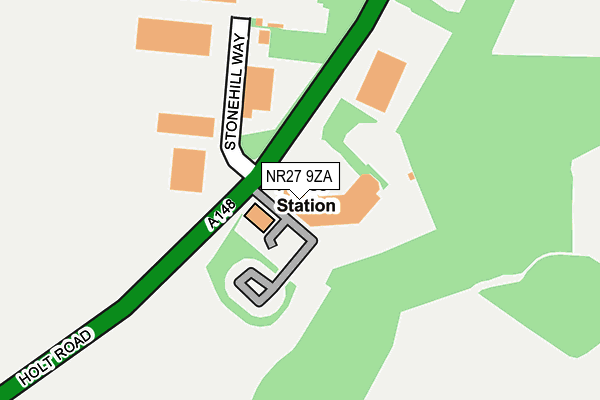
NR27 9ZA is located in the Cromer Town electoral ward, within the local authority district of North Norfolk and the English Parliamentary constituency of North Norfolk. The Sub Integrated Care Board (ICB) Location is NHS Norfolk and Waveney ICB - 26A and the police force is Norfolk. This postcode has been in use since February 2005.


GetTheData
Source: OS OpenMap – Local (Ordnance Survey)
Source: OS VectorMap District (Ordnance Survey)
Licence: Open Government Licence (requires attribution)
| Easting | 620940 |
| Northing | 341454 |
| Latitude | 52.925017 |
| Longitude | 1.285445 |
GetTheData
Source: Open Postcode Geo
Licence: Open Government Licence
| Country | England |
| Postcode District | NR27 |
➜ See where NR27 is on a map ➜ Where is Cromer? | |
GetTheData
Source: Land Registry Price Paid Data
Licence: Open Government Licence
Elevation or altitude of NR27 9ZA as distance above sea level:
| Metres | Feet | |
|---|---|---|
| Elevation | 60m | 197ft |
Elevation is measured from the approximate centre of the postcode, to the nearest point on an OS contour line from OS Terrain 50, which has contour spacing of ten vertical metres.
➜ How high above sea level am I? Find the elevation of your current position using your device's GPS.
GetTheData
Source: Open Postcode Elevation
Licence: Open Government Licence
| Ward | Cromer Town |
| Constituency | North Norfolk |
GetTheData
Source: ONS Postcode Database
Licence: Open Government Licence
| North Norfolk District Council Offices (Holt Road) | Cromer | 41m |
| North Norfolk District Council Offices (Holt Road) | Cromer | 59m |
| Lidl (Holt Road) | Cromer | 225m |
| Lidl (Holt Road) | Cromer | 244m |
| Sandy Lane (Holt Road) | Cromer | 481m |
| Cromer Station | 0.8km |
| Roughton Road Station | 1.2km |
| West Runton Station | 2.9km |
GetTheData
Source: NaPTAN
Licence: Open Government Licence
GetTheData
Source: ONS Postcode Database
Licence: Open Government Licence


➜ Get more ratings from the Food Standards Agency
GetTheData
Source: Food Standards Agency
Licence: FSA terms & conditions
| Last Collection | |||
|---|---|---|---|
| Location | Mon-Fri | Sat | Distance |
| Clifton Park | 18:00 | 11:30 | 790m |
| Holt Road | 16:15 | 07:00 | 919m |
| Runton Road | 18:00 | 11:30 | 977m |
GetTheData
Source: Dracos
Licence: Creative Commons Attribution-ShareAlike
The below table lists the International Territorial Level (ITL) codes (formerly Nomenclature of Territorial Units for Statistics (NUTS) codes) and Local Administrative Units (LAU) codes for NR27 9ZA:
| ITL 1 Code | Name |
|---|---|
| TLH | East |
| ITL 2 Code | Name |
| TLH1 | East Anglia |
| ITL 3 Code | Name |
| TLH16 | North and West Norfolk |
| LAU 1 Code | Name |
| E07000147 | North Norfolk |
GetTheData
Source: ONS Postcode Directory
Licence: Open Government Licence
The below table lists the Census Output Area (OA), Lower Layer Super Output Area (LSOA), and Middle Layer Super Output Area (MSOA) for NR27 9ZA:
| Code | Name | |
|---|---|---|
| OA | E00135902 | |
| LSOA | E01026736 | North Norfolk 003C |
| MSOA | E02005572 | North Norfolk 003 |
GetTheData
Source: ONS Postcode Directory
Licence: Open Government Licence
| NR27 9JR | Middlebrook Way | 299m |
| NR27 9JW | Holt Road | 344m |
| NR27 9JY | Charles Close | 425m |
| NR27 9NR | Blackberry Grove | 436m |
| NR27 9JT | Sandy Lane | 448m |
| NR27 9GU | Bittern Rise | 451m |
| NR27 9JX | Barclay Close | 528m |
| NR27 9JG | Hall Road | 558m |
| NR27 9SG | Fulcher Avenue | 588m |
| NR27 9SQ | Nelson Heights | 644m |
GetTheData
Source: Open Postcode Geo; Land Registry Price Paid Data
Licence: Open Government Licence