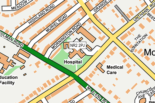
NR2 2PJ is located in the Nelson electoral ward, within the local authority district of Norwich and the English Parliamentary constituency of Norwich South. The Sub Integrated Care Board (ICB) Location is NHS Norfolk and Waveney ICB - 26A and the police force is Norfolk. This postcode has been in use since January 1980.


GetTheData
Source: OS OpenMap – Local (Ordnance Survey)
Source: OS VectorMap District (Ordnance Survey)
Licence: Open Government Licence (requires attribution)
| Easting | 621364 |
| Northing | 307518 |
| Latitude | 52.620275 |
| Longitude | 1.268826 |
GetTheData
Source: Open Postcode Geo
Licence: Open Government Licence
| Country | England |
| Postcode District | NR2 |
➜ See where NR2 is on a map ➜ Where is Norwich? | |
GetTheData
Source: Land Registry Price Paid Data
Licence: Open Government Licence
Elevation or altitude of NR2 2PJ as distance above sea level:
| Metres | Feet | |
|---|---|---|
| Elevation | 30m | 98ft |
Elevation is measured from the approximate centre of the postcode, to the nearest point on an OS contour line from OS Terrain 50, which has contour spacing of ten vertical metres.
➜ How high above sea level am I? Find the elevation of your current position using your device's GPS.
GetTheData
Source: Open Postcode Elevation
Licence: Open Government Licence
| Ward | Nelson |
| Constituency | Norwich South |
GetTheData
Source: ONS Postcode Database
Licence: Open Government Licence
| Colman Hospital (Unthank Road) | Norwich | 57m |
| Colman Hospital (Unthank Road) | Norwich | 85m |
| Mornington Road (Colman Road) | Norwich | 135m |
| Melrose Road (Mile End Road) | Norwich | 154m |
| Christchurch Road (Unthank Road) | Norwich | 206m |
| Norwich Station | 2.7km |
GetTheData
Source: NaPTAN
Licence: Open Government Licence
GetTheData
Source: ONS Postcode Database
Licence: Open Government Licence


➜ Get more ratings from the Food Standards Agency
GetTheData
Source: Food Standards Agency
Licence: FSA terms & conditions
| Last Collection | |||
|---|---|---|---|
| Location | Mon-Fri | Sat | Distance |
| Unthank/Mile End Road | 17:30 | 11:00 | 84m |
| Henley Road | 18:15 | 11:00 | 200m |
| Leopold Road Post Office | 17:15 | 11:00 | 267m |
GetTheData
Source: Dracos
Licence: Creative Commons Attribution-ShareAlike
The below table lists the International Territorial Level (ITL) codes (formerly Nomenclature of Territorial Units for Statistics (NUTS) codes) and Local Administrative Units (LAU) codes for NR2 2PJ:
| ITL 1 Code | Name |
|---|---|
| TLH | East |
| ITL 2 Code | Name |
| TLH1 | East Anglia |
| ITL 3 Code | Name |
| TLH15 | Norwich and East Norfolk |
| LAU 1 Code | Name |
| E07000148 | Norwich |
GetTheData
Source: ONS Postcode Directory
Licence: Open Government Licence
The below table lists the Census Output Area (OA), Lower Layer Super Output Area (LSOA), and Middle Layer Super Output Area (MSOA) for NR2 2PJ:
| Code | Name | |
|---|---|---|
| OA | E00136478 | |
| LSOA | E01026838 | Norwich 009D |
| MSOA | E02005592 | Norwich 009 |
GetTheData
Source: ONS Postcode Directory
Licence: Open Government Licence
| NR2 3NA | Mornington Road | 78m |
| NR2 3ND | Mornington Road | 97m |
| NR2 3NB | Mornington Road | 105m |
| NR2 2AJ | Unthank Road | 119m |
| NR2 3NY | Muriel Road | 126m |
| NR2 3NZ | Muriel Road | 151m |
| NR4 7AG | Colman Road | 156m |
| NR2 3NE | Christchurch Road | 172m |
| NR4 7QX | Mile End Road | 185m |
| NR2 3NN | Highland Road | 191m |
GetTheData
Source: Open Postcode Geo; Land Registry Price Paid Data
Licence: Open Government Licence