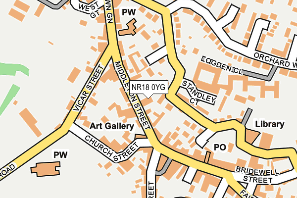
NR18 0YG is located in the Central Wymondham electoral ward, within the local authority district of South Norfolk and the English Parliamentary constituency of Mid Norfolk. The Sub Integrated Care Board (ICB) Location is NHS Norfolk and Waveney ICB - 26A and the police force is Norfolk. This postcode has been in use since May 2022.


GetTheData
Source: OS OpenMap – Local (Ordnance Survey)
Source: OS VectorMap District (Ordnance Survey)
Licence: Open Government Licence (requires attribution)
| Easting | 610779 |
| Northing | 302282 |
| Latitude | 52.577506 |
| Longitude | 1.109398 |
GetTheData
Source: Open Postcode Geo
Licence: Open Government Licence
| Country | England |
| Postcode District | NR18 |
➜ See where NR18 is on a map ➜ Where is Wymondham? | |
GetTheData
Source: Land Registry Price Paid Data
Licence: Open Government Licence
Elevation or altitude of NR18 0YG as distance above sea level:
| Metres | Feet | |
|---|---|---|
| Elevation | 40m | 131ft |
Elevation is measured from the approximate centre of the postcode, to the nearest point on an OS contour line from OS Terrain 50, which has contour spacing of ten vertical metres.
➜ How high above sea level am I? Find the elevation of your current position using your device's GPS.
GetTheData
Source: Open Postcode Elevation
Licence: Open Government Licence
| Ward | Central Wymondham |
| Constituency | Mid Norfolk |
GetTheData
Source: ONS Postcode Database
Licence: Open Government Licence
1, OLD MILL COURT, WYMONDHAM, NR18 0YG 2023 21 APR £400,000 |
7, OLD MILL COURT, WYMONDHAM, NR18 0YG 2022 24 JUN £395,000 |
8, OLD MILL COURT, WYMONDHAM, NR18 0YG 2022 24 JUN £365,000 |
GetTheData
Source: HM Land Registry Price Paid Data
Licence: Contains HM Land Registry data © Crown copyright and database right 2024. This data is licensed under the Open Government Licence v3.0.
| Sawmill Close (Barnham Broom Road) | Wymondham | 120m |
| Northfield Gardens (Melton Road) | Wymondham | 214m |
| Edwin Close (Ethel Gooch Road) | Wymondham | 222m |
| Barnham Broom Road (Chapel Lane) | Wymondham | 242m |
| Applegarth Court (Cock Street) | Wymondham | 346m |
| Wymondham Abbey (Mid Norfolk Railway) | Wymondham | 885m |
| Wymondham Station | 1.5km |
| Spooner Row Station | 5km |
GetTheData
Source: NaPTAN
Licence: Open Government Licence
GetTheData
Source: ONS Postcode Database
Licence: Open Government Licence


➜ Get more ratings from the Food Standards Agency
GetTheData
Source: Food Standards Agency
Licence: FSA terms & conditions
| Last Collection | |||
|---|---|---|---|
| Location | Mon-Fri | Sat | Distance |
| Pople Street | 17:30 | 12:15 | 420m |
| Northfields/Barnham Broom | 16:00 | 12:30 | 462m |
| Royal Mail Middleton Street | 18:00 | 13:00 | 671m |
GetTheData
Source: Dracos
Licence: Creative Commons Attribution-ShareAlike
The below table lists the International Territorial Level (ITL) codes (formerly Nomenclature of Territorial Units for Statistics (NUTS) codes) and Local Administrative Units (LAU) codes for NR18 0YG:
| ITL 1 Code | Name |
|---|---|
| TLH | East |
| ITL 2 Code | Name |
| TLH1 | East Anglia |
| ITL 3 Code | Name |
| TLH17 | Breckland and South Norfolk |
| LAU 1 Code | Name |
| E07000149 | South Norfolk |
GetTheData
Source: ONS Postcode Directory
Licence: Open Government Licence
The below table lists the Census Output Area (OA), Lower Layer Super Output Area (LSOA), and Middle Layer Super Output Area (MSOA) for NR18 0YG:
| Code | Name | |
|---|---|---|
| OA | E00136935 | |
| LSOA | E01026922 | South Norfolk 005D |
| MSOA | E02005601 | South Norfolk 005 |
GetTheData
Source: ONS Postcode Directory
Licence: Open Government Licence
| NR18 0DB | Melton Road | 35m |
| NR18 0UB | Poynt Close | 65m |
| NR18 0PQ | Melton Gate | 76m |
| NR18 0DF | Barnham Broom Road | 95m |
| NR18 0PG | Smock Mill Loke | 108m |
| NR18 0DD | Stile Lane | 139m |
| NR18 0TJ | Sawmill Close | 144m |
| NR18 0UA | Maden Close | 152m |
| NR18 0TZ | Palm Close | 170m |
| NR18 0DA | Melton Road | 189m |
GetTheData
Source: Open Postcode Geo; Land Registry Price Paid Data
Licence: Open Government Licence