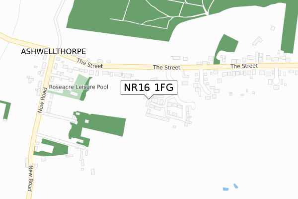
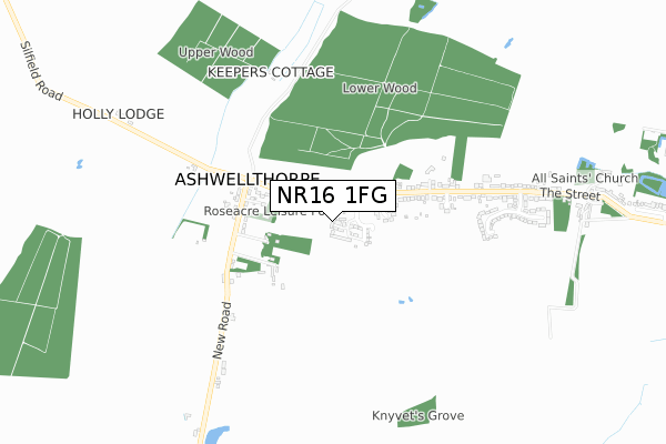
NR16 1FG is located in the Mulbarton & Stoke Holy Cross electoral ward, within the local authority district of South Norfolk and the English Parliamentary constituency of South Norfolk. The Sub Integrated Care Board (ICB) Location is NHS Norfolk and Waveney ICB - 26A and the police force is Norfolk. This postcode has been in use since April 2020.


GetTheData
Source: OS Open Zoomstack (Ordnance Survey)
Licence: Open Government Licence (requires attribution)
Attribution: Contains OS data © Crown copyright and database right 2024
Source: Open Postcode Geo
Licence: Open Government Licence (requires attribution)
Attribution: Contains OS data © Crown copyright and database right 2024; Contains Royal Mail data © Royal Mail copyright and database right 2024; Source: Office for National Statistics licensed under the Open Government Licence v.3.0
| Easting | 613756 |
| Northing | 297495 |
| Latitude | 52.533375 |
| Longitude | 1.150182 |
GetTheData
Source: Open Postcode Geo
Licence: Open Government Licence
| Country | England |
| Postcode District | NR16 |
➜ See where NR16 is on a map ➜ Where is Ashwellthorpe? | |
GetTheData
Source: Land Registry Price Paid Data
Licence: Open Government Licence
| Ward | Mulbarton & Stoke Holy Cross |
| Constituency | South Norfolk |
GetTheData
Source: ONS Postcode Database
Licence: Open Government Licence
5, BROWNE CLOSE, ASHWELLTHORPE, NORWICH, NR16 1FG 2020 30 APR £310,000 |
6, BROWNE CLOSE, ASHWELLTHORPE, NORWICH, NR16 1FG 2020 30 APR £285,000 |
GetTheData
Source: HM Land Registry Price Paid Data
Licence: Contains HM Land Registry data © Crown copyright and database right 2024. This data is licensed under the Open Government Licence v3.0.
| White Horse (The Street) | Ashwellthorpe | 368m |
| New Road (The Street) | Ashwellthorpe | 375m |
| New Road (The Street) | Ashwellthorpe | 399m |
| White Horse (The Street) | Ashwellthorpe | 417m |
| Village Shop (The Street) | Ashwellthorpe | 600m |
| Wymondham Station | 4.2km |
| Spooner Row Station | 4.3km |
GetTheData
Source: NaPTAN
Licence: Open Government Licence
GetTheData
Source: ONS Postcode Database
Licence: Open Government Licence

➜ Get more ratings from the Food Standards Agency
GetTheData
Source: Food Standards Agency
Licence: FSA terms & conditions
| Last Collection | |||
|---|---|---|---|
| Location | Mon-Fri | Sat | Distance |
| New Road | 17:00 | 12:20 | 370m |
| Post Office Stores The Street | 17:15 | 12:00 | 637m |
| The Common | 17:00 | 12:15 | 1,210m |
GetTheData
Source: Dracos
Licence: Creative Commons Attribution-ShareAlike
The below table lists the International Territorial Level (ITL) codes (formerly Nomenclature of Territorial Units for Statistics (NUTS) codes) and Local Administrative Units (LAU) codes for NR16 1FG:
| ITL 1 Code | Name |
|---|---|
| TLH | East |
| ITL 2 Code | Name |
| TLH1 | East Anglia |
| ITL 3 Code | Name |
| TLH17 | Breckland and South Norfolk |
| LAU 1 Code | Name |
| E07000149 | South Norfolk |
GetTheData
Source: ONS Postcode Directory
Licence: Open Government Licence
The below table lists the Census Output Area (OA), Lower Layer Super Output Area (LSOA), and Middle Layer Super Output Area (MSOA) for NR16 1FG:
| Code | Name | |
|---|---|---|
| OA | E00136807 | |
| LSOA | E01026897 | South Norfolk 011C |
| MSOA | E02005607 | South Norfolk 011 |
GetTheData
Source: ONS Postcode Directory
Licence: Open Government Licence
| NR16 1HD | The Street | 127m |
| NR16 1HB | Greenwood Close | 200m |
| NR16 1HF | New Road | 386m |
| NR16 1AA | The Street | 420m |
| NR16 1HA | Knyvett Green | 667m |
| NR16 1HG | New Road | 683m |
| NR16 1EZ | The Street | 862m |
| NR16 1HE | Wymondham Road | 868m |
| NR16 1DR | Common Road | 1174m |
| NR16 1EY | Old Hall Close | 1192m |
GetTheData
Source: Open Postcode Geo; Land Registry Price Paid Data
Licence: Open Government Licence