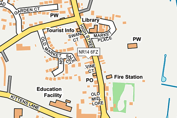
NR14 6FZ is located in the Loddon & Chedgrave electoral ward, within the local authority district of South Norfolk and the English Parliamentary constituency of South Norfolk. The Sub Integrated Care Board (ICB) Location is NHS Norfolk and Waveney ICB - 26A and the police force is Norfolk. This postcode has been in use since June 2017.


GetTheData
Source: OS OpenMap – Local (Ordnance Survey)
Source: OS VectorMap District (Ordnance Survey)
Licence: Open Government Licence (requires attribution)
| Easting | 636199 |
| Northing | 298680 |
| Latitude | 52.534750 |
| Longitude | 1.481290 |
GetTheData
Source: Open Postcode Geo
Licence: Open Government Licence
| Country | England |
| Postcode District | NR14 |
➜ See where NR14 is on a map ➜ Where is Loddon? | |
GetTheData
Source: Land Registry Price Paid Data
Licence: Open Government Licence
| Ward | Loddon & Chedgrave |
| Constituency | South Norfolk |
GetTheData
Source: ONS Postcode Database
Licence: Open Government Licence
| Market Place (High Street) | Loddon | 52m |
| Market Place (High Street) | Loddon | 85m |
| Beech Close (High Bungay Road) | Loddon | 352m |
| Broadland Meadows (Beccles Road) | Loddon | 467m |
| Broadland Meadows (Beccles Road) | Loddon | 480m |
| Cantley Station | 5.4km |
GetTheData
Source: NaPTAN
Licence: Open Government Licence
| Percentage of properties with Next Generation Access | 100.0% |
| Percentage of properties with Superfast Broadband | 100.0% |
| Percentage of properties with Ultrafast Broadband | 0.0% |
| Percentage of properties with Full Fibre Broadband | 0.0% |
Superfast Broadband is between 30Mbps and 300Mbps
Ultrafast Broadband is > 300Mbps
| Percentage of properties unable to receive 2Mbps | 0.0% |
| Percentage of properties unable to receive 5Mbps | 0.0% |
| Percentage of properties unable to receive 10Mbps | 0.0% |
| Percentage of properties unable to receive 30Mbps | 0.0% |
GetTheData
Source: Ofcom
Licence: Ofcom Terms of Use (requires attribution)
GetTheData
Source: ONS Postcode Database
Licence: Open Government Licence


➜ Get more ratings from the Food Standards Agency
GetTheData
Source: Food Standards Agency
Licence: FSA terms & conditions
| Last Collection | |||
|---|---|---|---|
| Location | Mon-Fri | Sat | Distance |
| Main Road Post Office | 16:50 | 12:45 | 105m |
| Gardenside/Yarmouth Road | 16:10 | 10:20 | 2,317m |
| Hall Farm | 10:15 | 10:15 | 2,466m |
GetTheData
Source: Dracos
Licence: Creative Commons Attribution-ShareAlike
The below table lists the International Territorial Level (ITL) codes (formerly Nomenclature of Territorial Units for Statistics (NUTS) codes) and Local Administrative Units (LAU) codes for NR14 6FZ:
| ITL 1 Code | Name |
|---|---|
| TLH | East |
| ITL 2 Code | Name |
| TLH1 | East Anglia |
| ITL 3 Code | Name |
| TLH17 | Breckland and South Norfolk |
| LAU 1 Code | Name |
| E07000149 | South Norfolk |
GetTheData
Source: ONS Postcode Directory
Licence: Open Government Licence
The below table lists the Census Output Area (OA), Lower Layer Super Output Area (LSOA), and Middle Layer Super Output Area (MSOA) for NR14 6FZ:
| Code | Name | |
|---|---|---|
| OA | E00136882 | |
| LSOA | E01026912 | South Norfolk 008D |
| MSOA | E02005604 | South Norfolk 008 |
GetTheData
Source: ONS Postcode Directory
Licence: Open Government Licence
| NR14 6QF | Sale Court | 40m |
| NR14 6LX | Church Plain | 44m |
| NR14 6AH | High Street | 93m |
| NR14 6EU | High Street | 100m |
| NR14 6GA | Swan Court | 109m |
| NR14 6QG | Old Market Green | 111m |
| NR14 6EX | Church Plain | 111m |
| NR14 6ET | High Street | 114m |
| NR14 6LZ | Bridge Street | 124m |
| NR14 6EY | Market Place | 125m |
GetTheData
Source: Open Postcode Geo; Land Registry Price Paid Data
Licence: Open Government Licence