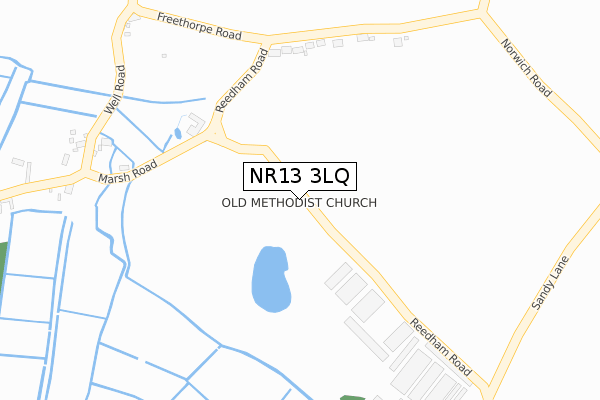
NR13 3LQ is located in the Brundall electoral ward, within the local authority district of Broadland and the English Parliamentary constituency of Broadland. The Sub Integrated Care Board (ICB) Location is NHS Norfolk and Waveney ICB - 26A and the police force is Norfolk. This postcode has been in use since August 2019.


GetTheData
Source: OS Open Zoomstack (Ordnance Survey)
Licence: Open Government Licence (requires attribution)
Attribution: Contains OS data © Crown copyright and database right 2024
Source: Open Postcode Geo
Licence: Open Government Licence (requires attribution)
Attribution: Contains OS data © Crown copyright and database right 2024; Contains Royal Mail data © Royal Mail copyright and database right 2024; Source: Office for National Statistics licensed under the Open Government Licence v.3.0
| Easting | 640016 |
| Northing | 303541 |
| Latitude | 52.576700 |
| Longitude | 1.540967 |
GetTheData
Source: Open Postcode Geo
Licence: Open Government Licence
| Country | England |
| Postcode District | NR13 |
➜ See where NR13 is on a map | |
GetTheData
Source: Land Registry Price Paid Data
Licence: Open Government Licence
| Ward | Brundall |
| Constituency | Broadland |
GetTheData
Source: ONS Postcode Database
Licence: Open Government Licence
| Council Houses (Cantley Road) | Limpenhoe | 849m |
| Council Houses (Cantley Road) | Limpenhoe | 855m |
| Old Chapel Road (The Common) | Freethorpe | 1,409m |
| Freethorpe Road | Reedham | 1,521m |
| Freethorpe Road | Reedham | 1,522m |
| Reedham (Norfolk) Station | 1.9km |
| Cantley Station | 1.9km |
| Buckenham Station | 5.3km |
GetTheData
Source: NaPTAN
Licence: Open Government Licence
GetTheData
Source: ONS Postcode Database
Licence: Open Government Licence


➜ Get more ratings from the Food Standards Agency
GetTheData
Source: Food Standards Agency
Licence: FSA terms & conditions
| Last Collection | |||
|---|---|---|---|
| Location | Mon-Fri | Sat | Distance |
| Monks Terrace | 16:05 | 09:50 | 4,253m |
| Main Road Post Office | 16:50 | 12:45 | 6,241m |
GetTheData
Source: Dracos
Licence: Creative Commons Attribution-ShareAlike
The below table lists the International Territorial Level (ITL) codes (formerly Nomenclature of Territorial Units for Statistics (NUTS) codes) and Local Administrative Units (LAU) codes for NR13 3LQ:
| ITL 1 Code | Name |
|---|---|
| TLH | East |
| ITL 2 Code | Name |
| TLH1 | East Anglia |
| ITL 3 Code | Name |
| TLH15 | Norwich and East Norfolk |
| LAU 1 Code | Name |
| E07000144 | Broadland |
GetTheData
Source: ONS Postcode Directory
Licence: Open Government Licence
The below table lists the Census Output Area (OA), Lower Layer Super Output Area (LSOA), and Middle Layer Super Output Area (MSOA) for NR13 3LQ:
| Code | Name | |
|---|---|---|
| OA | E00134715 | |
| LSOA | E01026511 | Broadland 017D |
| MSOA | E02005536 | Broadland 017 |
GetTheData
Source: ONS Postcode Directory
Licence: Open Government Licence
| NR13 3HZ | Freethorpe Road | 262m |
| NR13 3HU | Marsh Road | 300m |
| NR13 3AL | Well Road | 371m |
| NR13 3HT | The Hill | 402m |
| NR13 3HX | Marsh Road | 495m |
| NR13 3JB | Church Road | 759m |
| NR13 3JA | Church Road | 791m |
| NR13 3JE | Cantley Road | 898m |
| NR13 3JD | 1114m | |
| NR13 3SX | Walpole Way | 1300m |
GetTheData
Source: Open Postcode Geo; Land Registry Price Paid Data
Licence: Open Government Licence