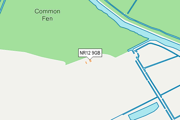
NR12 9GB lies on Fen Lane in Smallburgh, Norwich. NR12 9GB is located in the Hoveton & Tunstead electoral ward, within the local authority district of North Norfolk and the English Parliamentary constituency of North Norfolk. The Sub Integrated Care Board (ICB) Location is NHS Norfolk and Waveney ICB - 26A and the police force is Norfolk. This postcode has been in use since June 2017.


GetTheData
Source: OS OpenMap – Local (Ordnance Survey)
Source: OS VectorMap District (Ordnance Survey)
Licence: Open Government Licence (requires attribution)
| Easting | 635184 |
| Northing | 324343 |
| Latitude | 52.765470 |
| Longitude | 1.484629 |
GetTheData
Source: Open Postcode Geo
Licence: Open Government Licence
| Street | Fen Lane |
| Locality | Smallburgh |
| Town/City | Norwich |
| Country | England |
| Postcode District | NR12 |
➜ See where NR12 is on a map | |
GetTheData
Source: Land Registry Price Paid Data
Licence: Open Government Licence
| Ward | Hoveton & Tunstead |
| Constituency | North Norfolk |
GetTheData
Source: ONS Postcode Database
Licence: Open Government Licence
| Norwich Road | Smallburgh | 611m |
| Norwich Road | Smallburgh | 620m |
| Woodfarm Inn (Wayford Road) | Wayford | 641m |
| Woodfarm Inn (Wayford Road) | Wayford | 647m |
| Layby (Norwich Road) | Smallburgh | 1,018m |
GetTheData
Source: NaPTAN
Licence: Open Government Licence
| Percentage of properties with Next Generation Access | 100.0% |
| Percentage of properties with Superfast Broadband | 0.0% |
| Percentage of properties with Ultrafast Broadband | 0.0% |
| Percentage of properties with Full Fibre Broadband | 0.0% |
Superfast Broadband is between 30Mbps and 300Mbps
Ultrafast Broadband is > 300Mbps
| Percentage of properties unable to receive 2Mbps | 0.0% |
| Percentage of properties unable to receive 5Mbps | 0.0% |
| Percentage of properties unable to receive 10Mbps | 100.0% |
| Percentage of properties unable to receive 30Mbps | 100.0% |
GetTheData
Source: Ofcom
Licence: Ofcom Terms of Use (requires attribution)
GetTheData
Source: ONS Postcode Database
Licence: Open Government Licence


➜ Get more ratings from the Food Standards Agency
GetTheData
Source: Food Standards Agency
Licence: FSA terms & conditions
| Last Collection | |||
|---|---|---|---|
| Location | Mon-Fri | Sat | Distance |
| Staithe | 16:45 | 08:00 | 2,180m |
| Lyndford Road | 16:00 | 10:00 | 2,263m |
| High Street Post Office | 17:15 | 12:30 | 2,514m |
GetTheData
Source: Dracos
Licence: Creative Commons Attribution-ShareAlike
The below table lists the International Territorial Level (ITL) codes (formerly Nomenclature of Territorial Units for Statistics (NUTS) codes) and Local Administrative Units (LAU) codes for NR12 9GB:
| ITL 1 Code | Name |
|---|---|
| TLH | East |
| ITL 2 Code | Name |
| TLH1 | East Anglia |
| ITL 3 Code | Name |
| TLH16 | North and West Norfolk |
| LAU 1 Code | Name |
| E07000147 | North Norfolk |
GetTheData
Source: ONS Postcode Directory
Licence: Open Government Licence
The below table lists the Census Output Area (OA), Lower Layer Super Output Area (LSOA), and Middle Layer Super Output Area (MSOA) for NR12 9GB:
| Code | Name | |
|---|---|---|
| OA | E00136099 | |
| LSOA | E01026767 | North Norfolk 012B |
| MSOA | E02005581 | North Norfolk 012 |
GetTheData
Source: ONS Postcode Directory
Licence: Open Government Licence
| NR12 9LP | Thimble Hill | 504m |
| NR12 9LN | Wayford Bridge | 553m |
| NR12 9LS | 660m | |
| NR12 9LL | 674m | |
| NR12 9LR | Low Street | 705m |
| NR12 9LH | 812m | |
| NR12 9LX | Yarmouth Road | 906m |
| NR12 9LJ | 937m | |
| NR12 9LU | Norwich Road | 952m |
| NR12 9LZ | Chapel Terrace | 1107m |
GetTheData
Source: Open Postcode Geo; Land Registry Price Paid Data
Licence: Open Government Licence