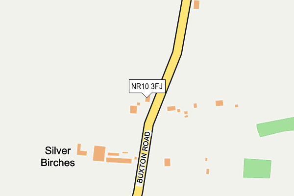
NR10 3FJ is located in the Spixworth with St Faiths electoral ward, within the local authority district of Broadland and the English Parliamentary constituency of Broadland. The Sub Integrated Care Board (ICB) Location is NHS Norfolk and Waveney ICB - 26A and the police force is Norfolk. This postcode has been in use since April 2014.


GetTheData
Source: OS OpenMap – Local (Ordnance Survey)
Source: OS VectorMap District (Ordnance Survey)
Licence: Open Government Licence (requires attribution)
| Easting | 623947 |
| Northing | 313604 |
| Latitude | 52.673862 |
| Longitude | 1.311066 |
GetTheData
Source: Open Postcode Geo
Licence: Open Government Licence
| Country | England |
| Postcode District | NR10 |
➜ See where NR10 is on a map ➜ Where is Norwich? | |
GetTheData
Source: Land Registry Price Paid Data
Licence: Open Government Licence
Elevation or altitude of NR10 3FJ as distance above sea level:
| Metres | Feet | |
|---|---|---|
| Elevation | 30m | 98ft |
Elevation is measured from the approximate centre of the postcode, to the nearest point on an OS contour line from OS Terrain 50, which has contour spacing of ten vertical metres.
➜ How high above sea level am I? Find the elevation of your current position using your device's GPS.
GetTheData
Source: Open Postcode Elevation
Licence: Open Government Licence
| Ward | Spixworth With St Faiths |
| Constituency | Broadland |
GetTheData
Source: ONS Postcode Database
Licence: Open Government Licence
FOXLEY LODGE, BUXTON ROAD, SPIXWORTH, NORWICH, NR10 3FJ 2021 26 OCT £130,000 |
GetTheData
Source: HM Land Registry Price Paid Data
Licence: Contains HM Land Registry data © Crown copyright and database right 2025. This data is licensed under the Open Government Licence v3.0.
| Beeston Lane (Buxton Road) | Spixworth | 304m |
| Beeston Lane (Buxton Road) | Spixworth | 325m |
| Shopping Centre (The Paddocks) | Old Catton | 547m |
| Shopping Centre (The Paddocks) | Old Catton | 559m |
| Desmond Drive (Spixworth Road) | Old Catton | 747m |
GetTheData
Source: NaPTAN
Licence: Open Government Licence
| Percentage of properties with Next Generation Access | 100.0% |
| Percentage of properties with Superfast Broadband | 100.0% |
| Percentage of properties with Ultrafast Broadband | 0.0% |
| Percentage of properties with Full Fibre Broadband | 0.0% |
Superfast Broadband is between 30Mbps and 300Mbps
Ultrafast Broadband is > 300Mbps
| Percentage of properties unable to receive 2Mbps | 0.0% |
| Percentage of properties unable to receive 5Mbps | 0.0% |
| Percentage of properties unable to receive 10Mbps | 0.0% |
| Percentage of properties unable to receive 30Mbps | 0.0% |
GetTheData
Source: Ofcom
Licence: Ofcom Terms of Use (requires attribution)
GetTheData
Source: ONS Postcode Database
Licence: Open Government Licence


➜ Get more ratings from the Food Standards Agency
GetTheData
Source: Food Standards Agency
Licence: FSA terms & conditions
| Last Collection | |||
|---|---|---|---|
| Location | Mon-Fri | Sat | Distance |
| The Paddocks | 17:45 | 11:00 | 627m |
| White Woman Lane | 17:45 | 11:00 | 894m |
| Norman Drive | 17:45 | 11:00 | 908m |
GetTheData
Source: Dracos
Licence: Creative Commons Attribution-ShareAlike
The below table lists the International Territorial Level (ITL) codes (formerly Nomenclature of Territorial Units for Statistics (NUTS) codes) and Local Administrative Units (LAU) codes for NR10 3FJ:
| ITL 1 Code | Name |
|---|---|
| TLH | East |
| ITL 2 Code | Name |
| TLH1 | East Anglia |
| ITL 3 Code | Name |
| TLH15 | Norwich and East Norfolk |
| LAU 1 Code | Name |
| E07000144 | Broadland |
GetTheData
Source: ONS Postcode Directory
Licence: Open Government Licence
The below table lists the Census Output Area (OA), Lower Layer Super Output Area (LSOA), and Middle Layer Super Output Area (MSOA) for NR10 3FJ:
| Code | Name | |
|---|---|---|
| OA | E00134912 | |
| LSOA | E01026550 | Broadland 005B |
| MSOA | E02005524 | Broadland 005 |
GetTheData
Source: ONS Postcode Directory
Licence: Open Government Licence
| NR10 3TN | Beeston Lane | 282m |
| NR10 3PN | Buxton Road | 320m |
| NR6 7HS | The Paddocks | 530m |
| NR6 7GB | Austin Way | 550m |
| NR6 7HP | Edgefield Close | 567m |
| NR6 7GA | Ernest Drive | 591m |
| NR6 7HX | Westacre Drive | 609m |
| NR6 7JT | Dunwood Drive | 615m |
| NR6 7JS | Dunwood Drive | 619m |
| NR6 7JR | Desmond Drive | 627m |
GetTheData
Source: Open Postcode Geo; Land Registry Price Paid Data
Licence: Open Government Licence