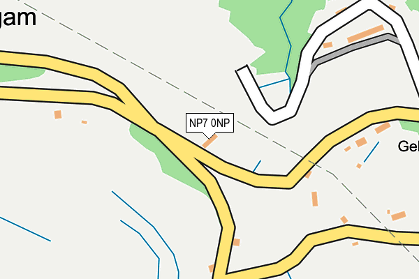
NP7 0NP is located in the Llanelly electoral ward, within the unitary authority of Monmouthshire and the Welsh Parliamentary constituency of Monmouth. The Local Health Board is Aneurin Bevan University and the police force is Gwent. This postcode has been in use since January 1980.


GetTheData
Source: OS OpenMap – Local (Ordnance Survey)
Source: OS VectorMap District (Ordnance Survey)
Licence: Open Government Licence (requires attribution)
| Easting | 321384 |
| Northing | 212096 |
| Latitude | 51.801959 |
| Longitude | -3.141525 |
GetTheData
Source: Open Postcode Geo
Licence: Open Government Licence
| Country | Wales |
| Postcode District | NP7 |
➜ See where NP7 is on a map ➜ Where is Gellifelen? | |
GetTheData
Source: Land Registry Price Paid Data
Licence: Open Government Licence
Elevation or altitude of NP7 0NP as distance above sea level:
| Metres | Feet | |
|---|---|---|
| Elevation | 360m | 1,181ft |
Elevation is measured from the approximate centre of the postcode, to the nearest point on an OS contour line from OS Terrain 50, which has contour spacing of ten vertical metres.
➜ How high above sea level am I? Find the elevation of your current position using your device's GPS.
GetTheData
Source: Open Postcode Elevation
Licence: Open Government Licence
| Ward | Llanelly |
| Constituency | Monmouth |
GetTheData
Source: ONS Postcode Database
Licence: Open Government Licence
| Gellifelen Post Box (Unclassified Road) | Llanelly Hill | 316m |
| Drum And Monkey Hov Road (A465) | Blackrock | 429m |
| Drum & Monkey (Main Road) | Blackrock | 457m |
| Drum & Monkey (Main Road) | Blackrock | 535m |
| Drum And Monkey Hov Road (A465) | Blackrock | 571m |
| Ebbw Vale Town Station | 5.1km |
| Ebbw Vale Parkway Station | 6.2km |
GetTheData
Source: NaPTAN
Licence: Open Government Licence
| Percentage of properties with Next Generation Access | 100.0% |
| Percentage of properties with Superfast Broadband | 100.0% |
| Percentage of properties with Ultrafast Broadband | 0.0% |
| Percentage of properties with Full Fibre Broadband | 0.0% |
Superfast Broadband is between 30Mbps and 300Mbps
Ultrafast Broadband is > 300Mbps
| Percentage of properties unable to receive 2Mbps | 0.0% |
| Percentage of properties unable to receive 5Mbps | 0.0% |
| Percentage of properties unable to receive 10Mbps | 0.0% |
| Percentage of properties unable to receive 30Mbps | 0.0% |
GetTheData
Source: Ofcom
Licence: Ofcom Terms of Use (requires attribution)
GetTheData
Source: ONS Postcode Database
Licence: Open Government Licence


➜ Get more ratings from the Food Standards Agency
GetTheData
Source: Food Standards Agency
Licence: FSA terms & conditions
| Last Collection | |||
|---|---|---|---|
| Location | Mon-Fri | Sat | Distance |
| King Street Post Office | 16:45 | 12:00 | 447m |
| Bryn Terrace | 16:15 | 11:30 | 5,247m |
| Alma Street | 16:45 | 11:45 | 5,912m |
GetTheData
Source: Dracos
Licence: Creative Commons Attribution-ShareAlike
The below table lists the International Territorial Level (ITL) codes (formerly Nomenclature of Territorial Units for Statistics (NUTS) codes) and Local Administrative Units (LAU) codes for NP7 0NP:
| ITL 1 Code | Name |
|---|---|
| TLL | Wales |
| ITL 2 Code | Name |
| TLL2 | East Wales |
| ITL 3 Code | Name |
| TLL21 | Monmouthshire and Newport |
| LAU 1 Code | Name |
| W06000021 | Monmouthshire |
GetTheData
Source: ONS Postcode Directory
Licence: Open Government Licence
The below table lists the Census Output Area (OA), Lower Layer Super Output Area (LSOA), and Middle Layer Super Output Area (MSOA) for NP7 0NP:
| Code | Name | |
|---|---|---|
| OA | W00008148 | |
| LSOA | W01001562 | Monmouthshire 003B |
| MSOA | W02000338 | Monmouthshire 003 |
GetTheData
Source: ONS Postcode Directory
Licence: Open Government Licence
| NP7 0NW | 218m | |
| NP7 0NN | Long Row | 277m |
| NP7 0PA | Upper Gelli | 297m |
| NP7 0RF | Upper Cwm Nant Gam | 476m |
| NP7 0RG | Lower Cwm Nant Gam | 489m |
| NP7 0LW | Blackrock | 511m |
| NP7 0NR | Darenfelin | 604m |
| NP7 0RE | Darenfelen | 705m |
| NP7 0PD | Miners Row | 705m |
| NP7 0PF | Wesley Terrace | 725m |
GetTheData
Source: Open Postcode Geo; Land Registry Price Paid Data
Licence: Open Government Licence