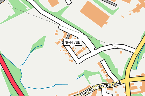
NP44 7BB is located in the Llantarnam electoral ward, within the unitary authority of Torfaen and the Welsh Parliamentary constituency of Torfaen. The Local Health Board is Aneurin Bevan University and the police force is Gwent. This postcode has been in use since March 2017.


GetTheData
Source: OS OpenMap – Local (Ordnance Survey)
Source: OS VectorMap District (Ordnance Survey)
Licence: Open Government Licence (requires attribution)
| Easting | 329977 |
| Northing | 192593 |
| Latitude | 51.627779 |
| Longitude | -3.013009 |
GetTheData
Source: Open Postcode Geo
Licence: Open Government Licence
| Country | Wales |
| Postcode District | NP44 |
➜ See where NP44 is on a map ➜ Where is Cwmbrân? | |
GetTheData
Source: Land Registry Price Paid Data
Licence: Open Government Licence
| Ward | Llantarnam |
| Constituency | Torfaen |
GetTheData
Source: ONS Postcode Database
Licence: Open Government Licence
43, THE MALTINGS, LLANTARNAM, CWMBRAN, NP44 7BB 2022 14 OCT £420,000 |
55, THE MALTINGS, LLANTARNAM, CWMBRAN, NP44 7BB 2022 23 MAY £415,000 |
44, THE MALTINGS, LLANTARNAM, CWMBRAN, NP44 7BB 2022 28 JAN £475,000 |
43, THE MALTINGS, LLANTARNAM, CWMBRAN, NP44 7BB 2021 2 JUN £370,000 |
32, THE MALTINGS, LLANTARNAM, CWMBRAN, NP44 7BB 2021 30 APR £282,000 |
59, THE MALTINGS, LLANTARNAM, CWMBRAN, NP44 7BB 2019 27 JUN £419,995 |
3, THE MALTINGS, LLANTARNAM, CWMBRAN, NP44 7BB 2019 21 JUN £354,995 |
58, THE MALTINGS, LLANTARNAM, CWMBRAN, NP44 7BB 2019 15 MAY £399,995 |
57, THE MALTINGS, LLANTARNAM, CWMBRAN, NP44 7BB 2019 26 APR £347,995 |
55, THE MALTINGS, LLANTARNAM, CWMBRAN, NP44 7BB 2019 29 MAR £301,995 |
GetTheData
Source: HM Land Registry Price Paid Data
Licence: Contains HM Land Registry data © Crown copyright and database right 2024. This data is licensed under the Open Government Licence v3.0.
| Blackbirds (Newport Road) | Croes-y-mwyalch | 438m |
| Abbey Gates (Newport Road) | Llantarnam | 446m |
| Abbey Gates (Newport Road) | Llantarnam | 449m |
| William Brown Close (Llantarnam Park Way) | Llantarnam | 453m |
| Blackbirds (Newport Road) | Croes-y-mwyalch | 453m |
| Cwmbran Station | 3.2km |
| Newport (S Wales) Station | 4.4km |
| Rogerstone Station | 5.2km |
GetTheData
Source: NaPTAN
Licence: Open Government Licence
| Percentage of properties with Next Generation Access | 100.0% |
| Percentage of properties with Superfast Broadband | 100.0% |
| Percentage of properties with Ultrafast Broadband | 0.0% |
| Percentage of properties with Full Fibre Broadband | 0.0% |
Superfast Broadband is between 30Mbps and 300Mbps
Ultrafast Broadband is > 300Mbps
| Median download speed | 55.0Mbps |
| Average download speed | 49.7Mbps |
| Maximum download speed | 78.12Mbps |
| Median upload speed | 10.0Mbps |
| Average upload speed | 12.7Mbps |
| Maximum upload speed | 20.00Mbps |
| Percentage of properties unable to receive 2Mbps | 0.0% |
| Percentage of properties unable to receive 5Mbps | 0.0% |
| Percentage of properties unable to receive 10Mbps | 0.0% |
| Percentage of properties unable to receive 30Mbps | 0.0% |
GetTheData
Source: Ofcom
Licence: Ofcom Terms of Use (requires attribution)
GetTheData
Source: ONS Postcode Database
Licence: Open Government Licence


➜ Get more ratings from the Food Standards Agency
GetTheData
Source: Food Standards Agency
Licence: FSA terms & conditions
| Last Collection | |||
|---|---|---|---|
| Location | Mon-Fri | Sat | Distance |
| Llantarnam Road | 17:30 | 11:00 | 1,706m |
| Bettws Post Office | 17:30 | 12:00 | 2,041m |
| Yewberry Lane | 17:30 | 11:45 | 2,079m |
GetTheData
Source: Dracos
Licence: Creative Commons Attribution-ShareAlike
The below table lists the International Territorial Level (ITL) codes (formerly Nomenclature of Territorial Units for Statistics (NUTS) codes) and Local Administrative Units (LAU) codes for NP44 7BB:
| ITL 1 Code | Name |
|---|---|
| TLL | Wales |
| ITL 2 Code | Name |
| TLL1 | West Wales and The Valleys |
| ITL 3 Code | Name |
| TLL16 | Gwent Valleys |
| LAU 1 Code | Name |
| W06000020 | Torfaen |
GetTheData
Source: ONS Postcode Directory
Licence: Open Government Licence
The below table lists the Census Output Area (OA), Lower Layer Super Output Area (LSOA), and Middle Layer Super Output Area (MSOA) for NP44 7BB:
| Code | Name | |
|---|---|---|
| OA | W00007858 | |
| LSOA | W01001505 | Torfaen 013B |
| MSOA | W02000335 | Torfaen 013 |
GetTheData
Source: ONS Postcode Directory
Licence: Open Government Licence
| NP44 7AX | Ty Coch Close | 195m |
| NP44 3AP | Pentre Lane | 246m |
| NP44 3AQ | The Manor | 413m |
| NP44 3AF | Newport Road | 469m |
| NP44 3GB | Lansdowne Gardens | 493m |
| NP44 3AE | Newport Road | 564m |
| NP44 3AB | William Browne Close | 648m |
| NP44 3DJ | Newport Road | 688m |
| NP44 3HF | Magna Porta Gardens | 696m |
| NP44 3HE | Cory Park | 750m |
GetTheData
Source: Open Postcode Geo; Land Registry Price Paid Data
Licence: Open Government Licence