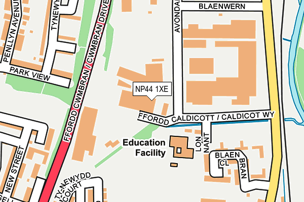
NP44 1XE is located in the Pontnewydd electoral ward, within the unitary authority of Torfaen and the Welsh Parliamentary constituency of Torfaen. The Local Health Board is Aneurin Bevan University and the police force is Gwent. This postcode has been in use since January 1993.


GetTheData
Source: OS OpenMap – Local (Ordnance Survey)
Source: OS VectorMap District (Ordnance Survey)
Licence: Open Government Licence (requires attribution)
| Easting | 329501 |
| Northing | 196578 |
| Latitude | 51.663544 |
| Longitude | -3.020689 |
GetTheData
Source: Open Postcode Geo
Licence: Open Government Licence
| Country | Wales |
| Postcode District | NP44 |
➜ See where NP44 is on a map ➜ Where is Cwmbrân? | |
GetTheData
Source: Land Registry Price Paid Data
Licence: Open Government Licence
Elevation or altitude of NP44 1XE as distance above sea level:
| Metres | Feet | |
|---|---|---|
| Elevation | 70m | 230ft |
Elevation is measured from the approximate centre of the postcode, to the nearest point on an OS contour line from OS Terrain 50, which has contour spacing of ten vertical metres.
➜ How high above sea level am I? Find the elevation of your current position using your device's GPS.
GetTheData
Source: Open Postcode Elevation
Licence: Open Government Licence
| Ward | Pontnewydd |
| Constituency | Torfaen |
GetTheData
Source: ONS Postcode Database
Licence: Open Government Licence
| War Memorial (Richmond Road) | Pontnewydd | 332m |
| War Memorial (Richmond Road) | Pontnewydd | 348m |
| King`s Head Hotel (Station Road) | Pontnewydd | 352m |
| Russell Street | Pontnewydd | 352m |
| St David`s Rc Church (Station Road) | Northville | 369m |
| Cwmbran Station | 0.8km |
| Pontypool & New Inn Station | 3.9km |
GetTheData
Source: NaPTAN
Licence: Open Government Licence
GetTheData
Source: ONS Postcode Database
Licence: Open Government Licence


➜ Get more ratings from the Food Standards Agency
GetTheData
Source: Food Standards Agency
Licence: FSA terms & conditions
| Last Collection | |||
|---|---|---|---|
| Location | Mon-Fri | Sat | Distance |
| Edlogan Square Post Office | 17:00 | 12:00 | 698m |
| Five Locks Close | 17:30 | 11:00 | 891m |
| North Road | 17:30 | 11:00 | 1,129m |
GetTheData
Source: Dracos
Licence: Creative Commons Attribution-ShareAlike
The below table lists the International Territorial Level (ITL) codes (formerly Nomenclature of Territorial Units for Statistics (NUTS) codes) and Local Administrative Units (LAU) codes for NP44 1XE:
| ITL 1 Code | Name |
|---|---|
| TLL | Wales |
| ITL 2 Code | Name |
| TLL1 | West Wales and The Valleys |
| ITL 3 Code | Name |
| TLL16 | Gwent Valleys |
| LAU 1 Code | Name |
| W06000020 | Torfaen |
GetTheData
Source: ONS Postcode Directory
Licence: Open Government Licence
The below table lists the Census Output Area (OA), Lower Layer Super Output Area (LSOA), and Middle Layer Super Output Area (MSOA) for NP44 1XE:
| Code | Name | |
|---|---|---|
| OA | W00007935 | |
| LSOA | W01001520 | Torfaen 007B |
| MSOA | W02000329 | Torfaen 007 |
GetTheData
Source: ONS Postcode Directory
Licence: Open Government Licence
| NP44 1TY | Blaenwern | 177m |
| NP44 1RG | Tynewydd South Close | 205m |
| NP44 1UU | Blaen Bran Close | 205m |
| NP44 1EW | Parklands Close | 218m |
| NP44 1RB | Park View | 247m |
| NP44 1NS | Tynewydd Road | 266m |
| NP44 1RQ | Tynewydd Green | 281m |
| NP44 1EB | Brookland Terrace | 283m |
| NP44 1RJ | Tynewydd Avenue | 291m |
| NP44 1EF | New Street | 315m |
GetTheData
Source: Open Postcode Geo; Land Registry Price Paid Data
Licence: Open Government Licence