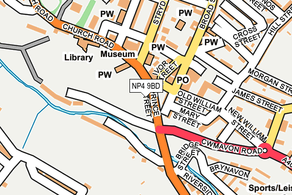
NP4 9BD is located in the Blaenavon electoral ward, within the unitary authority of Torfaen and the Welsh Parliamentary constituency of Torfaen. The Local Health Board is Aneurin Bevan University and the police force is Gwent. This postcode has been in use since January 1980.


GetTheData
Source: OS OpenMap – Local (Ordnance Survey)
Source: OS VectorMap District (Ordnance Survey)
Licence: Open Government Licence (requires attribution)
| Easting | 325174 |
| Northing | 208716 |
| Latitude | 51.772099 |
| Longitude | -3.085849 |
GetTheData
Source: Open Postcode Geo
Licence: Open Government Licence
| Country | Wales |
| Postcode District | NP4 |
➜ See where NP4 is on a map ➜ Where is Blaenavon? | |
GetTheData
Source: Land Registry Price Paid Data
Licence: Open Government Licence
Elevation or altitude of NP4 9BD as distance above sea level:
| Metres | Feet | |
|---|---|---|
| Elevation | 310m | 1,017ft |
Elevation is measured from the approximate centre of the postcode, to the nearest point on an OS contour line from OS Terrain 50, which has contour spacing of ten vertical metres.
➜ How high above sea level am I? Find the elevation of your current position using your device's GPS.
GetTheData
Source: Open Postcode Elevation
Licence: Open Government Licence
| Ward | Blaenavon |
| Constituency | Torfaen |
GetTheData
Source: ONS Postcode Database
Licence: Open Government Licence
| Curwood (Varteg Road) | Blaenavon | 88m |
| Curwood (Varteg Road) | Blaenavon | 113m |
| Lower Hill Street Steps (Church Road) | Blaenavon | 125m |
| World Heritage Centre (Church Rroad) | Blaenavon | 175m |
| Market Street | Blaenavon | 181m |
GetTheData
Source: NaPTAN
Licence: Open Government Licence
GetTheData
Source: ONS Postcode Database
Licence: Open Government Licence


➜ Get more ratings from the Food Standards Agency
GetTheData
Source: Food Standards Agency
Licence: FSA terms & conditions
| Last Collection | |||
|---|---|---|---|
| Location | Mon-Fri | Sat | Distance |
| Bryn Terrace | 16:15 | 11:30 | 423m |
| King Street Post Office | 16:45 | 12:00 | 5,522m |
GetTheData
Source: Dracos
Licence: Creative Commons Attribution-ShareAlike
The below table lists the International Territorial Level (ITL) codes (formerly Nomenclature of Territorial Units for Statistics (NUTS) codes) and Local Administrative Units (LAU) codes for NP4 9BD:
| ITL 1 Code | Name |
|---|---|
| TLL | Wales |
| ITL 2 Code | Name |
| TLL1 | West Wales and The Valleys |
| ITL 3 Code | Name |
| TLL16 | Gwent Valleys |
| LAU 1 Code | Name |
| W06000020 | Torfaen |
GetTheData
Source: ONS Postcode Directory
Licence: Open Government Licence
The below table lists the Census Output Area (OA), Lower Layer Super Output Area (LSOA), and Middle Layer Super Output Area (MSOA) for NP4 9BD:
| Code | Name | |
|---|---|---|
| OA | W00007769 | |
| LSOA | W01001489 | Torfaen 001C |
| MSOA | W02000323 | Torfaen 001 |
GetTheData
Source: ONS Postcode Directory
Licence: Open Government Licence
| NP4 9XA | Prince Street | 12m |
| NP4 9ND | Broad Street | 58m |
| NP4 9AN | Old William Street | 100m |
| NP4 9AP | Mary Street | 102m |
| NP4 9BJ | Curwood | 103m |
| NP4 9EH | Old James Street | 112m |
| NP4 9PT | High Street | 130m |
| NP4 9AR | Lower Hill Street | 142m |
| NP4 9JW | South View Terrace | 167m |
| NP4 9AA | Park Street | 173m |
GetTheData
Source: Open Postcode Geo; Land Registry Price Paid Data
Licence: Open Government Licence