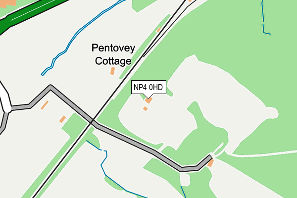
NP4 0HD is located in the New Inn electoral ward, within the unitary authority of Torfaen and the Welsh Parliamentary constituency of Torfaen. The Local Health Board is Aneurin Bevan University and the police force is Gwent. This postcode has been in use since January 1980.


GetTheData
Source: OS OpenMap – Local (Ordnance Survey)
Source: OS VectorMap District (Ordnance Survey)
Licence: Open Government Licence (requires attribution)
| Easting | 331500 |
| Northing | 202243 |
| Latitude | 51.714716 |
| Longitude | -2.992899 |
GetTheData
Source: Open Postcode Geo
Licence: Open Government Licence
| Country | Wales |
| Postcode District | NP4 |
➜ See where NP4 is on a map | |
GetTheData
Source: Land Registry Price Paid Data
Licence: Open Government Licence
Elevation or altitude of NP4 0HD as distance above sea level:
| Metres | Feet | |
|---|---|---|
| Elevation | 80m | 262ft |
Elevation is measured from the approximate centre of the postcode, to the nearest point on an OS contour line from OS Terrain 50, which has contour spacing of ten vertical metres.
➜ How high above sea level am I? Find the elevation of your current position using your device's GPS.
GetTheData
Source: Open Postcode Elevation
Licence: Open Government Licence
| Ward | New Inn |
| Constituency | Torfaen |
GetTheData
Source: ONS Postcode Database
Licence: Open Government Licence
| Waun-y-clare Inn (Usk Road) | Pontypool | 318m |
| Pont-y-pia (Usk Road) | Pontypool | 429m |
| Waun-y-clare Inn (Usk Road) | Pontypool | 431m |
| Pont-y - Pia (Usk Road) | Pontypool | 440m |
| Cwmoody Cottage (Usk Road) | Pontypool | 817m |
| Pontypool & New Inn Station | 2.4km |
GetTheData
Source: NaPTAN
Licence: Open Government Licence
GetTheData
Source: ONS Postcode Database
Licence: Open Government Licence


➜ Get more ratings from the Food Standards Agency
GetTheData
Source: Food Standards Agency
Licence: FSA terms & conditions
| Last Collection | |||
|---|---|---|---|
| Location | Mon-Fri | Sat | Distance |
| Garn Yr Erw | 11:30 | 10:00 | 3,348m |
| Forgeside Post Office | 16:45 | 11:45 | 3,348m |
| Penygarn Post Office | 16:00 | 11:15 | 3,490m |
GetTheData
Source: Dracos
Licence: Creative Commons Attribution-ShareAlike
The below table lists the International Territorial Level (ITL) codes (formerly Nomenclature of Territorial Units for Statistics (NUTS) codes) and Local Administrative Units (LAU) codes for NP4 0HD:
| ITL 1 Code | Name |
|---|---|
| TLL | Wales |
| ITL 2 Code | Name |
| TLL1 | West Wales and The Valleys |
| ITL 3 Code | Name |
| TLL16 | Gwent Valleys |
| LAU 1 Code | Name |
| W06000020 | Torfaen |
GetTheData
Source: ONS Postcode Directory
Licence: Open Government Licence
The below table lists the Census Output Area (OA), Lower Layer Super Output Area (LSOA), and Middle Layer Super Output Area (MSOA) for NP4 0HD:
| Code | Name | |
|---|---|---|
| OA | W00007899 | |
| LSOA | W01001513 | Torfaen 005D |
| MSOA | W02000327 | Torfaen 005 |
GetTheData
Source: ONS Postcode Directory
Licence: Open Government Licence
| NP4 0JA | 774m | |
| NP4 0HE | Berthon Road | 803m |
| NP4 0HF | Woodside | 835m |
| NP4 0HS | Brynhyfryd Close | 871m |
| NP4 0HW | White House Gardens | 978m |
| NP4 0JE | 984m | |
| NP4 0HU | Ty Gwyn Road | 997m |
| NP4 0HN | Millbrook Place | 1026m |
| NP4 0HT | Millbrook Court | 1067m |
| NP4 0HB | Greenmeadow Crescent | 1098m |
GetTheData
Source: Open Postcode Geo; Land Registry Price Paid Data
Licence: Open Government Licence