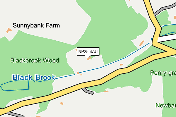
NP25 4AU lies on Glyn Road in Penallt, Monmouth. NP25 4AU is located in the Mitchel Troy and Trellech United electoral ward, within the unitary authority of Monmouthshire and the Welsh Parliamentary constituency of Monmouth. The Local Health Board is Aneurin Bevan University and the police force is Gwent. This postcode has been in use since August 2014.


GetTheData
Source: OS OpenMap – Local (Ordnance Survey)
Source: OS VectorMap District (Ordnance Survey)
Licence: Open Government Licence (requires attribution)
| Easting | 352774 |
| Northing | 210074 |
| Latitude | 51.787324 |
| Longitude | -2.686069 |
GetTheData
Source: Open Postcode Geo
Licence: Open Government Licence
| Street | Glyn Road |
| Locality | Penallt |
| Town/City | Monmouth |
| Country | Wales |
| Postcode District | NP25 |
➜ See where NP25 is on a map ➜ Where is Penallt? | |
GetTheData
Source: Land Registry Price Paid Data
Licence: Open Government Licence
Elevation or altitude of NP25 4AU as distance above sea level:
| Metres | Feet | |
|---|---|---|
| Elevation | 120m | 394ft |
Elevation is measured from the approximate centre of the postcode, to the nearest point on an OS contour line from OS Terrain 50, which has contour spacing of ten vertical metres.
➜ How high above sea level am I? Find the elevation of your current position using your device's GPS.
GetTheData
Source: Open Postcode Elevation
Licence: Open Government Licence
| Ward | Mitchel Troy And Trellech United |
| Constituency | Monmouth |
GetTheData
Source: ONS Postcode Database
Licence: Open Government Licence
| Redbrook Turn | Redbrook | 782m |
| Redbrook Turn | Redbrook | 789m |
| Newland Turn (Redbrook Road A466) | Redbrook | 794m |
| Village Store | Redbrook | 987m |
| Bell Inn (Redbrook Road A466) | Redbrook | 989m |
GetTheData
Source: NaPTAN
Licence: Open Government Licence
| Percentage of properties with Next Generation Access | 50.0% |
| Percentage of properties with Superfast Broadband | 50.0% |
| Percentage of properties with Ultrafast Broadband | 0.0% |
| Percentage of properties with Full Fibre Broadband | 0.0% |
Superfast Broadband is between 30Mbps and 300Mbps
Ultrafast Broadband is > 300Mbps
| Percentage of properties unable to receive 2Mbps | 0.0% |
| Percentage of properties unable to receive 5Mbps | 50.0% |
| Percentage of properties unable to receive 10Mbps | 50.0% |
| Percentage of properties unable to receive 30Mbps | 50.0% |
GetTheData
Source: Ofcom
Licence: Ofcom Terms of Use (requires attribution)
GetTheData
Source: ONS Postcode Database
Licence: Open Government Licence


➜ Get more ratings from the Food Standards Agency
GetTheData
Source: Food Standards Agency
Licence: FSA terms & conditions
| Last Collection | |||
|---|---|---|---|
| Location | Mon-Fri | Sat | Distance |
| Beech Road | 17:00 | 11:15 | 2,764m |
| Monnow Street | 17:30 | 11:45 | 3,408m |
| Agincourt Square | 17:00 | 12:00 | 3,418m |
GetTheData
Source: Dracos
Licence: Creative Commons Attribution-ShareAlike
The below table lists the International Territorial Level (ITL) codes (formerly Nomenclature of Territorial Units for Statistics (NUTS) codes) and Local Administrative Units (LAU) codes for NP25 4AU:
| ITL 1 Code | Name |
|---|---|
| TLL | Wales |
| ITL 2 Code | Name |
| TLL2 | East Wales |
| ITL 3 Code | Name |
| TLL21 | Monmouthshire and Newport |
| LAU 1 Code | Name |
| W06000021 | Monmouthshire |
GetTheData
Source: ONS Postcode Directory
Licence: Open Government Licence
The below table lists the Census Output Area (OA), Lower Layer Super Output Area (LSOA), and Middle Layer Super Output Area (MSOA) for NP25 4AU:
| Code | Name | |
|---|---|---|
| OA | W00008304 | |
| LSOA | W01001595 | Monmouthshire 007F |
| MSOA | W02000342 | Monmouthshire 007 |
GetTheData
Source: ONS Postcode Directory
Licence: Open Government Licence
| NP25 4AN | Upper Ferry Road | 429m |
| NP25 4AW | Birches Road | 588m |
| NP25 4AP | 780m | |
| NP25 4LQ | Brewery Terrace | 864m |
| NP25 4AL | Lone Lane | 867m |
| NP25 4LW | Rose Cottages | 920m |
| NP25 4LL | Mill Cottages | 936m |
| NP25 4LY | 954m | |
| NP25 4AJ | Lone Lane | 972m |
| NP25 4LR | Wye View Terrace | 1004m |
GetTheData
Source: Open Postcode Geo; Land Registry Price Paid Data
Licence: Open Government Licence