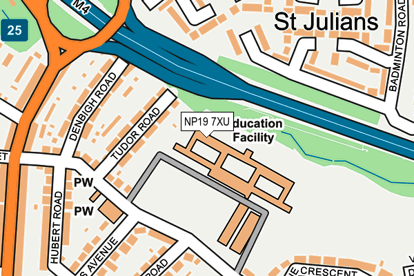
NP19 7XU is located in the St Julians electoral ward, within the unitary authority of Newport and the Welsh Parliamentary constituency of Newport East. The Local Health Board is Aneurin Bevan University and the police force is Gwent. This postcode has been in use since June 1999.


GetTheData
Source: OS OpenMap – Local (Ordnance Survey)
Source: OS VectorMap District (Ordnance Survey)
Licence: Open Government Licence (requires attribution)
| Easting | 332430 |
| Northing | 189590 |
| Latitude | 51.601079 |
| Longitude | -2.976990 |
GetTheData
Source: Open Postcode Geo
Licence: Open Government Licence
| Country | Wales |
| Postcode District | NP19 |
➜ See where NP19 is on a map ➜ Where is Newport? | |
GetTheData
Source: Land Registry Price Paid Data
Licence: Open Government Licence
Elevation or altitude of NP19 7XU as distance above sea level:
| Metres | Feet | |
|---|---|---|
| Elevation | 20m | 66ft |
Elevation is measured from the approximate centre of the postcode, to the nearest point on an OS contour line from OS Terrain 50, which has contour spacing of ten vertical metres.
➜ How high above sea level am I? Find the elevation of your current position using your device's GPS.
GetTheData
Source: Open Postcode Elevation
Licence: Open Government Licence
| Ward | St Julians |
| Constituency | Newport East |
GetTheData
Source: ONS Postcode Database
Licence: Open Government Licence
| Merlin Crescent (Heather Road) | St Julians | 266m |
| Haisbro` Avenue (Caerleon Road) | St Julians | 270m |
| Oak Street (Caerleon Road) | Barnardtown | 280m |
| Oak Street (Caerleon Road) | Barnardtown | 283m |
| Merlin Crescent (Heather Road) | St Julians | 291m |
| Newport (S Wales) Station | 2.1km |
GetTheData
Source: NaPTAN
Licence: Open Government Licence
GetTheData
Source: ONS Postcode Database
Licence: Open Government Licence


➜ Get more ratings from the Food Standards Agency
GetTheData
Source: Food Standards Agency
Licence: FSA terms & conditions
| Last Collection | |||
|---|---|---|---|
| Location | Mon-Fri | Sat | Distance |
| Barnardstown | 17:30 | 12:00 | 1,128m |
| Roman Way Post Office | 17:00 | 12:00 | 1,334m |
| East Usk Road | 17:30 | 12:00 | 1,468m |
GetTheData
Source: Dracos
Licence: Creative Commons Attribution-ShareAlike
The below table lists the International Territorial Level (ITL) codes (formerly Nomenclature of Territorial Units for Statistics (NUTS) codes) and Local Administrative Units (LAU) codes for NP19 7XU:
| ITL 1 Code | Name |
|---|---|
| TLL | Wales |
| ITL 2 Code | Name |
| TLL2 | East Wales |
| ITL 3 Code | Name |
| TLL21 | Monmouthshire and Newport |
| LAU 1 Code | Name |
| W06000022 | Newport |
GetTheData
Source: ONS Postcode Directory
Licence: Open Government Licence
The below table lists the Census Output Area (OA), Lower Layer Super Output Area (LSOA), and Middle Layer Super Output Area (MSOA) for NP19 7XU:
| Code | Name | |
|---|---|---|
| OA | W00008707 | |
| LSOA | W01001679 | Newport 007D |
| MSOA | W02000353 | Newport 007 |
GetTheData
Source: ONS Postcode Directory
Licence: Open Government Licence
| NP19 7JY | Tudor Road | 85m |
| NP19 7JX | Denbigh Road | 163m |
| NP19 7BN | Buttermere Way | 166m |
| NP19 7BJ | Buttermere Way | 167m |
| NP19 7JZ | Heather Road | 175m |
| NP19 7LB | Heather Road | 209m |
| NP19 7BS | Windermere Square | 212m |
| NP19 7BP | Coniston Close | 228m |
| NP19 7BR | Thirlmere Place | 234m |
| NP19 7LA | Carlton Road | 238m |
GetTheData
Source: Open Postcode Geo; Land Registry Price Paid Data
Licence: Open Government Licence