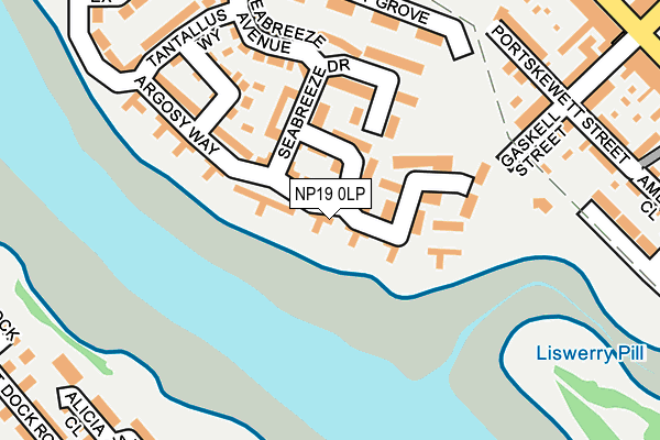
NP19 0LP lies on Argosy Way in Newport. NP19 0LP is located in the Lliswerry electoral ward, within the unitary authority of Newport and the Welsh Parliamentary constituency of Newport East. The Local Health Board is Aneurin Bevan University and the police force is Gwent. This postcode has been in use since December 2008.


GetTheData
Source: OS OpenMap – Local (Ordnance Survey)
Source: OS VectorMap District (Ordnance Survey)
Licence: Open Government Licence (requires attribution)
| Easting | 332371 |
| Northing | 187299 |
| Latitude | 51.580476 |
| Longitude | -2.977399 |
GetTheData
Source: Open Postcode Geo
Licence: Open Government Licence
| Street | Argosy Way |
| Town/City | Newport |
| Country | Wales |
| Postcode District | NP19 |
➜ See where NP19 is on a map ➜ Where is Newport? | |
GetTheData
Source: Land Registry Price Paid Data
Licence: Open Government Licence
Elevation or altitude of NP19 0LP as distance above sea level:
| Metres | Feet | |
|---|---|---|
| Elevation | 10m | 33ft |
Elevation is measured from the approximate centre of the postcode, to the nearest point on an OS contour line from OS Terrain 50, which has contour spacing of ten vertical metres.
➜ How high above sea level am I? Find the elevation of your current position using your device's GPS.
GetTheData
Source: Open Postcode Elevation
Licence: Open Government Licence
| Ward | Lliswerry |
| Constituency | Newport East |
GetTheData
Source: ONS Postcode Database
Licence: Open Government Licence
| Corporation Hotel (Corporation Road) | Newport | 316m |
| Corporation Hotel (Corporation Road) | Newport | 338m |
| Bilston Street (Corporation Road) | Newport | 358m |
| Corporation Hotel (Cromwell Road) | Newport | 373m |
| St Andrew`s Schools (Corporation Road) | Newport | 373m |
| Newport (S Wales) Station | 1.9km |
GetTheData
Source: NaPTAN
Licence: Open Government Licence
| Percentage of properties with Next Generation Access | 100.0% |
| Percentage of properties with Superfast Broadband | 100.0% |
| Percentage of properties with Ultrafast Broadband | 0.0% |
| Percentage of properties with Full Fibre Broadband | 0.0% |
Superfast Broadband is between 30Mbps and 300Mbps
Ultrafast Broadband is > 300Mbps
| Median download speed | 40.0Mbps |
| Average download speed | 36.7Mbps |
| Maximum download speed | 75.55Mbps |
| Median upload speed | 10.0Mbps |
| Average upload speed | 9.6Mbps |
| Maximum upload speed | 20.00Mbps |
| Percentage of properties unable to receive 2Mbps | 0.0% |
| Percentage of properties unable to receive 5Mbps | 0.0% |
| Percentage of properties unable to receive 10Mbps | 0.0% |
| Percentage of properties unable to receive 30Mbps | 0.0% |
GetTheData
Source: Ofcom
Licence: Ofcom Terms of Use (requires attribution)
Estimated total energy consumption in NP19 0LP by fuel type, 2015.
| Consumption (kWh) | 374,215 |
|---|---|
| Meter count | 75 |
| Mean (kWh/meter) | 4,990 |
| Median (kWh/meter) | 4,790 |
| Consumption (kWh) | 108,887 |
|---|---|
| Meter count | 74 |
| Mean (kWh/meter) | 1,471 |
| Median (kWh/meter) | 1,260 |
GetTheData
Source: Postcode level gas estimates: 2015 (experimental)
Source: Postcode level electricity estimates: 2015 (experimental)
Licence: Open Government Licence
GetTheData
Source: ONS Postcode Database
Licence: Open Government Licence


➜ Get more ratings from the Food Standards Agency
GetTheData
Source: Food Standards Agency
Licence: FSA terms & conditions
| Last Collection | |||
|---|---|---|---|
| Location | Mon-Fri | Sat | Distance |
| Vivian Road | 17:00 | 12:00 | 608m |
| Capel Street | 18:30 | 12:00 | 870m |
| Alexandra Road | 18:30 | 12:00 | 987m |
GetTheData
Source: Dracos
Licence: Creative Commons Attribution-ShareAlike
The below table lists the International Territorial Level (ITL) codes (formerly Nomenclature of Territorial Units for Statistics (NUTS) codes) and Local Administrative Units (LAU) codes for NP19 0LP:
| ITL 1 Code | Name |
|---|---|
| TLL | Wales |
| ITL 2 Code | Name |
| TLL2 | East Wales |
| ITL 3 Code | Name |
| TLL21 | Monmouthshire and Newport |
| LAU 1 Code | Name |
| W06000022 | Newport |
GetTheData
Source: ONS Postcode Directory
Licence: Open Government Licence
The below table lists the Census Output Area (OA), Lower Layer Super Output Area (LSOA), and Middle Layer Super Output Area (MSOA) for NP19 0LP:
| Code | Name | |
|---|---|---|
| OA | W00009865 | |
| LSOA | W01001644 | Newport 013C |
| MSOA | W02000359 | Newport 013 |
GetTheData
Source: ONS Postcode Directory
Licence: Open Government Licence
| NP19 0LG | Seabreeze Crescent | 53m |
| NP19 0LE | Argosy Way | 80m |
| NP19 0LJ | Tantallus Close | 99m |
| NP19 0LF | Seabreeze Drive | 123m |
| NP19 0LL | Argosy Walk | 137m |
| NP19 0LD | Tantallus Crescent | 155m |
| NP19 0LN | Argosy Way | 160m |
| NP19 0NG | Liberty Grove | 192m |
| NP19 0LA | Seabreeze Avenue | 193m |
| NP19 0NA | Liberty Grove | 210m |
GetTheData
Source: Open Postcode Geo; Land Registry Price Paid Data
Licence: Open Government Licence