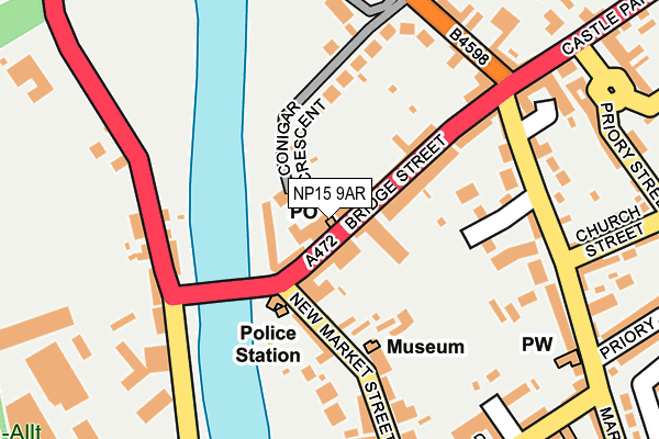
NP15 9AR is located in the Llanbadoc and Usk electoral ward, within the unitary authority of Monmouthshire and the Welsh Parliamentary constituency of Monmouth. The Local Health Board is Aneurin Bevan University and the police force is Gwent. This postcode has been in use since February 2020.


GetTheData
Source: OS OpenMap – Local (Ordnance Survey)
Source: OS VectorMap District (Ordnance Survey)
Licence: Open Government Licence (requires attribution)
| Easting | 337512 |
| Northing | 200797 |
| Latitude | 51.702422 |
| Longitude | -2.905638 |
GetTheData
Source: Open Postcode Geo
Licence: Open Government Licence
| Country | Wales |
| Postcode District | NP15 |
➜ See where NP15 is on a map ➜ Where is Usk? | |
GetTheData
Source: Land Registry Price Paid Data
Licence: Open Government Licence
Elevation or altitude of NP15 9AR as distance above sea level:
| Metres | Feet | |
|---|---|---|
| Elevation | 20m | 66ft |
Elevation is measured from the approximate centre of the postcode, to the nearest point on an OS contour line from OS Terrain 50, which has contour spacing of ten vertical metres.
➜ How high above sea level am I? Find the elevation of your current position using your device's GPS.
GetTheData
Source: Open Postcode Elevation
Licence: Open Government Licence
| Ward | Llanbadoc And Usk |
| Constituency | Monmouth |
GetTheData
Source: ONS Postcode Database
Licence: Open Government Licence
| Woodside (A472) | Usk | 167m |
| Woodside (A472) | Usk | 170m |
| Woodside Garage (Llandadoc Road) | Usk | 179m |
| Woodside Garage (Llanbadoc Road) | Usk | 227m |
| Clock Tower (Twyn Square) | Usk | 269m |
GetTheData
Source: NaPTAN
Licence: Open Government Licence
GetTheData
Source: ONS Postcode Database
Licence: Open Government Licence


➜ Get more ratings from the Food Standards Agency
GetTheData
Source: Food Standards Agency
Licence: FSA terms & conditions
| Last Collection | |||
|---|---|---|---|
| Location | Mon-Fri | Sat | Distance |
| Bridge Street Delivery Office | 17:45 | 12:15 | 15m |
| Maryport | 17:30 | 11:30 | 245m |
| Castle Parade | 17:30 | 11:30 | 377m |
GetTheData
Source: Dracos
Licence: Creative Commons Attribution-ShareAlike
The below table lists the International Territorial Level (ITL) codes (formerly Nomenclature of Territorial Units for Statistics (NUTS) codes) and Local Administrative Units (LAU) codes for NP15 9AR:
| ITL 1 Code | Name |
|---|---|
| TLL | Wales |
| ITL 2 Code | Name |
| TLL2 | East Wales |
| ITL 3 Code | Name |
| TLL21 | Monmouthshire and Newport |
| LAU 1 Code | Name |
| W06000021 | Monmouthshire |
GetTheData
Source: ONS Postcode Directory
Licence: Open Government Licence
The below table lists the Census Output Area (OA), Lower Layer Super Output Area (LSOA), and Middle Layer Super Output Area (MSOA) for NP15 9AR:
| Code | Name | |
|---|---|---|
| OA | W00008313 | |
| LSOA | W01001597 | Monmouthshire 006F |
| MSOA | W02000341 | Monmouthshire 006 |
GetTheData
Source: ONS Postcode Directory
Licence: Open Government Licence
| NP15 1BG | Bridge Street | 53m |
| NP15 1SW | Usk Bridge Mews | 59m |
| NP15 1BQ | Bridge Street | 65m |
| NP15 1AT | New Market Street | 123m |
| NP15 1ED | Maryport Street | 126m |
| NP15 1RX | Conigar Crescent | 128m |
| NP15 1EG | Maryport Street | 161m |
| NP15 1AB | Maryport Street | 165m |
| NP15 1AU | New Market Street | 166m |
| NP15 1TJ | Woodside | 168m |
GetTheData
Source: Open Postcode Geo; Land Registry Price Paid Data
Licence: Open Government Licence