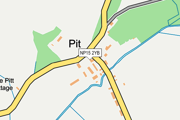
NP15 2YB is located in the Gobion Fawr electoral ward, within the unitary authority of Monmouthshire and the Welsh Parliamentary constituency of Monmouth. The Local Health Board is Aneurin Bevan University and the police force is Gwent. This postcode has been in use since June 1999.


GetTheData
Source: OS OpenMap – Local (Ordnance Survey)
Source: OS VectorMap District (Ordnance Survey)
Licence: Open Government Licence (requires attribution)
| Easting | 337131 |
| Northing | 210009 |
| Latitude | 51.785192 |
| Longitude | -2.912812 |
GetTheData
Source: Open Postcode Geo
Licence: Open Government Licence
| Country | Wales |
| Postcode District | NP15 |
➜ See where NP15 is on a map ➜ Where is Pit? | |
GetTheData
Source: Land Registry Price Paid Data
Licence: Open Government Licence
Elevation or altitude of NP15 2YB as distance above sea level:
| Metres | Feet | |
|---|---|---|
| Elevation | 40m | 131ft |
Elevation is measured from the approximate centre of the postcode, to the nearest point on an OS contour line from OS Terrain 50, which has contour spacing of ten vertical metres.
➜ How high above sea level am I? Find the elevation of your current position using your device's GPS.
GetTheData
Source: Open Postcode Elevation
Licence: Open Government Licence
| Ward | Gobion Fawr |
| Constituency | Monmouth |
GetTheData
Source: ONS Postcode Database
Licence: Open Government Licence
| Estate Office & Yard (Pit Farm Road) | Pit | 19m |
| Estate Office & Yard (Pit Farm Road) | Pit | 24m |
| Clytha Crossroads (Main Road) | Pit | 1,241m |
| Clytha Crossroads (Main Road) | Pit | 1,245m |
| Clytha Arms (Main Road) | Pit | 1,255m |
GetTheData
Source: NaPTAN
Licence: Open Government Licence
GetTheData
Source: ONS Postcode Database
Licence: Open Government Licence


➜ Get more ratings from the Food Standards Agency
GetTheData
Source: Food Standards Agency
Licence: FSA terms & conditions
The below table lists the International Territorial Level (ITL) codes (formerly Nomenclature of Territorial Units for Statistics (NUTS) codes) and Local Administrative Units (LAU) codes for NP15 2YB:
| ITL 1 Code | Name |
|---|---|
| TLL | Wales |
| ITL 2 Code | Name |
| TLL2 | East Wales |
| ITL 3 Code | Name |
| TLL21 | Monmouthshire and Newport |
| LAU 1 Code | Name |
| W06000021 | Monmouthshire |
GetTheData
Source: ONS Postcode Directory
Licence: Open Government Licence
The below table lists the Census Output Area (OA), Lower Layer Super Output Area (LSOA), and Middle Layer Super Output Area (MSOA) for NP15 2YB:
| Code | Name | |
|---|---|---|
| OA | W00008161 | |
| LSOA | W01001566 | Monmouthshire 005A |
| MSOA | W02000340 | Monmouthshire 005 |
GetTheData
Source: ONS Postcode Directory
Licence: Open Government Licence
| NP15 2BA | 9m | |
| NP15 2BN | 860m | |
| NP15 2AU | 1056m | |
| NP15 2AY | Bersondy | 1200m |
| NP15 2AN | 1362m | |
| NP15 2AG | 1489m | |
| NP15 2AQ | Cae Capel | 1489m |
| NP15 2DD | 1623m | |
| NP7 9BA | 1683m | |
| NP7 9BH | 1955m |
GetTheData
Source: Open Postcode Geo; Land Registry Price Paid Data
Licence: Open Government Licence