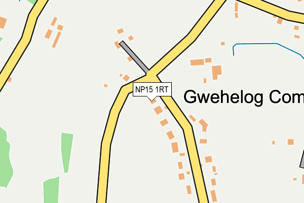
NP15 1RT is in Gwehelog, Usk. NP15 1RT is located in the Raglan electoral ward, within the unitary authority of Monmouthshire and the Welsh Parliamentary constituency of Monmouth. The Local Health Board is Aneurin Bevan University and the police force is Gwent. This postcode has been in use since June 1999.


GetTheData
Source: OS OpenMap – Local (Ordnance Survey)
Source: OS VectorMap District (Ordnance Survey)
Licence: Open Government Licence (requires attribution)
| Easting | 338823 |
| Northing | 204347 |
| Latitude | 51.734482 |
| Longitude | -2.887293 |
GetTheData
Source: Open Postcode Geo
Licence: Open Government Licence
| Locality | Gwehelog |
| Town/City | Usk |
| Country | Wales |
| Postcode District | NP15 |
➜ See where NP15 is on a map ➜ Where is Gwehelog Common? | |
GetTheData
Source: Land Registry Price Paid Data
Licence: Open Government Licence
Elevation or altitude of NP15 1RT as distance above sea level:
| Metres | Feet | |
|---|---|---|
| Elevation | 110m | 361ft |
Elevation is measured from the approximate centre of the postcode, to the nearest point on an OS contour line from OS Terrain 50, which has contour spacing of ten vertical metres.
➜ How high above sea level am I? Find the elevation of your current position using your device's GPS.
GetTheData
Source: Open Postcode Elevation
Licence: Open Government Licence
| Ward | Raglan |
| Constituency | Monmouth |
GetTheData
Source: ONS Postcode Database
Licence: Open Government Licence
| Trostrey (Monmouth Road) | Gwehelog Fawr | 378m |
| Trostrey (Monmouth Road) | Gwehelog Fawr | 406m |
| Birchgrove (Monmouth Road) | Gwehelog Fawr | 619m |
| Birchgrove (Monmouth Road) | Gwehelog Fawr | 629m |
| Woodland View (Monmouth Road) | Gwehelog Fawr | 859m |
GetTheData
Source: NaPTAN
Licence: Open Government Licence
| Percentage of properties with Next Generation Access | 100.0% |
| Percentage of properties with Superfast Broadband | 11.1% |
| Percentage of properties with Ultrafast Broadband | 0.0% |
| Percentage of properties with Full Fibre Broadband | 0.0% |
Superfast Broadband is between 30Mbps and 300Mbps
Ultrafast Broadband is > 300Mbps
| Percentage of properties unable to receive 2Mbps | 0.0% |
| Percentage of properties unable to receive 5Mbps | 0.0% |
| Percentage of properties unable to receive 10Mbps | 0.0% |
| Percentage of properties unable to receive 30Mbps | 88.9% |
GetTheData
Source: Ofcom
Licence: Ofcom Terms of Use (requires attribution)
Estimated total energy consumption in NP15 1RT by fuel type, 2015.
| Consumption (kWh) | 58,548 |
|---|---|
| Meter count | 9 |
| Mean (kWh/meter) | 6,505 |
| Median (kWh/meter) | 5,163 |
GetTheData
Source: Postcode level gas estimates: 2015 (experimental)
Source: Postcode level electricity estimates: 2015 (experimental)
Licence: Open Government Licence
GetTheData
Source: ONS Postcode Database
Licence: Open Government Licence


➜ Get more ratings from the Food Standards Agency
GetTheData
Source: Food Standards Agency
Licence: FSA terms & conditions
| Last Collection | |||
|---|---|---|---|
| Location | Mon-Fri | Sat | Distance |
| Llancayo | 16:00 | 08:30 | 2,292m |
| Lady Hill | 17:30 | 11:30 | 3,121m |
| Castle Parade | 17:30 | 11:30 | 3,472m |
GetTheData
Source: Dracos
Licence: Creative Commons Attribution-ShareAlike
The below table lists the International Territorial Level (ITL) codes (formerly Nomenclature of Territorial Units for Statistics (NUTS) codes) and Local Administrative Units (LAU) codes for NP15 1RT:
| ITL 1 Code | Name |
|---|---|
| TLL | Wales |
| ITL 2 Code | Name |
| TLL2 | East Wales |
| ITL 3 Code | Name |
| TLL21 | Monmouthshire and Newport |
| LAU 1 Code | Name |
| W06000021 | Monmouthshire |
GetTheData
Source: ONS Postcode Directory
Licence: Open Government Licence
The below table lists the Census Output Area (OA), Lower Layer Super Output Area (LSOA), and Middle Layer Super Output Area (MSOA) for NP15 1RT:
| Code | Name | |
|---|---|---|
| OA | W00008133 | |
| LSOA | W01001560 | Monmouthshire 006C |
| MSOA | W02000341 | Monmouthshire 006 |
GetTheData
Source: ONS Postcode Directory
Licence: Open Government Licence
| NP15 1RG | Wainfield Lane | 250m |
| NP15 1RH | 265m | |
| NP15 1RD | 391m | |
| NP15 1JH | 628m | |
| NP15 1RS | 665m | |
| NP15 1RE | 737m | |
| NP15 1HS | 854m | |
| NP15 1RB | 861m | |
| NP15 1RL | Ty Freeman Houses | 1016m |
| NP15 1LA | 1070m |
GetTheData
Source: Open Postcode Geo; Land Registry Price Paid Data
Licence: Open Government Licence