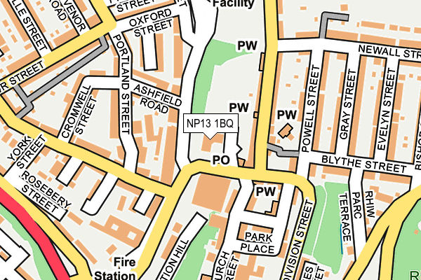
NP13 1BQ is located in the Cwmtillery electoral ward, within the unitary authority of Blaenau Gwent and the Welsh Parliamentary constituency of Blaenau Gwent. The Local Health Board is Aneurin Bevan University and the police force is Gwent. This postcode has been in use since June 1999.


GetTheData
Source: OS OpenMap – Local (Ordnance Survey)
Source: OS VectorMap District (Ordnance Survey)
Licence: Open Government Licence (requires attribution)
| Easting | 321730 |
| Northing | 204363 |
| Latitude | 51.732493 |
| Longitude | -3.134763 |
GetTheData
Source: Open Postcode Geo
Licence: Open Government Licence
| Country | Wales |
| Postcode District | NP13 |
➜ See where NP13 is on a map ➜ Where is Abertillery? | |
GetTheData
Source: Land Registry Price Paid Data
Licence: Open Government Licence
Elevation or altitude of NP13 1BQ as distance above sea level:
| Metres | Feet | |
|---|---|---|
| Elevation | 220m | 722ft |
Elevation is measured from the approximate centre of the postcode, to the nearest point on an OS contour line from OS Terrain 50, which has contour spacing of ten vertical metres.
➜ How high above sea level am I? Find the elevation of your current position using your device's GPS.
GetTheData
Source: Open Postcode Elevation
Licence: Open Government Licence
| Ward | Cwmtillery |
| Constituency | Blaenau Gwent |
GetTheData
Source: ONS Postcode Database
Licence: Open Government Licence
| Alma Street | Abertillery | 36m |
| Foundry Bridge | Abertillery | 58m |
| Glyncrug Cottages (Tillery Street) | Abertillery | 67m |
| Glyncrug Cottages (Tillery Street) | Abertillery | 76m |
| Portland Street | Abertillery | 124m |
| Llanhilleth Station | 3.6km |
| Ebbw Vale Parkway Station | 5km |
| Ebbw Vale Town Station | 6.8km |
GetTheData
Source: NaPTAN
Licence: Open Government Licence
GetTheData
Source: ONS Postcode Database
Licence: Open Government Licence


➜ Get more ratings from the Food Standards Agency
GetTheData
Source: Food Standards Agency
Licence: FSA terms & conditions
| Last Collection | |||
|---|---|---|---|
| Location | Mon-Fri | Sat | Distance |
| Marine Street | 16:30 | 11:00 | 3,152m |
| Bryn Terrace | 16:15 | 11:30 | 5,937m |
| Alma Street | 16:45 | 11:45 | 5,988m |
GetTheData
Source: Dracos
Licence: Creative Commons Attribution-ShareAlike
The below table lists the International Territorial Level (ITL) codes (formerly Nomenclature of Territorial Units for Statistics (NUTS) codes) and Local Administrative Units (LAU) codes for NP13 1BQ:
| ITL 1 Code | Name |
|---|---|
| TLL | Wales |
| ITL 2 Code | Name |
| TLL1 | West Wales and The Valleys |
| ITL 3 Code | Name |
| TLL16 | Gwent Valleys |
| LAU 1 Code | Name |
| W06000019 | Blaenau Gwent |
GetTheData
Source: ONS Postcode Directory
Licence: Open Government Licence
The below table lists the Census Output Area (OA), Lower Layer Super Output Area (LSOA), and Middle Layer Super Output Area (MSOA) for NP13 1BQ:
| Code | Name | |
|---|---|---|
| OA | W00007597 | |
| LSOA | W01001455 | Blaenau Gwent 008F |
| MSOA | W02000321 | Blaenau Gwent 008 |
GetTheData
Source: ONS Postcode Directory
Licence: Open Government Licence
| NP13 1BX | Foundry Bridge | 52m |
| NP13 1QA | Alma Street | 63m |
| NP13 1HT | Tillery Street | 98m |
| NP13 1DB | Church Street | 106m |
| NP13 1QE | Ashfield Road | 113m |
| NP13 1EE | Glyn Crug Cottages | 115m |
| NP13 1EF | Division Street | 117m |
| NP13 1NA | Fernfield Terrace | 142m |
| NP13 1NB | Gladstone Street | 145m |
| NP13 1QB | Alma Street | 145m |
GetTheData
Source: Open Postcode Geo; Land Registry Price Paid Data
Licence: Open Government Licence