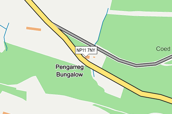
NP11 7NY lies on Ynys Hywel Lane in Wattsville, Newport. NP11 7NY is located in the Ynysddu electoral ward, within the unitary authority of Caerphilly and the Welsh Parliamentary constituency of Islwyn. The Local Health Board is Aneurin Bevan University and the police force is Gwent. This postcode has been in use since October 2009.


GetTheData
Source: OS OpenMap – Local (Ordnance Survey)
Source: OS VectorMap District (Ordnance Survey)
Licence: Open Government Licence (requires attribution)
| Easting | 319798 |
| Northing | 190623 |
| Latitude | 51.608706 |
| Longitude | -3.159574 |
GetTheData
Source: Open Postcode Geo
Licence: Open Government Licence
| Street | Ynys Hywel Lane |
| Locality | Wattsville |
| Town/City | Newport |
| Country | Wales |
| Postcode District | NP11 |
➜ See where NP11 is on a map | |
GetTheData
Source: Land Registry Price Paid Data
Licence: Open Government Licence
Elevation or altitude of NP11 7NY as distance above sea level:
| Metres | Feet | |
|---|---|---|
| Elevation | 180m | 591ft |
Elevation is measured from the approximate centre of the postcode, to the nearest point on an OS contour line from OS Terrain 50, which has contour spacing of ten vertical metres.
➜ How high above sea level am I? Find the elevation of your current position using your device's GPS.
GetTheData
Source: Open Postcode Elevation
Licence: Open Government Licence
| Ward | Ynysddu |
| Constituency | Islwyn |
GetTheData
Source: ONS Postcode Database
Licence: Open Government Licence
| Llanarth Street (Duffryn Road) | Brynawel | 562m |
| Llanarth Street (Duffryn Road) | Brynawel | 570m |
| Garage (Nine Mile Point Road) | Wattsville | 757m |
| Garage (Nine Mile Point Road) | Wattsville | 784m |
| National Club (Islwyn Road) | Wattsville | 1,070m |
| Crosskeys Station | 2.7km |
| Risca & Pontymister Station | 4.7km |
| Energlyn & Churchill Park Station | 5.6km |
GetTheData
Source: NaPTAN
Licence: Open Government Licence
| Percentage of properties with Next Generation Access | 100.0% |
| Percentage of properties with Superfast Broadband | 0.0% |
| Percentage of properties with Ultrafast Broadband | 0.0% |
| Percentage of properties with Full Fibre Broadband | 0.0% |
Superfast Broadband is between 30Mbps and 300Mbps
Ultrafast Broadband is > 300Mbps
| Percentage of properties unable to receive 2Mbps | 0.0% |
| Percentage of properties unable to receive 5Mbps | 0.0% |
| Percentage of properties unable to receive 10Mbps | 100.0% |
| Percentage of properties unable to receive 30Mbps | 100.0% |
GetTheData
Source: Ofcom
Licence: Ofcom Terms of Use (requires attribution)
GetTheData
Source: ONS Postcode Database
Licence: Open Government Licence


➜ Get more ratings from the Food Standards Agency
GetTheData
Source: Food Standards Agency
Licence: FSA terms & conditions
| Last Collection | |||
|---|---|---|---|
| Location | Mon-Fri | Sat | Distance |
| Ridgeway | 16:00 | 11:15 | 2,032m |
| Bedwas Road | 17:00 | 12:00 | 4,411m |
| Blockbusters | 16:15 | 12:15 | 5,239m |
GetTheData
Source: Dracos
Licence: Creative Commons Attribution-ShareAlike
The below table lists the International Territorial Level (ITL) codes (formerly Nomenclature of Territorial Units for Statistics (NUTS) codes) and Local Administrative Units (LAU) codes for NP11 7NY:
| ITL 1 Code | Name |
|---|---|
| TLL | Wales |
| ITL 2 Code | Name |
| TLL1 | West Wales and The Valleys |
| ITL 3 Code | Name |
| TLL16 | Gwent Valleys |
| LAU 1 Code | Name |
| W06000018 | Caerphilly |
GetTheData
Source: ONS Postcode Directory
Licence: Open Government Licence
The below table lists the Census Output Area (OA), Lower Layer Super Output Area (LSOA), and Middle Layer Super Output Area (MSOA) for NP11 7NY:
| Code | Name | |
|---|---|---|
| OA | W00007481 | |
| LSOA | W01001430 | Caerphilly 015B |
| MSOA | W02000304 | Caerphilly 015 |
GetTheData
Source: ONS Postcode Directory
Licence: Open Government Licence
| NP11 7QU | Duffryn Road | 537m |
| NP11 7QZ | Morrisville | 601m |
| NP11 7QX | Llanarth Villas | 622m |
| NP11 7QW | Llanarth Street | 636m |
| NP11 7PU | Railway Cottages | 666m |
| NP11 7QY | Falcon Terrace | 684m |
| NP11 7NZ | Woodside Walk | 887m |
| NP11 7HZ | Nine Mile Point Industrial Estate | 896m |
| NP11 7QP | Nine Mile Point Road | 935m |
| NP11 7QS | Troed Y Rhiw Road | 1001m |
GetTheData
Source: Open Postcode Geo; Land Registry Price Paid Data
Licence: Open Government Licence