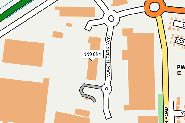
NN9 6NY is located in the Raunds electoral ward, within the unitary authority of North Northamptonshire and the English Parliamentary constituency of Corby. The Sub Integrated Care Board (ICB) Location is NHS Northamptonshire ICB - 78H and the police force is Northamptonshire. This postcode has been in use since December 2001.


GetTheData
Source: OS OpenMap – Local (Ordnance Survey)
Source: OS VectorMap District (Ordnance Survey)
Licence: Open Government Licence (requires attribution)
| Easting | 498840 |
| Northing | 273402 |
| Latitude | 52.349788 |
| Longitude | -0.550335 |
GetTheData
Source: Open Postcode Geo
Licence: Open Government Licence
| Country | England |
| Postcode District | NN9 |
➜ See where NN9 is on a map ➜ Where is Raunds? | |
GetTheData
Source: Land Registry Price Paid Data
Licence: Open Government Licence
Elevation or altitude of NN9 6NY as distance above sea level:
| Metres | Feet | |
|---|---|---|
| Elevation | 70m | 230ft |
Elevation is measured from the approximate centre of the postcode, to the nearest point on an OS contour line from OS Terrain 50, which has contour spacing of ten vertical metres.
➜ How high above sea level am I? Find the elevation of your current position using your device's GPS.
GetTheData
Source: Open Postcode Elevation
Licence: Open Government Licence
| Ward | Raunds |
| Constituency | Corby |
GetTheData
Source: ONS Postcode Database
Licence: Open Government Licence
| Football Club (Brick Kiln Road) | Raunds | 349m |
| Webb Road | Raunds | 448m |
| Ramsey Close (Whitefield Way) | Raunds | 460m |
| Welbourn Close (Twyford Avenue) | Raunds | 485m |
| Medical Centre (Meadow Lane) | Raunds | 520m |
GetTheData
Source: NaPTAN
Licence: Open Government Licence
GetTheData
Source: ONS Postcode Database
Licence: Open Government Licence


➜ Get more ratings from the Food Standards Agency
GetTheData
Source: Food Standards Agency
Licence: FSA terms & conditions
| Last Collection | |||
|---|---|---|---|
| Location | Mon-Fri | Sat | Distance |
| Mallows Drive | 16:45 | 08:30 | 474m |
| Marshalls Road | 16:15 | 08:00 | 934m |
| Chelveston Tso | 16:15 | 10:45 | 3,827m |
GetTheData
Source: Dracos
Licence: Creative Commons Attribution-ShareAlike
The below table lists the International Territorial Level (ITL) codes (formerly Nomenclature of Territorial Units for Statistics (NUTS) codes) and Local Administrative Units (LAU) codes for NN9 6NY:
| ITL 1 Code | Name |
|---|---|
| TLF | East Midlands (England) |
| ITL 2 Code | Name |
| TLF2 | Leicestershire, Rutland and Northamptonshire |
| ITL 3 Code | Name |
| TLF25 | North Northamptonshire |
| LAU 1 Code | Name |
| E07000152 | East Northamptonshire |
GetTheData
Source: ONS Postcode Directory
Licence: Open Government Licence
The below table lists the Census Output Area (OA), Lower Layer Super Output Area (LSOA), and Middle Layer Super Output Area (MSOA) for NN9 6NY:
| Code | Name | |
|---|---|---|
| OA | E00137622 | |
| LSOA | E01027054 | East Northamptonshire 005D |
| MSOA | E02005633 | East Northamptonshire 005 |
GetTheData
Source: ONS Postcode Directory
Licence: Open Government Licence
| NN9 6SB | Nichols Way | 358m |
| NN9 6SD | St Crispins Way | 365m |
| NN9 6HQ | York Way | 367m |
| NN9 6EQ | London Road | 390m |
| NN9 6HG | Ramsay Close | 432m |
| NN9 6HH | Webb Road | 434m |
| NN9 6SA | Catlow Close | 452m |
| NN9 6HF | Whitefield Way | 471m |
| NN9 6HD | Twyford Avenue | 474m |
| NN9 6UA | Meadow Lane | 492m |
GetTheData
Source: Open Postcode Geo; Land Registry Price Paid Data
Licence: Open Government Licence