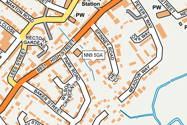
NN9 5GA is located in the Irthlingborough electoral ward, within the unitary authority of North Northamptonshire and the English Parliamentary constituency of Corby. The Sub Integrated Care Board (ICB) Location is NHS Northamptonshire ICB - 78H and the police force is Northamptonshire. This postcode has been in use since December 1997.


GetTheData
Source: OS OpenMap – Local (Ordnance Survey)
Source: OS VectorMap District (Ordnance Survey)
Licence: Open Government Licence (requires attribution)
| Easting | 494555 |
| Northing | 270491 |
| Latitude | 52.324380 |
| Longitude | -0.614041 |
GetTheData
Source: Open Postcode Geo
Licence: Open Government Licence
| Country | England |
| Postcode District | NN9 |
➜ See where NN9 is on a map ➜ Where is Irthlingborough? | |
GetTheData
Source: Land Registry Price Paid Data
Licence: Open Government Licence
Elevation or altitude of NN9 5GA as distance above sea level:
| Metres | Feet | |
|---|---|---|
| Elevation | 50m | 164ft |
Elevation is measured from the approximate centre of the postcode, to the nearest point on an OS contour line from OS Terrain 50, which has contour spacing of ten vertical metres.
➜ How high above sea level am I? Find the elevation of your current position using your device's GPS.
GetTheData
Source: Open Postcode Elevation
Licence: Open Government Licence
| Ward | Irthlingborough |
| Constituency | Corby |
GetTheData
Source: ONS Postcode Database
Licence: Open Government Licence
| The Horseshoe Ph (High Street) | Irthlingborough | 86m |
| The Horseshoe Ph (High Street) | Irthlingborough | 100m |
| Scarborough Street (College Street) | Irthlingborough | 188m |
| Baker Street (High Street) | Irthlingborough | 244m |
| Church Street (High Street) | Irthlingborough | 328m |
| Wellingborough Station | 4.8km |
GetTheData
Source: NaPTAN
Licence: Open Government Licence
GetTheData
Source: ONS Postcode Database
Licence: Open Government Licence


➜ Get more ratings from the Food Standards Agency
GetTheData
Source: Food Standards Agency
Licence: FSA terms & conditions
| Last Collection | |||
|---|---|---|---|
| Location | Mon-Fri | Sat | Distance |
| Irthlingborough Tso | 17:00 | 10:30 | 277m |
| Wellingborough Road | 16:00 | 08:00 | 491m |
| Thomas Flawn Road | 16:00 | 08:30 | 777m |
GetTheData
Source: Dracos
Licence: Creative Commons Attribution-ShareAlike
The below table lists the International Territorial Level (ITL) codes (formerly Nomenclature of Territorial Units for Statistics (NUTS) codes) and Local Administrative Units (LAU) codes for NN9 5GA:
| ITL 1 Code | Name |
|---|---|
| TLF | East Midlands (England) |
| ITL 2 Code | Name |
| TLF2 | Leicestershire, Rutland and Northamptonshire |
| ITL 3 Code | Name |
| TLF25 | North Northamptonshire |
| LAU 1 Code | Name |
| E07000152 | East Northamptonshire |
GetTheData
Source: ONS Postcode Directory
Licence: Open Government Licence
The below table lists the Census Output Area (OA), Lower Layer Super Output Area (LSOA), and Middle Layer Super Output Area (MSOA) for NN9 5GA:
| Code | Name | |
|---|---|---|
| OA | E00137542 | |
| LSOA | E01027041 | East Northamptonshire 006D |
| MSOA | E02005634 | East Northamptonshire 006 |
GetTheData
Source: ONS Postcode Directory
Licence: Open Government Licence
| NN9 5UA | Briar Court | 44m |
| NN9 5RY | Spinney Road | 57m |
| NN9 5PW | Park Road | 103m |
| NN9 5SA | Spinney Terrace | 105m |
| NN9 5PP | Wilson Crescent | 123m |
| NN9 5RS | Meadow Way | 129m |
| NN9 5AU | Meadowvale | 145m |
| NN9 5RU | Meadow Walk | 145m |
| NN9 5PU | High Street | 164m |
| NN9 5TE | High Street | 165m |
GetTheData
Source: Open Postcode Geo; Land Registry Price Paid Data
Licence: Open Government Licence