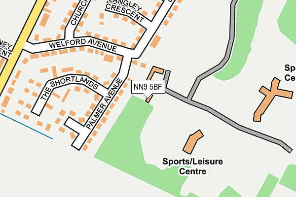
NN9 5BF is located in the Irthlingborough electoral ward, within the unitary authority of North Northamptonshire and the English Parliamentary constituency of Corby. The Sub Integrated Care Board (ICB) Location is NHS Northamptonshire ICB - 78H and the police force is Northamptonshire. This postcode has been in use since December 2000.


GetTheData
Source: OS OpenMap – Local (Ordnance Survey)
Source: OS VectorMap District (Ordnance Survey)
Licence: Open Government Licence (requires attribution)
| Easting | 495997 |
| Northing | 272270 |
| Latitude | 52.340134 |
| Longitude | -0.592366 |
GetTheData
Source: Open Postcode Geo
Licence: Open Government Licence
| Country | England |
| Postcode District | NN9 |
➜ See where NN9 is on a map | |
GetTheData
Source: Land Registry Price Paid Data
Licence: Open Government Licence
Elevation or altitude of NN9 5BF as distance above sea level:
| Metres | Feet | |
|---|---|---|
| Elevation | 70m | 230ft |
Elevation is measured from the approximate centre of the postcode, to the nearest point on an OS contour line from OS Terrain 50, which has contour spacing of ten vertical metres.
➜ How high above sea level am I? Find the elevation of your current position using your device's GPS.
GetTheData
Source: Open Postcode Elevation
Licence: Open Government Licence
| Ward | Irthlingborough |
| Constituency | Corby |
GetTheData
Source: ONS Postcode Database
Licence: Open Government Licence
| Recreation Ground (Bugby Drive) | Irthlingborough | 235m |
| Palmer Avenue (Welford Avenue) | Irthlingborough | 365m |
| Laundry (Addington Road) | Irthlingborough | 563m |
| Laundry (Addington Road) | Irthlingborough | 583m |
| 143 Addington Road (Addington Road) | Irthlingborough | 1,129m |
GetTheData
Source: NaPTAN
Licence: Open Government Licence
GetTheData
Source: ONS Postcode Database
Licence: Open Government Licence


➜ Get more ratings from the Food Standards Agency
GetTheData
Source: Food Standards Agency
Licence: FSA terms & conditions
| Last Collection | |||
|---|---|---|---|
| Location | Mon-Fri | Sat | Distance |
| Irthlingborough Tso | 17:00 | 10:30 | 2,019m |
| Wellingborough Road | 16:00 | 08:00 | 2,751m |
| North End | 17:15 | 11:15 | 2,975m |
GetTheData
Source: Dracos
Licence: Creative Commons Attribution-ShareAlike
The below table lists the International Territorial Level (ITL) codes (formerly Nomenclature of Territorial Units for Statistics (NUTS) codes) and Local Administrative Units (LAU) codes for NN9 5BF:
| ITL 1 Code | Name |
|---|---|
| TLF | East Midlands (England) |
| ITL 2 Code | Name |
| TLF2 | Leicestershire, Rutland and Northamptonshire |
| ITL 3 Code | Name |
| TLF25 | North Northamptonshire |
| LAU 1 Code | Name |
| E07000152 | East Northamptonshire |
GetTheData
Source: ONS Postcode Directory
Licence: Open Government Licence
The below table lists the Census Output Area (OA), Lower Layer Super Output Area (LSOA), and Middle Layer Super Output Area (MSOA) for NN9 5BF:
| Code | Name | |
|---|---|---|
| OA | E00137534 | |
| LSOA | E01027038 | East Northamptonshire 006A |
| MSOA | E02005634 | East Northamptonshire 006 |
GetTheData
Source: ONS Postcode Directory
Licence: Open Government Licence
| NN9 5XF | Fettledine Road | 173m |
| NN9 5XG | Bugby Drive | 255m |
| NN9 5XL | Langley Crescent | 328m |
| NN9 5XQ | Welford Close | 331m |
| NN9 5XH | Churchill Avenue | 348m |
| NN9 5XJ | Festival Close | 384m |
| NN9 5XA | Welford Avenue | 411m |
| NN9 5UT | Addington Road | 447m |
| NN9 5XB | Palmer Avenue | 456m |
| NN9 5FF | Addington Road | 472m |
GetTheData
Source: Open Postcode Geo; Land Registry Price Paid Data
Licence: Open Government Licence