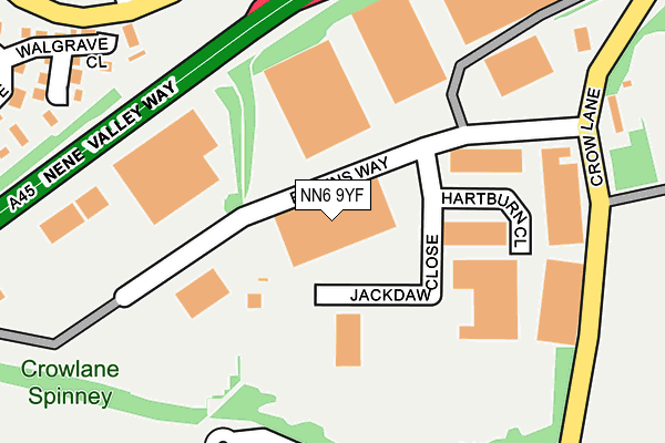
NN6 9YF is located in the Riverside Park electoral ward, within the unitary authority of West Northamptonshire and the English Parliamentary constituency of Northampton South. The Sub Integrated Care Board (ICB) Location is NHS Northamptonshire ICB - 78H and the police force is Northamptonshire. This postcode has been in use since February 2017.


GetTheData
Source: OS OpenMap – Local (Ordnance Survey)
Source: OS VectorMap District (Ordnance Survey)
Licence: Open Government Licence (requires attribution)
| Easting | 481210 |
| Northing | 261724 |
| Latitude | 52.247728 |
| Longitude | -0.811893 |
GetTheData
Source: Open Postcode Geo
Licence: Open Government Licence
| Country | England |
| Postcode District | NN6 |
➜ See where NN6 is on a map ➜ Where is Northampton? | |
GetTheData
Source: Land Registry Price Paid Data
Licence: Open Government Licence
| Ward | Riverside Park |
| Constituency | Northampton South |
GetTheData
Source: ONS Postcode Database
Licence: Open Government Licence
| Gibbsacre Court (Fishponds Road) | Bellinge | 264m |
| Toilet Block (Crow Lane) | Billing Aquadrome | 281m |
| Foskitt Court (Fishponds Road) | Bellinge | 447m |
| Foskitt Court (Fishponds Road) | Bellinge | 452m |
| Bellinge Primary School (Fieldmill Road) | Bellinge | 488m |
GetTheData
Source: NaPTAN
Licence: Open Government Licence
GetTheData
Source: ONS Postcode Database
Licence: Open Government Licence


➜ Get more ratings from the Food Standards Agency
GetTheData
Source: Food Standards Agency
Licence: FSA terms & conditions
| Last Collection | |||
|---|---|---|---|
| Location | Mon-Fri | Sat | Distance |
| Ravens Way | 175m | ||
| Ravens Way | 18:30 | 12:45 | 177m |
| Billing Aquadrome | 17:30 | 12:45 | 292m |
GetTheData
Source: Dracos
Licence: Creative Commons Attribution-ShareAlike
The below table lists the International Territorial Level (ITL) codes (formerly Nomenclature of Territorial Units for Statistics (NUTS) codes) and Local Administrative Units (LAU) codes for NN6 9YF:
| ITL 1 Code | Name |
|---|---|
| TLF | East Midlands (England) |
| ITL 2 Code | Name |
| TLF2 | Leicestershire, Rutland and Northamptonshire |
| ITL 3 Code | Name |
| TLF24 | West Northamptonshire |
| LAU 1 Code | Name |
| E07000154 | Northampton |
GetTheData
Source: ONS Postcode Directory
Licence: Open Government Licence
The below table lists the Census Output Area (OA), Lower Layer Super Output Area (LSOA), and Middle Layer Super Output Area (MSOA) for NN6 9YF:
| Code | Name | |
|---|---|---|
| OA | E00138060 | |
| LSOA | E01027140 | Northampton 011A |
| MSOA | E02005660 | Northampton 011 |
GetTheData
Source: ONS Postcode Directory
Licence: Open Government Licence
| NN3 9UE | Hartburn Close | 147m |
| NN3 9SJ | Walgrave Close | 273m |
| NN3 9BX | Crow Lane | 274m |
| NN3 9AN | Gibbs Acre Court | 307m |
| NN3 9XE | Gallfield Court | 317m |
| NN3 9AU | Gallfield Court | 330m |
| NN3 9BT | Glendale Court | 345m |
| NN3 9SL | Manorfield Close | 355m |
| NN3 9AX | Foskitt Court | 358m |
| NN3 9NP | Palmer Square | 383m |
GetTheData
Source: Open Postcode Geo; Land Registry Price Paid Data
Licence: Open Government Licence