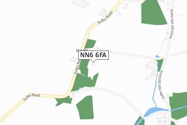
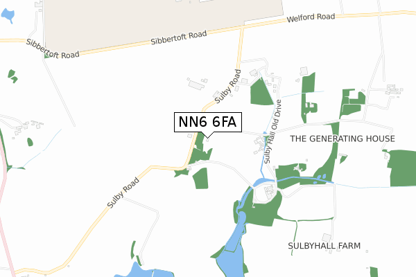
NN6 6FA is located in the Brixworth electoral ward, within the unitary authority of West Northamptonshire and the English Parliamentary constituency of Daventry. The Sub Integrated Care Board (ICB) Location is NHS Northamptonshire ICB - 78H and the police force is Northamptonshire. This postcode has been in use since May 2019.


GetTheData
Source: OS Open Zoomstack (Ordnance Survey)
Licence: Open Government Licence (requires attribution)
Attribution: Contains OS data © Crown copyright and database right 2025
Source: Open Postcode Geo
Licence: Open Government Licence (requires attribution)
Attribution: Contains OS data © Crown copyright and database right 2025; Contains Royal Mail data © Royal Mail copyright and database right 2025; Source: Office for National Statistics licensed under the Open Government Licence v.3.0
| Easting | 465547 |
| Northing | 282018 |
| Latitude | 52.432237 |
| Longitude | -1.037326 |
GetTheData
Source: Open Postcode Geo
Licence: Open Government Licence
| Country | England |
| Postcode District | NN6 |
➜ See where NN6 is on a map ➜ Where is Sulby? | |
GetTheData
Source: Land Registry Price Paid Data
Licence: Open Government Licence
| Ward | Brixworth |
| Constituency | Daventry |
GetTheData
Source: ONS Postcode Database
Licence: Open Government Licence
| Home Farm (Sulby Road) | Sulby | 91m |
| Home Farm (Sulby Road) | Sulby | 95m |
| Demand Responsive Area | Sulby | 418m |
| Wry Furlong (Welford Road) | Sulby | 1,089m |
| Wry Furlong (Welford Road) | Sulby | 1,109m |
GetTheData
Source: NaPTAN
Licence: Open Government Licence
| Percentage of properties with Next Generation Access | 0.0% |
| Percentage of properties with Superfast Broadband | 0.0% |
| Percentage of properties with Ultrafast Broadband | 0.0% |
| Percentage of properties with Full Fibre Broadband | 0.0% |
Superfast Broadband is between 30Mbps and 300Mbps
Ultrafast Broadband is > 300Mbps
| Percentage of properties unable to receive 2Mbps | 0.0% |
| Percentage of properties unable to receive 5Mbps | 0.0% |
| Percentage of properties unable to receive 10Mbps | 0.0% |
| Percentage of properties unable to receive 30Mbps | 0.0% |
GetTheData
Source: Ofcom
Licence: Ofcom Terms of Use (requires attribution)
GetTheData
Source: ONS Postcode Database
Licence: Open Government Licence


➜ Get more ratings from the Food Standards Agency
GetTheData
Source: Food Standards Agency
Licence: FSA terms & conditions
| Last Collection | |||
|---|---|---|---|
| Location | Mon-Fri | Sat | Distance |
| High Street | 16:30 | 10:30 | 2,009m |
| Sibbertoft | 16:30 | 09:00 | 2,393m |
| West End | 16:00 | 10:30 | 2,547m |
GetTheData
Source: Dracos
Licence: Creative Commons Attribution-ShareAlike
The below table lists the International Territorial Level (ITL) codes (formerly Nomenclature of Territorial Units for Statistics (NUTS) codes) and Local Administrative Units (LAU) codes for NN6 6FA:
| ITL 1 Code | Name |
|---|---|
| TLF | East Midlands (England) |
| ITL 2 Code | Name |
| TLF2 | Leicestershire, Rutland and Northamptonshire |
| ITL 3 Code | Name |
| TLF24 | West Northamptonshire |
| LAU 1 Code | Name |
| E07000151 | Daventry |
GetTheData
Source: ONS Postcode Directory
Licence: Open Government Licence
The below table lists the Census Output Area (OA), Lower Layer Super Output Area (LSOA), and Middle Layer Super Output Area (MSOA) for NN6 6FA:
| Code | Name | |
|---|---|---|
| OA | E00137457 | |
| LSOA | E01027026 | Daventry 001B |
| MSOA | E02005619 | Daventry 001 |
GetTheData
Source: ONS Postcode Directory
Licence: Open Government Licence
| NN6 6EZ | 431m | |
| LE17 6JL | Welford Road | 1155m |
| LE16 9UJ | Welford Road | 1183m |
| NN6 6EY | Naseby Road | 1359m |
| NN6 6HZ | Naseby Road | 1406m |
| NN6 6HW | The Square | 1797m |
| NN6 6JW | Dovehouse Close | 1851m |
| NN6 6HA | Chambers Row | 1861m |
| NN6 6JL | Avon Fields | 1862m |
| LE17 6JN | 1871m |
GetTheData
Source: Open Postcode Geo; Land Registry Price Paid Data
Licence: Open Government Licence