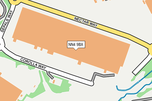
NN4 9BX is located in the Sixfields electoral ward, within the unitary authority of West Northamptonshire and the English Parliamentary constituency of South Northamptonshire. The Sub Integrated Care Board (ICB) Location is NHS Northamptonshire ICB - 78H and the police force is Northamptonshire. This postcode has been in use since October 2007.


GetTheData
Source: OS OpenMap – Local (Ordnance Survey)
Source: OS VectorMap District (Ordnance Survey)
Licence: Open Government Licence (requires attribution)
| Easting | 471218 |
| Northing | 258568 |
| Latitude | 52.220742 |
| Longitude | -0.958887 |
GetTheData
Source: Open Postcode Geo
Licence: Open Government Licence
| Country | England |
| Postcode District | NN4 |
➜ See where NN4 is on a map ➜ Where is Northampton? | |
GetTheData
Source: Land Registry Price Paid Data
Licence: Open Government Licence
Elevation or altitude of NN4 9BX as distance above sea level:
| Metres | Feet | |
|---|---|---|
| Elevation | 70m | 230ft |
Elevation is measured from the approximate centre of the postcode, to the nearest point on an OS contour line from OS Terrain 50, which has contour spacing of ten vertical metres.
➜ How high above sea level am I? Find the elevation of your current position using your device's GPS.
GetTheData
Source: Open Postcode Elevation
Licence: Open Government Licence
| Ward | Sixfields |
| Constituency | South Northamptonshire |
GetTheData
Source: ONS Postcode Database
Licence: Open Government Licence
| Sepals Way (Nectar Way) | Swan Valley | 62m |
| Sepals Way (Nectar Way) | Swan Valley | 72m |
| Sainsburys Distribution Centre (Upton Valley Way North) | Swan Valley | 103m |
| Sainsburys Distribution Centre (Sepals Way) | Swan Valley | 164m |
| Sainsburys Distribution Centre (Upton Valley Way North) | Swan Valley | 176m |
| Northampton Station | 4km |
GetTheData
Source: NaPTAN
Licence: Open Government Licence
GetTheData
Source: ONS Postcode Database
Licence: Open Government Licence

➜ Get more ratings from the Food Standards Agency
GetTheData
Source: Food Standards Agency
Licence: FSA terms & conditions
| Last Collection | |||
|---|---|---|---|
| Location | Mon-Fri | Sat | Distance |
| Samwell Way | 17:30 | 11:30 | 1,343m |
| Banbury Lane | 16:00 | 10:30 | 1,585m |
| Rothersthorpe M1 Services | 17:30 | 11:15 | 1,597m |
GetTheData
Source: Dracos
Licence: Creative Commons Attribution-ShareAlike
The below table lists the International Territorial Level (ITL) codes (formerly Nomenclature of Territorial Units for Statistics (NUTS) codes) and Local Administrative Units (LAU) codes for NN4 9BX:
| ITL 1 Code | Name |
|---|---|
| TLF | East Midlands (England) |
| ITL 2 Code | Name |
| TLF2 | Leicestershire, Rutland and Northamptonshire |
| ITL 3 Code | Name |
| TLF24 | West Northamptonshire |
| LAU 1 Code | Name |
| E07000154 | Northampton |
GetTheData
Source: ONS Postcode Directory
Licence: Open Government Licence
The below table lists the Census Output Area (OA), Lower Layer Super Output Area (LSOA), and Middle Layer Super Output Area (MSOA) for NN4 9BX:
| Code | Name | |
|---|---|---|
| OA | E00169238 | |
| LSOA | E01032977 | Northampton 029G |
| MSOA | E02005678 | Northampton 029 |
GetTheData
Source: ONS Postcode Directory
Licence: Open Government Licence
| NN4 9EN | Mayfly Road | 261m |
| NN4 9ES | Damselfly Road | 292m |
| NN4 9EQ | Mayfly Road | 339m |
| NN4 9EW | Hawker Way | 351m |
| NN4 9ET | Damselfly Road | 429m |
| NN4 9EH | Dragonfly Way | 435m |
| NN4 9EG | Chaser Way | 468m |
| NN4 9EL | Drake Way | 469m |
| NN4 9ER | Clubtail Way | 514m |
| NN4 9EU | Darter Way | 556m |
GetTheData
Source: Open Postcode Geo; Land Registry Price Paid Data
Licence: Open Government Licence