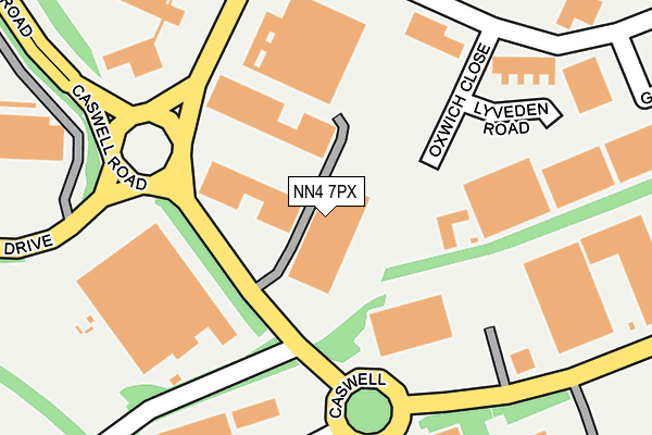
NN4 7PX is located in the Nene Valley electoral ward, within the unitary authority of West Northamptonshire and the English Parliamentary constituency of South Northamptonshire. The Sub Integrated Care Board (ICB) Location is NHS Northamptonshire ICB - 78H and the police force is Northamptonshire. This postcode has been in use since March 2017.


GetTheData
Source: OS OpenMap – Local (Ordnance Survey)
Source: OS VectorMap District (Ordnance Survey)
Licence: Open Government Licence (requires attribution)
| Easting | 477222 |
| Northing | 258171 |
| Latitude | 52.216365 |
| Longitude | -0.871105 |
GetTheData
Source: Open Postcode Geo
Licence: Open Government Licence
| Country | England |
| Postcode District | NN4 |
➜ See where NN4 is on a map ➜ Where is Northampton? | |
GetTheData
Source: Land Registry Price Paid Data
Licence: Open Government Licence
| Ward | Nene Valley |
| Constituency | South Northamptonshire |
GetTheData
Source: ONS Postcode Database
Licence: Open Government Licence
| Blaise Pascal House (Caswell Road) | Brackmills | 161m |
| Kilvey Road (Rhosili Road) | Brackmills | 388m |
| Kilvey Road (Rhosili Road) | Brackmills | 411m |
| The White Company (Gowerton Road) | Brackmills | 413m |
| British Pepper & Spice (Kilvey Road) | Brackmills | 437m |
| Northampton Station | 3.4km |
GetTheData
Source: NaPTAN
Licence: Open Government Licence
GetTheData
Source: ONS Postcode Database
Licence: Open Government Licence


➜ Get more ratings from the Food Standards Agency
GetTheData
Source: Food Standards Agency
Licence: FSA terms & conditions
| Last Collection | |||
|---|---|---|---|
| Location | Mon-Fri | Sat | Distance |
| Pavillion Drive | 17:30 | 11:30 | 349m |
| Hardingstone Tso | 17:30 | 12:00 | 709m |
| Kilvey Road | 18:30 | 11:30 | 762m |
GetTheData
Source: Dracos
Licence: Creative Commons Attribution-ShareAlike
The below table lists the International Territorial Level (ITL) codes (formerly Nomenclature of Territorial Units for Statistics (NUTS) codes) and Local Administrative Units (LAU) codes for NN4 7PX:
| ITL 1 Code | Name |
|---|---|
| TLF | East Midlands (England) |
| ITL 2 Code | Name |
| TLF2 | Leicestershire, Rutland and Northamptonshire |
| ITL 3 Code | Name |
| TLF24 | West Northamptonshire |
| LAU 1 Code | Name |
| E07000154 | Northampton |
GetTheData
Source: ONS Postcode Directory
Licence: Open Government Licence
The below table lists the Census Output Area (OA), Lower Layer Super Output Area (LSOA), and Middle Layer Super Output Area (MSOA) for NN4 7PX:
| Code | Name | |
|---|---|---|
| OA | E00138385 | |
| LSOA | E01027202 | Northampton 028D |
| MSOA | E02005677 | Northampton 028 |
GetTheData
Source: ONS Postcode Directory
Licence: Open Government Licence
| NN4 7BH | Oxwich Close | 283m |
| NN4 7PU | Caswell Road | 297m |
| NN4 6DS | Ilex Close | 395m |
| NN4 6DR | Baxter Court | 463m |
| NN4 6BX | Back Lane | 494m |
| NN4 7YJ | Pavilion Drive | 545m |
| NN4 7BQ | Kilvey Road | 554m |
| NN4 6FG | Heritage Farm Close | 579m |
| NN4 7BU | The Green | 597m |
| NN4 7BD | Salthouse Road | 604m |
GetTheData
Source: Open Postcode Geo; Land Registry Price Paid Data
Licence: Open Government Licence