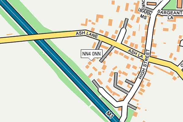
NN4 0NN is located in the Nene Valley electoral ward, within the unitary authority of West Northamptonshire and the English Parliamentary constituency of South Northamptonshire. The Sub Integrated Care Board (ICB) Location is NHS Northamptonshire ICB - 78H and the police force is Northamptonshire. This postcode has been in use since March 2017.


GetTheData
Source: OS OpenMap – Local (Ordnance Survey)
Source: OS VectorMap District (Ordnance Survey)
Licence: Open Government Licence (requires attribution)
| Easting | 474899 |
| Northing | 255536 |
| Latitude | 52.193000 |
| Longitude | -0.905682 |
GetTheData
Source: Open Postcode Geo
Licence: Open Government Licence
| Country | England |
| Postcode District | NN4 |
➜ See where NN4 is on a map ➜ Where is Collingtree? | |
GetTheData
Source: Land Registry Price Paid Data
Licence: Open Government Licence
| Ward | Nene Valley |
| Constituency | South Northamptonshire |
GetTheData
Source: ONS Postcode Database
Licence: Open Government Licence
| 8 Ash Lane (Ash Lane) | Collingtree | 117m |
| Toms Close (Watering Lane) | Collingtree | 469m |
| Hilton Hotel (Watering Lane) | Collingtree | 807m |
| Watering Lane (London Road) | Collingtree | 857m |
| Watering Lane (London Road) | Collingtree | 900m |
| Northampton Station | 5km |
GetTheData
Source: NaPTAN
Licence: Open Government Licence
| Percentage of properties with Next Generation Access | 100.0% |
| Percentage of properties with Superfast Broadband | 100.0% |
| Percentage of properties with Ultrafast Broadband | 0.0% |
| Percentage of properties with Full Fibre Broadband | 0.0% |
Superfast Broadband is between 30Mbps and 300Mbps
Ultrafast Broadband is > 300Mbps
| Percentage of properties unable to receive 2Mbps | 0.0% |
| Percentage of properties unable to receive 5Mbps | 0.0% |
| Percentage of properties unable to receive 10Mbps | 0.0% |
| Percentage of properties unable to receive 30Mbps | 0.0% |
GetTheData
Source: Ofcom
Licence: Ofcom Terms of Use (requires attribution)
GetTheData
Source: ONS Postcode Database
Licence: Open Government Licence


➜ Get more ratings from the Food Standards Agency
GetTheData
Source: Food Standards Agency
Licence: FSA terms & conditions
| Last Collection | |||
|---|---|---|---|
| Location | Mon-Fri | Sat | Distance |
| Collingtree | 17:30 | 10:45 | 167m |
| Windingbrook Lane | 17:30 | 11:45 | 1,031m |
| Saxon Way | 17:30 | 11:30 | 1,301m |
GetTheData
Source: Dracos
Licence: Creative Commons Attribution-ShareAlike
The below table lists the International Territorial Level (ITL) codes (formerly Nomenclature of Territorial Units for Statistics (NUTS) codes) and Local Administrative Units (LAU) codes for NN4 0NN:
| ITL 1 Code | Name |
|---|---|
| TLF | East Midlands (England) |
| ITL 2 Code | Name |
| TLF2 | Leicestershire, Rutland and Northamptonshire |
| ITL 3 Code | Name |
| TLF24 | West Northamptonshire |
| LAU 1 Code | Name |
| E07000154 | Northampton |
GetTheData
Source: ONS Postcode Directory
Licence: Open Government Licence
The below table lists the Census Output Area (OA), Lower Layer Super Output Area (LSOA), and Middle Layer Super Output Area (MSOA) for NN4 0NN:
| Code | Name | |
|---|---|---|
| OA | E00138376 | |
| LSOA | E01027206 | Northampton 031D |
| MSOA | E02005680 | Northampton 031 |
GetTheData
Source: ONS Postcode Directory
Licence: Open Government Licence
| NN4 0ND | Ash Lane | 75m |
| NN4 0NE | High Street | 151m |
| NN4 0PR | Barn Mews | 212m |
| NN4 0NF | Barn Corner | 222m |
| NN4 0PF | Applebarn Close | 286m |
| NN4 0NJ | Watering Lane | 327m |
| NN4 0NR | Glebe Farm Close | 337m |
| NN4 0NG | Spinney Drive | 378m |
| NN4 0DF | Glebe Farm Stables | 384m |
| NN4 0NH | Lake Walk | 447m |
GetTheData
Source: Open Postcode Geo; Land Registry Price Paid Data
Licence: Open Government Licence