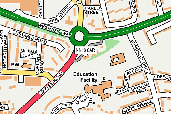
NN18 8AR is located in the Kingswood electoral ward, within the unitary authority of North Northamptonshire and the English Parliamentary constituency of Corby. The Sub Integrated Care Board (ICB) Location is NHS Northamptonshire ICB - 78H and the police force is Northamptonshire. This postcode has been in use since June 1981.


GetTheData
Source: OS OpenMap – Local (Ordnance Survey)
Source: OS VectorMap District (Ordnance Survey)
Licence: Open Government Licence (requires attribution)
| Easting | 488554 |
| Northing | 288195 |
| Latitude | 52.484516 |
| Longitude | -0.697375 |
GetTheData
Source: Open Postcode Geo
Licence: Open Government Licence
| Country | England |
| Postcode District | NN18 |
➜ See where NN18 is on a map ➜ Where is Corby? | |
GetTheData
Source: Land Registry Price Paid Data
Licence: Open Government Licence
Elevation or altitude of NN18 8AR as distance above sea level:
| Metres | Feet | |
|---|---|---|
| Elevation | 100m | 328ft |
Elevation is measured from the approximate centre of the postcode, to the nearest point on an OS contour line from OS Terrain 50, which has contour spacing of ten vertical metres.
➜ How high above sea level am I? Find the elevation of your current position using your device's GPS.
GetTheData
Source: Open Postcode Elevation
Licence: Open Government Licence
| Ward | Kingswood |
| Constituency | Corby |
GetTheData
Source: ONS Postcode Database
Licence: Open Government Licence
| Burghley Drive (Oakley Road) | Exeter | 106m |
| Burghley Drive (Oakley Road) | Exeter | 294m |
| Cecil Drive (Oakley Road) | Hazel Leys | 296m |
| Elizabeth Street | Corby | 336m |
| Buckfast Square (Burghley Drive) | Exeter | 341m |
| Corby Station | 0.8km |
GetTheData
Source: NaPTAN
Licence: Open Government Licence
GetTheData
Source: ONS Postcode Database
Licence: Open Government Licence


➜ Get more ratings from the Food Standards Agency
GetTheData
Source: Food Standards Agency
Licence: FSA terms & conditions
| Last Collection | |||
|---|---|---|---|
| Location | Mon-Fri | Sat | Distance |
| Cottingham Road | 17:00 | 11:15 | 691m |
| Farmstead Road | 17:00 | 11:15 | 1,010m |
| Saxon Way East | 18:00 | 09:00 | 1,330m |
GetTheData
Source: Dracos
Licence: Creative Commons Attribution-ShareAlike
The below table lists the International Territorial Level (ITL) codes (formerly Nomenclature of Territorial Units for Statistics (NUTS) codes) and Local Administrative Units (LAU) codes for NN18 8AR:
| ITL 1 Code | Name |
|---|---|
| TLF | East Midlands (England) |
| ITL 2 Code | Name |
| TLF2 | Leicestershire, Rutland and Northamptonshire |
| ITL 3 Code | Name |
| TLF25 | North Northamptonshire |
| LAU 1 Code | Name |
| E07000150 | Corby |
GetTheData
Source: ONS Postcode Directory
Licence: Open Government Licence
The below table lists the Census Output Area (OA), Lower Layer Super Output Area (LSOA), and Middle Layer Super Output Area (MSOA) for NN18 8AR:
| Code | Name | |
|---|---|---|
| OA | E00137077 | |
| LSOA | E01026950 | Corby 005B |
| MSOA | E02005616 | Corby 005 |
GetTheData
Source: ONS Postcode Directory
Licence: Open Government Licence
| NN17 1SD | Elizabeth Street | 93m |
| NN18 0SR | Maxwell Walk | 115m |
| NN17 1RP | Campbell Road | 117m |
| NN17 1SG | Elizabeth Street | 131m |
| NN18 8DL | Brayford Avenue | 138m |
| NN17 1SB | Elizabeth Street | 150m |
| NN17 1RE | Charles Street | 167m |
| NN18 0RJ | Gainsborough Road | 168m |
| NN18 0SS | Morland Road | 175m |
| NN17 1RD | Cameron Court | 182m |
GetTheData
Source: Open Postcode Geo; Land Registry Price Paid Data
Licence: Open Government Licence