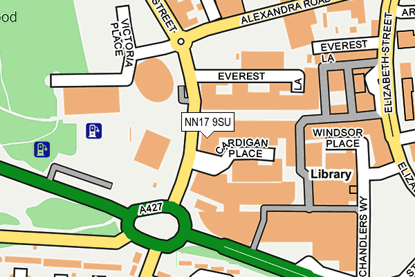
NN17 9SU is located in the Lloyds electoral ward, within the unitary authority of North Northamptonshire and the English Parliamentary constituency of Corby. The Sub Integrated Care Board (ICB) Location is NHS Northamptonshire ICB - 78H and the police force is Northamptonshire. This postcode has been in use since February 2007.


GetTheData
Source: OS OpenMap – Local (Ordnance Survey)
Source: OS VectorMap District (Ordnance Survey)
Licence: Open Government Licence (requires attribution)
| Easting | 488151 |
| Northing | 288514 |
| Latitude | 52.487432 |
| Longitude | -0.703238 |
GetTheData
Source: Open Postcode Geo
Licence: Open Government Licence
| Country | England |
| Postcode District | NN17 |
➜ See where NN17 is on a map ➜ Where is Corby? | |
GetTheData
Source: Land Registry Price Paid Data
Licence: Open Government Licence
Elevation or altitude of NN17 9SU as distance above sea level:
| Metres | Feet | |
|---|---|---|
| Elevation | 110m | 361ft |
Elevation is measured from the approximate centre of the postcode, to the nearest point on an OS contour line from OS Terrain 50, which has contour spacing of ten vertical metres.
➜ How high above sea level am I? Find the elevation of your current position using your device's GPS.
GetTheData
Source: Open Postcode Elevation
Licence: Open Government Licence
| Ward | Lloyds |
| Constituency | Corby |
GetTheData
Source: ONS Postcode Database
Licence: Open Government Licence
| George Street | Corby | 15m |
| George Street | Corby | 24m |
| George Street | Corby | 29m |
| George Street | Corby | 34m |
| George Street | Corby | 60m |
| Corby Station | 1km |
GetTheData
Source: NaPTAN
Licence: Open Government Licence
GetTheData
Source: ONS Postcode Database
Licence: Open Government Licence


➜ Get more ratings from the Food Standards Agency
GetTheData
Source: Food Standards Agency
Licence: FSA terms & conditions
| Last Collection | |||
|---|---|---|---|
| Location | Mon-Fri | Sat | Distance |
| Cottingham Road | 17:00 | 11:15 | 584m |
| Farmstead Road | 17:00 | 11:15 | 966m |
| Saxon Way East | 18:00 | 09:00 | 1,258m |
GetTheData
Source: Dracos
Licence: Creative Commons Attribution-ShareAlike
The below table lists the International Territorial Level (ITL) codes (formerly Nomenclature of Territorial Units for Statistics (NUTS) codes) and Local Administrative Units (LAU) codes for NN17 9SU:
| ITL 1 Code | Name |
|---|---|
| TLF | East Midlands (England) |
| ITL 2 Code | Name |
| TLF2 | Leicestershire, Rutland and Northamptonshire |
| ITL 3 Code | Name |
| TLF25 | North Northamptonshire |
| LAU 1 Code | Name |
| E07000150 | Corby |
GetTheData
Source: ONS Postcode Directory
Licence: Open Government Licence
The below table lists the Census Output Area (OA), Lower Layer Super Output Area (LSOA), and Middle Layer Super Output Area (MSOA) for NN17 9SU:
| Code | Name | |
|---|---|---|
| OA | E00137073 | |
| LSOA | E01026949 | Corby 005A |
| MSOA | E02005616 | Corby 005 |
GetTheData
Source: ONS Postcode Directory
Licence: Open Government Licence
| NN17 1NL | Corporation Street | 90m |
| NN17 1NQ | Corporation Street | 91m |
| NN17 1NU | Spencer Court | 129m |
| NN17 1NJ | Corporation Street | 145m |
| NN17 1QN | Queens Square | 175m |
| NN17 1PB | New Post Office Square | 209m |
| NN17 1PP | Everest Lane | 227m |
| NN17 1QE | George Street | 231m |
| NN17 1SW | Anne Street | 249m |
| NN18 0RS | Turner Road | 250m |
GetTheData
Source: Open Postcode Geo; Land Registry Price Paid Data
Licence: Open Government Licence