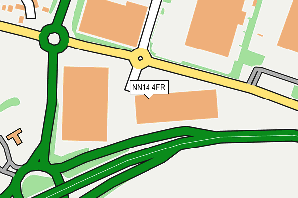
NN14 4FR is located in the Thrapston electoral ward, within the unitary authority of North Northamptonshire and the English Parliamentary constituency of Corby. The Sub Integrated Care Board (ICB) Location is NHS Northamptonshire ICB - 78H and the police force is Northamptonshire. This postcode has been in use since June 2008.


GetTheData
Source: OS OpenMap – Local (Ordnance Survey)
Source: OS VectorMap District (Ordnance Survey)
Licence: Open Government Licence (requires attribution)
| Easting | 500777 |
| Northing | 278276 |
| Latitude | 52.393255 |
| Longitude | -0.520428 |
GetTheData
Source: Open Postcode Geo
Licence: Open Government Licence
| Country | England |
| Postcode District | NN14 |
➜ See where NN14 is on a map ➜ Where is Thrapston? | |
GetTheData
Source: Land Registry Price Paid Data
Licence: Open Government Licence
Elevation or altitude of NN14 4FR as distance above sea level:
| Metres | Feet | |
|---|---|---|
| Elevation | 60m | 197ft |
Elevation is measured from the approximate centre of the postcode, to the nearest point on an OS contour line from OS Terrain 50, which has contour spacing of ten vertical metres.
➜ How high above sea level am I? Find the elevation of your current position using your device's GPS.
GetTheData
Source: Open Postcode Elevation
Licence: Open Government Licence
| Ward | Thrapston |
| Constituency | Corby |
GetTheData
Source: ONS Postcode Database
Licence: Open Government Licence
| Lazy Acre Ind Estate (Huntingdon Road) | Thrapston | 98m |
| Orchard Way (Huntingdon Road) | Thrapston | 557m |
| Barnwell Close (Windsor Drive) | Thrapston | 567m |
| Faraday Court (Highfield Road) | Thrapston | 663m |
| Arundel Close (Windsor Drive) | Thrapston | 701m |
GetTheData
Source: NaPTAN
Licence: Open Government Licence
GetTheData
Source: ONS Postcode Database
Licence: Open Government Licence


➜ Get more ratings from the Food Standards Agency
GetTheData
Source: Food Standards Agency
Licence: FSA terms & conditions
| Last Collection | |||
|---|---|---|---|
| Location | Mon-Fri | Sat | Distance |
| Thrapston Tso | 17:15 | 10:30 | 939m |
| Keyston | 16:15 | 10:00 | 4,584m |
| Mallows Drive | 16:45 | 08:30 | 5,023m |
GetTheData
Source: Dracos
Licence: Creative Commons Attribution-ShareAlike
The below table lists the International Territorial Level (ITL) codes (formerly Nomenclature of Territorial Units for Statistics (NUTS) codes) and Local Administrative Units (LAU) codes for NN14 4FR:
| ITL 1 Code | Name |
|---|---|
| TLF | East Midlands (England) |
| ITL 2 Code | Name |
| TLF2 | Leicestershire, Rutland and Northamptonshire |
| ITL 3 Code | Name |
| TLF25 | North Northamptonshire |
| LAU 1 Code | Name |
| E07000152 | East Northamptonshire |
GetTheData
Source: ONS Postcode Directory
Licence: Open Government Licence
The below table lists the Census Output Area (OA), Lower Layer Super Output Area (LSOA), and Middle Layer Super Output Area (MSOA) for NN14 4FR:
| Code | Name | |
|---|---|---|
| OA | E00137727 | |
| LSOA | E01027077 | East Northamptonshire 003E |
| MSOA | E02005631 | East Northamptonshire 003 |
GetTheData
Source: ONS Postcode Directory
Licence: Open Government Licence
| NN14 4UW | Harlech Court | 299m |
| NN14 4UG | Lindisfarne Way | 353m |
| NN14 4UU | Treen Close | 368m |
| NN14 4US | Lindisfarne Way | 372m |
| NN14 4UF | Penrhyn Court | 419m |
| NN14 4RG | Damson Close | 449m |
| NN14 4XB | Warwick Gardens | 450m |
| NN14 4QP | Rockingham Close | 462m |
| NN14 4RF | Crab Apple Way | 466m |
| NN14 4NH | The Limes | 495m |
GetTheData
Source: Open Postcode Geo; Land Registry Price Paid Data
Licence: Open Government Licence