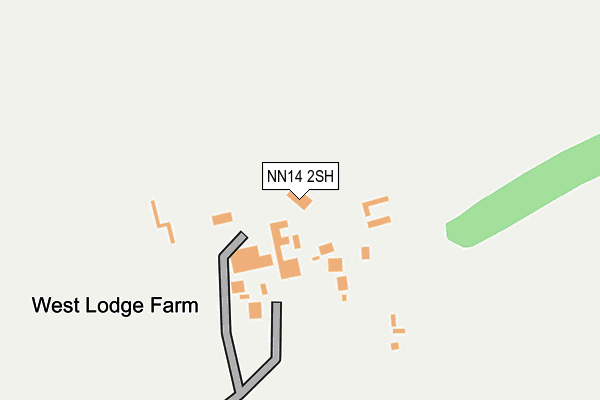
NN14 2SH is located in the Desborough electoral ward, within the unitary authority of North Northamptonshire and the English Parliamentary constituency of Kettering. The Sub Integrated Care Board (ICB) Location is NHS Northamptonshire ICB - 78H and the police force is Northamptonshire. This postcode has been in use since January 1980.


GetTheData
Source: OS OpenMap – Local (Ordnance Survey)
Source: OS VectorMap District (Ordnance Survey)
Licence: Open Government Licence (requires attribution)
| Easting | 481094 |
| Northing | 284935 |
| Latitude | 52.456373 |
| Longitude | -0.807996 |
GetTheData
Source: Open Postcode Geo
Licence: Open Government Licence
| Country | England |
| Postcode District | NN14 |
➜ See where NN14 is on a map | |
GetTheData
Source: Land Registry Price Paid Data
Licence: Open Government Licence
Elevation or altitude of NN14 2SH as distance above sea level:
| Metres | Feet | |
|---|---|---|
| Elevation | 140m | 459ft |
Elevation is measured from the approximate centre of the postcode, to the nearest point on an OS contour line from OS Terrain 50, which has contour spacing of ten vertical metres.
➜ How high above sea level am I? Find the elevation of your current position using your device's GPS.
GetTheData
Source: Open Postcode Elevation
Licence: Open Government Licence
| Ward | Desborough |
| Constituency | Kettering |
GetTheData
Source: ONS Postcode Database
Licence: Open Government Licence
| Foxglove Road (Thistle Drive) | Desborough | 1,065m |
| Rowan Close (Ironwood Avenue) | Desborough | 1,080m |
| Buttercup Road (Thistle Drive) | Desborough | 1,254m |
| 42 To 48 Ironwood Avenue (Ironwood Avenue) | Desborough | 1,284m |
| Eagle Avenue (Bear Way) | Desborough | 1,345m |
GetTheData
Source: NaPTAN
Licence: Open Government Licence
GetTheData
Source: ONS Postcode Database
Licence: Open Government Licence


➜ Get more ratings from the Food Standards Agency
GetTheData
Source: Food Standards Agency
Licence: FSA terms & conditions
| Last Collection | |||
|---|---|---|---|
| Location | Mon-Fri | Sat | Distance |
| Harrington Road | 16:00 | 08:45 | 1,691m |
| Braybrooke Road | 16:00 | 08:30 | 1,743m |
| Dunkirk Avenue | 16:00 | 08:30 | 2,064m |
GetTheData
Source: Dracos
Licence: Creative Commons Attribution-ShareAlike
The below table lists the International Territorial Level (ITL) codes (formerly Nomenclature of Territorial Units for Statistics (NUTS) codes) and Local Administrative Units (LAU) codes for NN14 2SH:
| ITL 1 Code | Name |
|---|---|
| TLF | East Midlands (England) |
| ITL 2 Code | Name |
| TLF2 | Leicestershire, Rutland and Northamptonshire |
| ITL 3 Code | Name |
| TLF25 | North Northamptonshire |
| LAU 1 Code | Name |
| E07000153 | Kettering |
GetTheData
Source: ONS Postcode Directory
Licence: Open Government Licence
The below table lists the Census Output Area (OA), Lower Layer Super Output Area (LSOA), and Middle Layer Super Output Area (MSOA) for NN14 2SH:
| Code | Name | |
|---|---|---|
| OA | E00138011 | |
| LSOA | E01027129 | Kettering 001C |
| MSOA | E02005639 | Kettering 001 |
GetTheData
Source: ONS Postcode Directory
Licence: Open Government Licence
| NN14 2SP | Stoke Albany Road | 678m |
| NN14 2JW | Woodgreen Close | 845m |
| NN14 2HZ | The Ride | 962m |
| NN14 2GQ | Oakwood Close | 966m |
| NN14 2GP | Rowan Close | 976m |
| NN14 2SW | Pipewell Road | 976m |
| NN14 2JU | Ironwood Avenue | 986m |
| NN14 2GY | Buttercup Road | 1007m |
| NN14 2GZ | Thistle Drive | 1025m |
| NN14 2RU | Wood Avens Way | 1097m |
GetTheData
Source: Open Postcode Geo; Land Registry Price Paid Data
Licence: Open Government Licence