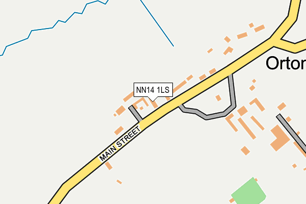
NN14 1LS is located in the Rothwell and Mawsley electoral ward, within the unitary authority of North Northamptonshire and the English Parliamentary constituency of Kettering. The Sub Integrated Care Board (ICB) Location is NHS Northamptonshire ICB - 78H and the police force is Northamptonshire. This postcode has been in use since April 2017.


GetTheData
Source: OS OpenMap – Local (Ordnance Survey)
Source: OS VectorMap District (Ordnance Survey)
Licence: Open Government Licence (requires attribution)
| Easting | 480392 |
| Northing | 279288 |
| Latitude | 52.405719 |
| Longitude | -0.819680 |
GetTheData
Source: Open Postcode Geo
Licence: Open Government Licence
| Country | England |
| Postcode District | NN14 |
➜ See where NN14 is on a map ➜ Where is Orton? | |
GetTheData
Source: Land Registry Price Paid Data
Licence: Open Government Licence
| Ward | Rothwell And Mawsley |
| Constituency | Kettering |
GetTheData
Source: ONS Postcode Database
Licence: Open Government Licence
| Village Hall (Main Street) | Loddington | 1,365m |
| Chequered Flag Ph (Main Street) | Loddington | 1,372m |
| Village Hall (Main Street) | Loddington | 1,374m |
| Richardsons Lane (Harrington Road) | Loddington | 1,652m |
| Jubilee Street (Kettering Road) | Rothwell | 1,837m |
GetTheData
Source: NaPTAN
Licence: Open Government Licence
| Percentage of properties with Next Generation Access | 100.0% |
| Percentage of properties with Superfast Broadband | 20.0% |
| Percentage of properties with Ultrafast Broadband | 20.0% |
| Percentage of properties with Full Fibre Broadband | 20.0% |
Superfast Broadband is between 30Mbps and 300Mbps
Ultrafast Broadband is > 300Mbps
| Median download speed | 7.1Mbps |
| Average download speed | 22.1Mbps |
| Maximum download speed | 100.00Mbps |
| Median upload speed | 0.8Mbps |
| Average upload speed | 17.2Mbps |
| Maximum upload speed | 100.00Mbps |
| Percentage of properties unable to receive 2Mbps | 0.0% |
| Percentage of properties unable to receive 5Mbps | 0.0% |
| Percentage of properties unable to receive 10Mbps | 0.0% |
| Percentage of properties unable to receive 30Mbps | 80.0% |
GetTheData
Source: Ofcom
Licence: Ofcom Terms of Use (requires attribution)
GetTheData
Source: ONS Postcode Database
Licence: Open Government Licence


➜ Get more ratings from the Food Standards Agency
GetTheData
Source: Food Standards Agency
Licence: FSA terms & conditions
| Last Collection | |||
|---|---|---|---|
| Location | Mon-Fri | Sat | Distance |
| Braybrooke Road | 16:00 | 08:30 | 4,211m |
| Harrington Road | 16:00 | 08:45 | 4,312m |
| Dunkirk Avenue | 16:00 | 08:30 | 4,458m |
GetTheData
Source: Dracos
Licence: Creative Commons Attribution-ShareAlike
The below table lists the International Territorial Level (ITL) codes (formerly Nomenclature of Territorial Units for Statistics (NUTS) codes) and Local Administrative Units (LAU) codes for NN14 1LS:
| ITL 1 Code | Name |
|---|---|
| TLF | East Midlands (England) |
| ITL 2 Code | Name |
| TLF2 | Leicestershire, Rutland and Northamptonshire |
| ITL 3 Code | Name |
| TLF25 | North Northamptonshire |
| LAU 1 Code | Name |
| E07000153 | Kettering |
GetTheData
Source: ONS Postcode Directory
Licence: Open Government Licence
The below table lists the Census Output Area (OA), Lower Layer Super Output Area (LSOA), and Middle Layer Super Output Area (MSOA) for NN14 1LS:
| Code | Name | |
|---|---|---|
| OA | E00137956 | |
| LSOA | E01032974 | Kettering 011I |
| MSOA | E02005649 | Kettering 011 |
GetTheData
Source: ONS Postcode Directory
Licence: Open Government Licence
| NN14 1LJ | Main Street | 134m |
| NN14 1LH | 930m | |
| NN14 1RZ | Sterling Court | 1280m |
| NN14 1LQ | 1289m | |
| NN14 1PP | Loddington Hall | 1313m |
| NN14 1LA | Main Street | 1391m |
| NN14 1LF | Hall Gardens | 1402m |
| NN14 1SG | The Grove | 1417m |
| NN14 1LE | Stable Yard | 1423m |
| NN14 6FJ | Cecilia Avenue | 1454m |
GetTheData
Source: Open Postcode Geo; Land Registry Price Paid Data
Licence: Open Government Licence