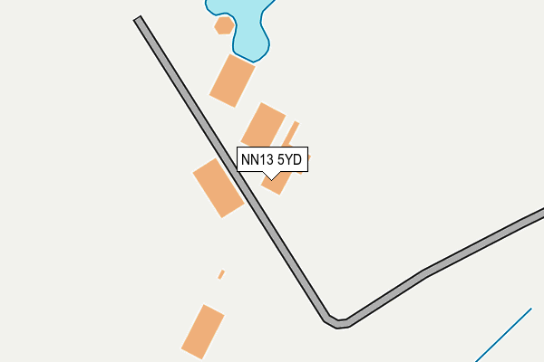
NN13 5YD is located in the Buckingham West electoral ward, within the unitary authority of Buckinghamshire and the English Parliamentary constituency of Buckingham. The Sub Integrated Care Board (ICB) Location is NHS Buckinghamshire, Oxfordshire and Berkshire West ICB - 14Y and the police force is Thames Valley. This postcode has been in use since February 1990.


GetTheData
Source: OS OpenMap – Local (Ordnance Survey)
Source: OS VectorMap District (Ordnance Survey)
Licence: Open Government Licence (requires attribution)
| Easting | 461537 |
| Northing | 238113 |
| Latitude | 52.038013 |
| Longitude | -1.104289 |
GetTheData
Source: Open Postcode Geo
Licence: Open Government Licence
| Country | England |
| Postcode District | NN13 |
➜ See where NN13 is on a map | |
GetTheData
Source: Land Registry Price Paid Data
Licence: Open Government Licence
Elevation or altitude of NN13 5YD as distance above sea level:
| Metres | Feet | |
|---|---|---|
| Elevation | 130m | 427ft |
Elevation is measured from the approximate centre of the postcode, to the nearest point on an OS contour line from OS Terrain 50, which has contour spacing of ten vertical metres.
➜ How high above sea level am I? Find the elevation of your current position using your device's GPS.
GetTheData
Source: Open Postcode Elevation
Licence: Open Government Licence
| Ward | Buckingham West |
| Constituency | Buckingham |
GetTheData
Source: ONS Postcode Database
Licence: Open Government Licence
| Airfield Park & Ride (Mill Road) | Turweston | 809m |
| Main Street (Turweston Road) | Turweston | 1,436m |
| Main Street (Turweston Road) | Turweston | 1,460m |
| St John's Church (The Avenue) | Whitfield | 1,592m |
GetTheData
Source: NaPTAN
Licence: Open Government Licence
GetTheData
Source: ONS Postcode Database
Licence: Open Government Licence


➜ Get more ratings from the Food Standards Agency
GetTheData
Source: Food Standards Agency
Licence: FSA terms & conditions
| Last Collection | |||
|---|---|---|---|
| Location | Mon-Fri | Sat | Distance |
| Buckingham Road | 18:30 | 08:00 | 2,634m |
| Church Road | 16:15 | 08:00 | 2,644m |
| Ellesmere Road | 16:30 | 08:00 | 2,785m |
GetTheData
Source: Dracos
Licence: Creative Commons Attribution-ShareAlike
The below table lists the International Territorial Level (ITL) codes (formerly Nomenclature of Territorial Units for Statistics (NUTS) codes) and Local Administrative Units (LAU) codes for NN13 5YD:
| ITL 1 Code | Name |
|---|---|
| TLJ | South East (England) |
| ITL 2 Code | Name |
| TLJ1 | Berkshire, Buckinghamshire and Oxfordshire |
| ITL 3 Code | Name |
| TLJ13 | Buckinghamshire |
| LAU 1 Code | Name |
| E06000060 | Buckinghamshire |
GetTheData
Source: ONS Postcode Directory
Licence: Open Government Licence
The below table lists the Census Output Area (OA), Lower Layer Super Output Area (LSOA), and Middle Layer Super Output Area (MSOA) for NN13 5YD:
| Code | Name | |
|---|---|---|
| OA | E00089408 | |
| LSOA | E01017717 | Aylesbury Vale 004E |
| MSOA | E02003655 | Aylesbury Vale 004 |
GetTheData
Source: ONS Postcode Directory
Licence: Open Government Licence
| NN13 5TD | 816m | |
| NN13 5JX | 1326m | |
| NN13 5JG | The Green | 1428m |
| NN13 5TQ | Mill Road | 1492m |
| NN13 5TY | Chestnut Green | 1521m |
| NN13 5TF | Chapel Lane | 1590m |
| NN13 5TG | Farrer Close | 1630m |
| NN13 5JU | Main Street | 1649m |
| NN13 5TE | The Avenue | 1688m |
| NN13 5JD | South Bank | 1715m |
GetTheData
Source: Open Postcode Geo; Land Registry Price Paid Data
Licence: Open Government Licence