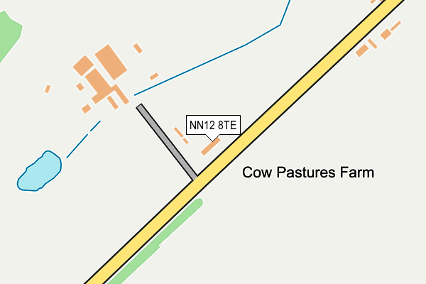
NN12 8TE lies on Follet Close in Whittlebury, Towcester. NN12 8TE is located in the Deanshanger electoral ward, within the unitary authority of West Northamptonshire and the English Parliamentary constituency of South Northamptonshire. The Sub Integrated Care Board (ICB) Location is NHS Northamptonshire ICB - 78H and the police force is Northamptonshire. This postcode has been in use since January 1980.


GetTheData
Source: OS OpenMap – Local (Ordnance Survey)
Source: OS VectorMap District (Ordnance Survey)
Licence: Open Government Licence (requires attribution)
| Easting | 469564 |
| Northing | 245364 |
| Latitude | 52.102259 |
| Longitude | -0.985792 |
GetTheData
Source: Open Postcode Geo
Licence: Open Government Licence
| Street | Follet Close |
| Locality | Whittlebury |
| Town/City | Towcester |
| Country | England |
| Postcode District | NN12 |
➜ See where NN12 is on a map | |
GetTheData
Source: Land Registry Price Paid Data
Licence: Open Government Licence
Elevation or altitude of NN12 8TE as distance above sea level:
| Metres | Feet | |
|---|---|---|
| Elevation | 140m | 459ft |
Elevation is measured from the approximate centre of the postcode, to the nearest point on an OS contour line from OS Terrain 50, which has contour spacing of ten vertical metres.
➜ How high above sea level am I? Find the elevation of your current position using your device's GPS.
GetTheData
Source: Open Postcode Elevation
Licence: Open Government Licence
| Ward | Deanshanger |
| Constituency | South Northamptonshire |
GetTheData
Source: ONS Postcode Database
Licence: Open Government Licence
| Whittlebury Court (Towcester Road) | Whittlebury | 1,049m |
| Whittlebury Court (Towcester Road) | Whittlebury | 1,074m |
| The Crescent (Towcester Road) | Whittlebury | 1,332m |
| Demand Responsive Area | Whittlebury | 1,359m |
| The Old Chapel (Westy Road) | Pury End | 1,370m |
GetTheData
Source: NaPTAN
Licence: Open Government Licence
| Percentage of properties with Next Generation Access | 100.0% |
| Percentage of properties with Superfast Broadband | 60.0% |
| Percentage of properties with Ultrafast Broadband | 0.0% |
| Percentage of properties with Full Fibre Broadband | 0.0% |
Superfast Broadband is between 30Mbps and 300Mbps
Ultrafast Broadband is > 300Mbps
| Percentage of properties unable to receive 2Mbps | 0.0% |
| Percentage of properties unable to receive 5Mbps | 0.0% |
| Percentage of properties unable to receive 10Mbps | 0.0% |
| Percentage of properties unable to receive 30Mbps | 40.0% |
GetTheData
Source: Ofcom
Licence: Ofcom Terms of Use (requires attribution)
GetTheData
Source: ONS Postcode Database
Licence: Open Government Licence

➜ Get more ratings from the Food Standards Agency
GetTheData
Source: Food Standards Agency
Licence: FSA terms & conditions
| Last Collection | |||
|---|---|---|---|
| Location | Mon-Fri | Sat | Distance |
| Whittlebury | 16:15 | 08:00 | 1,384m |
| Silverstone By-pass | 16:45 | 08:45 | 1,446m |
| Wood Burcote | 16:45 | 07:00 | 1,511m |
GetTheData
Source: Dracos
Licence: Creative Commons Attribution-ShareAlike
The below table lists the International Territorial Level (ITL) codes (formerly Nomenclature of Territorial Units for Statistics (NUTS) codes) and Local Administrative Units (LAU) codes for NN12 8TE:
| ITL 1 Code | Name |
|---|---|
| TLF | East Midlands (England) |
| ITL 2 Code | Name |
| TLF2 | Leicestershire, Rutland and Northamptonshire |
| ITL 3 Code | Name |
| TLF24 | West Northamptonshire |
| LAU 1 Code | Name |
| E07000155 | South Northamptonshire |
GetTheData
Source: ONS Postcode Directory
Licence: Open Government Licence
The below table lists the Census Output Area (OA), Lower Layer Super Output Area (LSOA), and Middle Layer Super Output Area (MSOA) for NN12 8TE:
| Code | Name | |
|---|---|---|
| OA | E00138926 | |
| LSOA | E01027307 | South Northamptonshire 008D |
| MSOA | E02005688 | South Northamptonshire 008 |
GetTheData
Source: ONS Postcode Directory
Licence: Open Government Licence
| NN12 8TD | Towcester Road | 744m |
| NN12 8XU | Towcester Road | 1121m |
| NN12 8TF | Sholebroke Cottage | 1144m |
| NN12 8XQ | Whittlebury Court | 1158m |
| NN12 8TA | 1232m | |
| NN12 8XR | Vicarage Close | 1243m |
| NN12 8XP | The Crescent | 1252m |
| NN12 8XS | Church Way | 1260m |
| NN12 7NY | Westy Road | 1346m |
| NN12 8XD | Chestnut Drive | 1365m |
GetTheData
Source: Open Postcode Geo; Land Registry Price Paid Data
Licence: Open Government Licence