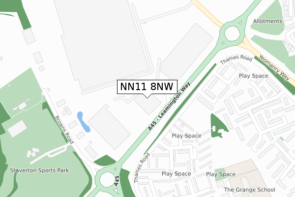
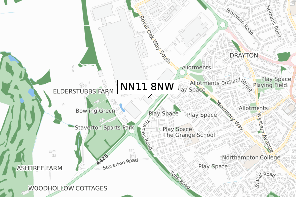
NN11 8NW is located in the Daventry West electoral ward, within the unitary authority of West Northamptonshire and the English Parliamentary constituency of Daventry. The Sub Integrated Care Board (ICB) Location is NHS Northamptonshire ICB - 78H and the police force is Northamptonshire. This postcode has been in use since February 2020.


GetTheData
Source: OS Open Zoomstack (Ordnance Survey)
Licence: Open Government Licence (requires attribution)
Attribution: Contains OS data © Crown copyright and database right 2024
Source: Open Postcode Geo
Licence: Open Government Licence (requires attribution)
Attribution: Contains OS data © Crown copyright and database right 2024; Contains Royal Mail data © Royal Mail copyright and database right 2024; Source: Office for National Statistics licensed under the Open Government Licence v.3.0
| Easting | 455846 |
| Northing | 262410 |
| Latitude | 52.257050 |
| Longitude | -1.183246 |
GetTheData
Source: Open Postcode Geo
Licence: Open Government Licence
| Country | England |
| Postcode District | NN11 |
➜ See where NN11 is on a map ➜ Where is Daventry? | |
GetTheData
Source: Land Registry Price Paid Data
Licence: Open Government Licence
| Ward | Daventry West |
| Constituency | Daventry |
GetTheData
Source: ONS Postcode Database
Licence: Open Government Licence
| Nene Walk (Thames Road) | Daventry | 123m |
| The Cherwell (Thames Road) | Daventry | 332m |
| The Cherwell (Thames Road) | Daventry | 336m |
| Ford Factory South Entrance (Royal Oak Way South) | Daventry | 349m |
| Ford Factory South Entrance (Royal Oak Way South) | Daventry | 365m |
GetTheData
Source: NaPTAN
Licence: Open Government Licence
GetTheData
Source: ONS Postcode Database
Licence: Open Government Licence


➜ Get more ratings from the Food Standards Agency
GetTheData
Source: Food Standards Agency
Licence: FSA terms & conditions
| Last Collection | |||
|---|---|---|---|
| Location | Mon-Fri | Sat | Distance |
| Prospect Way | 18:30 | 856m | |
| Churchill Road | 16:00 | 09:30 | 4,013m |
| Kiln Lane | 16:00 | 09:00 | 4,144m |
GetTheData
Source: Dracos
Licence: Creative Commons Attribution-ShareAlike
The below table lists the International Territorial Level (ITL) codes (formerly Nomenclature of Territorial Units for Statistics (NUTS) codes) and Local Administrative Units (LAU) codes for NN11 8NW:
| ITL 1 Code | Name |
|---|---|
| TLF | East Midlands (England) |
| ITL 2 Code | Name |
| TLF2 | Leicestershire, Rutland and Northamptonshire |
| ITL 3 Code | Name |
| TLF24 | West Northamptonshire |
| LAU 1 Code | Name |
| E07000151 | Daventry |
GetTheData
Source: ONS Postcode Directory
Licence: Open Government Licence
The below table lists the Census Output Area (OA), Lower Layer Super Output Area (LSOA), and Middle Layer Super Output Area (MSOA) for NN11 8NW:
| Code | Name | |
|---|---|---|
| OA | E00137370 | |
| LSOA | E01027009 | Daventry 008C |
| MSOA | E02005626 | Daventry 008 |
GetTheData
Source: ONS Postcode Directory
Licence: Open Government Licence
| NN11 4RA | Derwent Close | 188m |
| NN11 4QW | The Witham | 216m |
| NN11 4QP | The Leam | 220m |
| NN11 4QZ | Eden Close | 270m |
| NN11 4QH | Nene Walk | 277m |
| NN11 4QN | Dee Walk | 293m |
| NN11 4QL | The Cherwell | 324m |
| NN11 4QX | The Medway | 352m |
| NN11 4QY | The Medway | 359m |
| NN11 4QJ | The Cherwell | 373m |
GetTheData
Source: Open Postcode Geo; Land Registry Price Paid Data
Licence: Open Government Licence