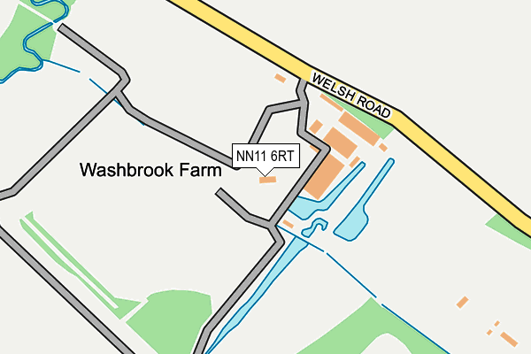
NN11 6RT is located in the Silverstone electoral ward, within the unitary authority of West Northamptonshire and the English Parliamentary constituency of South Northamptonshire. The Sub Integrated Care Board (ICB) Location is NHS Northamptonshire ICB - 78H and the police force is Northamptonshire. This postcode has been in use since February 1990.


GetTheData
Source: OS OpenMap – Local (Ordnance Survey)
Source: OS VectorMap District (Ordnance Survey)
Licence: Open Government Licence (requires attribution)
| Easting | 449169 |
| Northing | 251179 |
| Latitude | 52.156720 |
| Longitude | -1.282684 |
GetTheData
Source: Open Postcode Geo
Licence: Open Government Licence
| Country | England |
| Postcode District | NN11 |
➜ See where NN11 is on a map | |
GetTheData
Source: Land Registry Price Paid Data
Licence: Open Government Licence
Elevation or altitude of NN11 6RT as distance above sea level:
| Metres | Feet | |
|---|---|---|
| Elevation | 120m | 394ft |
Elevation is measured from the approximate centre of the postcode, to the nearest point on an OS contour line from OS Terrain 50, which has contour spacing of ten vertical metres.
➜ How high above sea level am I? Find the elevation of your current position using your device's GPS.
GetTheData
Source: Open Postcode Elevation
Licence: Open Government Licence
| Ward | Silverstone |
| Constituency | South Northamptonshire |
GetTheData
Source: ONS Postcode Database
Licence: Open Government Licence
| Church (Main Street) | Aston Le Walls | 557m |
| Demand Responsive Area | Aston Le Walls | 558m |
| Church (Main Street) | Aston Le Walls | 558m |
| Main Street (Welsh Road) | Aston Le Walls | 720m |
| The Paddock (Banbury Road) | Lower Boddington | 1,328m |
GetTheData
Source: NaPTAN
Licence: Open Government Licence
GetTheData
Source: ONS Postcode Database
Licence: Open Government Licence


➜ Get more ratings from the Food Standards Agency
GetTheData
Source: Food Standards Agency
Licence: FSA terms & conditions
| Last Collection | |||
|---|---|---|---|
| Location | Mon-Fri | Sat | Distance |
| Chipping Warden Post Office | 16:15 | 08:00 | 2,472m |
| West Farndon | 16:30 | 11:15 | 3,813m |
| Manor Road | 16:00 | 08:30 | 4,838m |
GetTheData
Source: Dracos
Licence: Creative Commons Attribution-ShareAlike
The below table lists the International Territorial Level (ITL) codes (formerly Nomenclature of Territorial Units for Statistics (NUTS) codes) and Local Administrative Units (LAU) codes for NN11 6RT:
| ITL 1 Code | Name |
|---|---|
| TLF | East Midlands (England) |
| ITL 2 Code | Name |
| TLF2 | Leicestershire, Rutland and Northamptonshire |
| ITL 3 Code | Name |
| TLF24 | West Northamptonshire |
| LAU 1 Code | Name |
| E07000155 | South Northamptonshire |
GetTheData
Source: ONS Postcode Directory
Licence: Open Government Licence
The below table lists the Census Output Area (OA), Lower Layer Super Output Area (LSOA), and Middle Layer Super Output Area (MSOA) for NN11 6RT:
| Code | Name | |
|---|---|---|
| OA | E00138904 | |
| LSOA | E01027304 | South Northamptonshire 006D |
| MSOA | E02005686 | South Northamptonshire 006 |
GetTheData
Source: ONS Postcode Directory
Licence: Open Government Licence
| NN11 6UJ | Sutton Close | 465m |
| NN11 6UN | Blacksmiths Lane | 469m |
| NN11 6UH | Butlers Close | 541m |
| NN11 6UF | Main Street | 599m |
| NN11 6TL | Appletree Lane | 616m |
| NN11 6UD | Welsh Road | 649m |
| NN11 6UE | Plowden Close | 725m |
| NN11 6XY | Banbury Road | 1198m |
| NN11 6XZ | Owl End Lane | 1337m |
| NN11 6YF | The Paddock | 1381m |
GetTheData
Source: Open Postcode Geo; Land Registry Price Paid Data
Licence: Open Government Licence