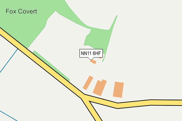
NN11 6HF is located in the Silverstone electoral ward, within the unitary authority of West Northamptonshire and the English Parliamentary constituency of South Northamptonshire. The Sub Integrated Care Board (ICB) Location is NHS Northamptonshire ICB - 78H and the police force is Northamptonshire. This postcode has been in use since June 2001.


GetTheData
Source: OS OpenMap – Local (Ordnance Survey)
Source: OS VectorMap District (Ordnance Survey)
Licence: Open Government Licence (requires attribution)
| Easting | 446500 |
| Northing | 253424 |
| Latitude | 52.177133 |
| Longitude | -1.321389 |
GetTheData
Source: Open Postcode Geo
Licence: Open Government Licence
| Country | England |
| Postcode District | NN11 |
➜ See where NN11 is on a map | |
GetTheData
Source: Land Registry Price Paid Data
Licence: Open Government Licence
Elevation or altitude of NN11 6HF as distance above sea level:
| Metres | Feet | |
|---|---|---|
| Elevation | 140m | 459ft |
Elevation is measured from the approximate centre of the postcode, to the nearest point on an OS contour line from OS Terrain 50, which has contour spacing of ten vertical metres.
➜ How high above sea level am I? Find the elevation of your current position using your device's GPS.
GetTheData
Source: Open Postcode Elevation
Licence: Open Government Licence
| Ward | Silverstone |
| Constituency | South Northamptonshire |
GetTheData
Source: ONS Postcode Database
Licence: Open Government Licence
GetTheData
Source: ONS Postcode Database
Licence: Open Government Licence


➜ Get more ratings from the Food Standards Agency
GetTheData
Source: Food Standards Agency
Licence: FSA terms & conditions
| Last Collection | |||
|---|---|---|---|
| Location | Mon-Fri | Sat | Distance |
| Wormleighton | 16:00 | 09:30 | 1,648m |
| Fenny Compton Wharf | 16:00 | 09:30 | 3,444m |
| Hay Pool | 16:00 | 07:45 | 4,475m |
GetTheData
Source: Dracos
Licence: Creative Commons Attribution-ShareAlike
The below table lists the International Territorial Level (ITL) codes (formerly Nomenclature of Territorial Units for Statistics (NUTS) codes) and Local Administrative Units (LAU) codes for NN11 6HF:
| ITL 1 Code | Name |
|---|---|
| TLF | East Midlands (England) |
| ITL 2 Code | Name |
| TLF2 | Leicestershire, Rutland and Northamptonshire |
| ITL 3 Code | Name |
| TLF24 | West Northamptonshire |
| LAU 1 Code | Name |
| E07000155 | South Northamptonshire |
GetTheData
Source: ONS Postcode Directory
Licence: Open Government Licence
The below table lists the Census Output Area (OA), Lower Layer Super Output Area (LSOA), and Middle Layer Super Output Area (MSOA) for NN11 6HF:
| Code | Name | |
|---|---|---|
| OA | E00138906 | |
| LSOA | E01027304 | South Northamptonshire 006D |
| MSOA | E02005686 | South Northamptonshire 006 |
GetTheData
Source: ONS Postcode Directory
Licence: Open Government Licence
| NN11 6XX | 703m | |
| NN11 6DR | Townsend Lane | 1545m |
| NN11 6DJ | Frog Lane | 1554m |
| NN11 6DH | Warwick Road | 1613m |
| CV47 2XG | 1673m | |
| NN11 6DL | Church Road | 1690m |
| NN11 6DB | The Orchard | 1704m |
| NN11 6DP | London End | 1769m |
| NN11 6DQ | Farm Stile | 1800m |
| CV47 2XH | 1817m |
GetTheData
Source: Open Postcode Geo; Land Registry Price Paid Data
Licence: Open Government Licence