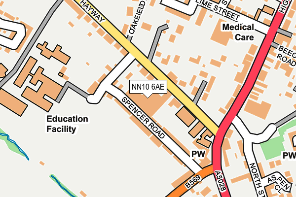
NN10 6AE is located in the Higham Ferrers electoral ward, within the unitary authority of North Northamptonshire and the English Parliamentary constituency of Wellingborough. The Sub Integrated Care Board (ICB) Location is NHS Northamptonshire ICB - 78H and the police force is Northamptonshire. This postcode has been in use since August 1993.


GetTheData
Source: OS OpenMap – Local (Ordnance Survey)
Source: OS VectorMap District (Ordnance Survey)
Licence: Open Government Licence (requires attribution)
| Easting | 495442 |
| Northing | 267532 |
| Latitude | 52.297633 |
| Longitude | -0.601869 |
GetTheData
Source: Open Postcode Geo
Licence: Open Government Licence
| Country | England |
| Postcode District | NN10 |
➜ See where NN10 is on a map ➜ Where is Rushden? | |
GetTheData
Source: Land Registry Price Paid Data
Licence: Open Government Licence
Elevation or altitude of NN10 6AE as distance above sea level:
| Metres | Feet | |
|---|---|---|
| Elevation | 50m | 164ft |
Elevation is measured from the approximate centre of the postcode, to the nearest point on an OS contour line from OS Terrain 50, which has contour spacing of ten vertical metres.
➜ How high above sea level am I? Find the elevation of your current position using your device's GPS.
GetTheData
Source: Open Postcode Elevation
Licence: Open Government Licence
| Ward | Higham Ferrers |
| Constituency | Wellingborough |
GetTheData
Source: ONS Postcode Database
Licence: Open Government Licence
| Hayway (Higham Road) | Rushden | 161m |
| Hayway (Higham Road) | Rushden | 185m |
| Asda (Higham Road) | Rushden | 286m |
| Asda (Higham Road) | Rushden | 291m |
| Kilburn Place (Higham Road) | Rushden | 370m |
GetTheData
Source: NaPTAN
Licence: Open Government Licence
GetTheData
Source: ONS Postcode Database
Licence: Open Government Licence


➜ Get more ratings from the Food Standards Agency
GetTheData
Source: Food Standards Agency
Licence: FSA terms & conditions
| Last Collection | |||
|---|---|---|---|
| Location | Mon-Fri | Sat | Distance |
| Larkhill | 17:00 | 11:00 | 440m |
| High Street | 17:00 | 11:00 | 510m |
| South End | 17:15 | 11:15 | 656m |
GetTheData
Source: Dracos
Licence: Creative Commons Attribution-ShareAlike
The below table lists the International Territorial Level (ITL) codes (formerly Nomenclature of Territorial Units for Statistics (NUTS) codes) and Local Administrative Units (LAU) codes for NN10 6AE:
| ITL 1 Code | Name |
|---|---|
| TLF | East Midlands (England) |
| ITL 2 Code | Name |
| TLF2 | Leicestershire, Rutland and Northamptonshire |
| ITL 3 Code | Name |
| TLF25 | North Northamptonshire |
| LAU 1 Code | Name |
| E07000152 | East Northamptonshire |
GetTheData
Source: ONS Postcode Directory
Licence: Open Government Licence
The below table lists the Census Output Area (OA), Lower Layer Super Output Area (LSOA), and Middle Layer Super Output Area (MSOA) for NN10 6AE:
| Code | Name | |
|---|---|---|
| OA | E00137652 | |
| LSOA | E01027062 | East Northamptonshire 008B |
| MSOA | E02005636 | East Northamptonshire 008 |
GetTheData
Source: ONS Postcode Directory
Licence: Open Government Licence
| NN10 6AD | Spencer Road | 50m |
| NN10 6AG | Hayway | 64m |
| NN10 6AF | Spencer Road | 77m |
| NN10 6EU | The Moorlands | 122m |
| NN10 6AB | Ealing Terrace | 175m |
| NN10 6EL | Oakfield | 178m |
| NN10 6EX | Peck Way | 180m |
| NN10 6DG | Higham Road | 190m |
| NN10 6ES | Lime Street | 197m |
| NN10 6DA | Lime Street | 213m |
GetTheData
Source: Open Postcode Geo; Land Registry Price Paid Data
Licence: Open Government Licence