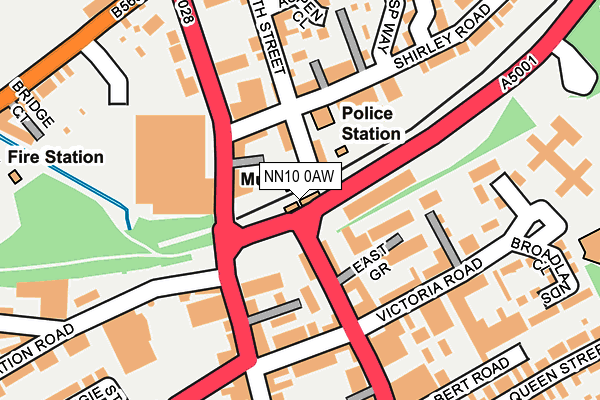
NN10 0AW is located in the Rushden South electoral ward, within the unitary authority of North Northamptonshire and the English Parliamentary constituency of Wellingborough. The Sub Integrated Care Board (ICB) Location is NHS Northamptonshire ICB - 78H and the police force is Northamptonshire. This postcode has been in use since January 1980.


GetTheData
Source: OS OpenMap – Local (Ordnance Survey)
Source: OS VectorMap District (Ordnance Survey)
Licence: Open Government Licence (requires attribution)
| Easting | 495706 |
| Northing | 267168 |
| Latitude | 52.294316 |
| Longitude | -0.598102 |
GetTheData
Source: Open Postcode Geo
Licence: Open Government Licence
| Country | England |
| Postcode District | NN10 |
➜ See where NN10 is on a map ➜ Where is Rushden? | |
GetTheData
Source: Land Registry Price Paid Data
Licence: Open Government Licence
Elevation or altitude of NN10 0AW as distance above sea level:
| Metres | Feet | |
|---|---|---|
| Elevation | 60m | 197ft |
Elevation is measured from the approximate centre of the postcode, to the nearest point on an OS contour line from OS Terrain 50, which has contour spacing of ten vertical metres.
➜ How high above sea level am I? Find the elevation of your current position using your device's GPS.
GetTheData
Source: Open Postcode Elevation
Licence: Open Government Licence
| Ward | Rushden South |
| Constituency | Wellingborough |
GetTheData
Source: ONS Postcode Database
Licence: Open Government Licence
| Station Road (High Street) | Rushden | 124m |
| Asda (Higham Road) | Rushden | 159m |
| Asda (Higham Road) | Rushden | 164m |
| Hayway (Higham Road) | Rushden | 303m |
| Hayway (Higham Road) | Rushden | 355m |
GetTheData
Source: NaPTAN
Licence: Open Government Licence
GetTheData
Source: ONS Postcode Database
Licence: Open Government Licence


➜ Get more ratings from the Food Standards Agency
GetTheData
Source: Food Standards Agency
Licence: FSA terms & conditions
| Last Collection | |||
|---|---|---|---|
| Location | Mon-Fri | Sat | Distance |
| High Street | 17:00 | 11:00 | 117m |
| College Street | 18:30 | 12:30 | 396m |
| St Margarets Avenue | 17:30 | 11:00 | 550m |
GetTheData
Source: Dracos
Licence: Creative Commons Attribution-ShareAlike
The below table lists the International Territorial Level (ITL) codes (formerly Nomenclature of Territorial Units for Statistics (NUTS) codes) and Local Administrative Units (LAU) codes for NN10 0AW:
| ITL 1 Code | Name |
|---|---|
| TLF | East Midlands (England) |
| ITL 2 Code | Name |
| TLF2 | Leicestershire, Rutland and Northamptonshire |
| ITL 3 Code | Name |
| TLF25 | North Northamptonshire |
| LAU 1 Code | Name |
| E07000152 | East Northamptonshire |
GetTheData
Source: ONS Postcode Directory
Licence: Open Government Licence
The below table lists the Census Output Area (OA), Lower Layer Super Output Area (LSOA), and Middle Layer Super Output Area (MSOA) for NN10 0AW:
| Code | Name | |
|---|---|---|
| OA | E00137637 | |
| LSOA | E01027060 | East Northamptonshire 009C |
| MSOA | E02005637 | East Northamptonshire 009 |
GetTheData
Source: ONS Postcode Directory
Licence: Open Government Licence
| NN10 0AN | Beaconsfield Terrace | 65m |
| NN10 9BT | High Street | 73m |
| NN10 0AL | Beaconsfield Place | 102m |
| NN10 0AP | East Grove | 105m |
| NN10 0PD | High Street | 134m |
| NN10 0AH | Victoria Road | 135m |
| NN10 0ER | Monarch Gate | 140m |
| NN10 0AS | Victoria Road | 144m |
| NN10 6BU | North Street | 151m |
| NN10 0DG | Victoria Close | 177m |
GetTheData
Source: Open Postcode Geo; Land Registry Price Paid Data
Licence: Open Government Licence